Dun Ringill facts for kids

Dun Ringill fort
|
|
| Location | Skye |
|---|---|
| Coordinates | 57°10′45″N 6°02′16″W / 57.179167°N 6.037778°W |
| Type | Dun / Broch |
| History | |
| Periods | Iron Age |
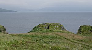
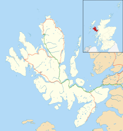
Dun Ringill is an ancient hill fort located on the Strathaird peninsula on the Isle of Skye in Scotland. Its name comes from Scottish Gaelic words meaning 'fort' and 'point of the ravine'. This historic site was first built during the Iron Age. Later, it was made even stronger in the Middle Ages. For many centuries, it was believed to be the main home of Clan MacKinnon. You can find Dun Ringill east of Kirkibost, right on the west shore of Loch Slapin.
The Story of Dun Ringill
The first part of Dun Ringill was built around the time of the common era, during the Iron Age. It was designed like a special type of ancient building called a Broch. A broch is a strong, round stone tower found only in Scotland. People lived in and changed the fort and its smaller buildings for a very long time, right up until the 1800s.
Stories say that the MacKinnon clan used Dun Ringill as their main home, or "clan seat," long before the 1500s. The fort is mentioned in old writings from the 1500s. After that time, the MacKinnons moved their home to another place called Dunakin.
What Dun Ringill Looks Like Today
Today, Dun Ringill is a set of stone ruins that look out over Loch Slapin. The parts of the fort that are still standing are about 4 meters (13 feet) tall. Each side of the fort is about 16 meters (52 feet) long. There's also a ditch around the outside wall.
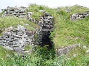
The most interesting part is the main doorway, which faces the land. It's about 1.8 meters (6 feet) high and leads into the middle of the fort. Inside, there were once two rectangular buildings. These measured about 4.5 by 2.4 meters (15 by 8 feet). The original design of Dun Ringill was like a Broch, which is a type of large, round stone house from the Iron Age.
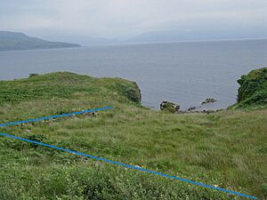
A stone wall foundation surrounds the area next to the main fort. Like other old castles, this wall likely helped protect the fort and keep livestock safe. Today, plants hide most of what's left of this wall. Surveys of the site show that there are also remains of other buildings nearby. We don't know exactly how old these buildings are, but they were probably used throughout Dun Ringill's history, until the 1800s.
To the north and west of the fort, there's a hilly plain near the coast. Loch Slapin is to the east and south. On both sides of the fort, there are natural earth and stone ramps that go down to the ocean. These ramps probably made it easy for people to get to the water and for boats to land. Since there weren't many roads in this part of Skye until recently, traveling by sea was the main way to get around.
 | Toni Morrison |
 | Barack Obama |
 | Martin Luther King Jr. |
 | Ralph Bunche |


