Dungeon Hill facts for kids
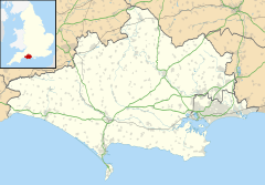
Dungeon Hill is an ancient hillfort from the Iron Age. It is located about 2 kilometers (1.25 miles) north of Buckland Newton village in Dorset, England. This special historical site is protected as a scheduled monument.
| Location | Near Buckland Newton, Dorset |
|---|---|
| Coordinates | 50°51′55″N 2°26′30″W / 50.86528°N 2.44167°W |
| Type | Hillfort |
| Area | 9 acres (3.6 ha) |
| History | |
| Periods | Iron Age Roman |
| Designated | 26 October 1934 |
| Reference no. | 1016895 |
| Identifiers | |
| Atlas of Hillforts | 3591 |
Contents
What is Dungeon Hill?
Dungeon Hill is built on a low hill, about 183 meters (600 feet) high. It has a single, roughly oval-shaped wall or "bank." This wall encloses an area of about 3.6 hectares (9 acres).
The Fort's Walls and Ditches
The main wall, called a rampart, is about 7 meters (23 feet) wide. It stands about 1.5 meters (5 feet) above the inside of the fort. Outside this wall is a ditch, which is about 13 meters (43 feet) wide. This ditch is about 2 meters (6.5 feet) deep. From the bottom of the ditch to the top of the rampart, the height can be up to 6 meters (20 feet). On the east side, there are also signs of another outer wall.
Entrances to the Fort
The original entrance to the fort is on the south side. It is a causeway, about 3 meters (10 feet) wide. Today, there are also modern entrances on the north side.
Signs of Old Farming
On the east side of the hill, you can see four lynchets. These are terraces that show where people used to farm the land. This suggests that the area was used for growing crops during the Middle Ages.
What Was Found at Dungeon Hill?
In the late 1700s, a man named Fitzwalter Foy owned the fort. He cleared away the trees from the site. During this work, he found some interesting things. These included human bones, parts of old swords, and Roman coins.
Later Discoveries
More digging happened at the site in 1881. During this excavation, archaeologists found Roman pottery. They also found pieces of Roman quern-stones, which were used for grinding grain. Building stones and Roman tiles were also discovered inside the fort. These finds tell us that people lived here during the Roman period too.
 | James B. Knighten |
 | Azellia White |
 | Willa Brown |


