
Durocornovium facts for kids

Durocornovium was a Roman town in ancient Britain. It was located on a major Roman road. This road connected two important Roman cities. These cities were Corinium Dobunnorum (modern Cirencester) and Calleva Atrebatum (modern Silchester). Durocornovium was a typical small Roman town.
Contents
Where was Durocornovium?
The town covered about 25 hectares. That's like 50 football fields! It was located at Nythe Farm. This is east of the A419 road, near modern Swindon. People often connect the site with the village of Wanborough. The land here is a flood plain. This means it often flooded in the past. Modern drainage now helps with this. You cannot visit the site today. No ancient Roman remains are visible.
What have archaeologists found?
Archaeologists have dug at Durocornovium many times. Here are some of their discoveries:
- 1692: Workers found a pot. It held two thousand Roman coins! These coins were from the time of Emperor Commodus.
- 1862: Sir R. C. Hoare visited the site. He saw many signs of Roman life. These included coins, bricks, and tiles.
- 1967: Digs found evidence of stone buildings.
- 1968: Another stone building was found. Also, cobbled surfaces and post holes were discovered.
- 1969: A six-week dig revealed even older buildings.
- 1970: This dig was not very clear. The area had been disturbed after Roman times.
- 1975: Two trenches were dug. More Roman materials were found.
- 1976: This was the biggest dig. It helped experts create a timeline for the town.
How did Durocornovium develop?
Early life before the Romans
The area around Durocornovium was used long ago. People farmed here during the Neolithic (New Stone Age) and Bronze Age. During the Iron Age, people built hill forts nearby. There is little sign of people living right at Durocornovium then. Only one coin from this time was found. It belonged to Eppillus. He was a king who lived around 1st century BC to 1st century AD.
Roman beginnings (AD 50-80)
The first Roman buildings were likely for the military. Roman soldiers built roads through this area. Finds from Emperor Nero's time support this idea. One building from this period was found. It seemed to be a workshop for iron. Perhaps it was a mutatio, a place where horses could be changed.
The name "Durocornovium" might mean "fort of the Cornovii tribe." Also, "Nythe" (the modern name of the farm) comes from "nidum." This means "nest" and was used for forts. So far, no clear fort has been found. Some ditches might have been from a temporary army camp. When the Roman army moved north, the site was left empty. After about 20 years, local Britons moved back. They built roundhouses there.
Growing as a town (AD 80-230)
Durocornovium became a busy place. Many buildings were constructed. Evidence of lime kilns and lead working shows building was happening. The town benefited from its location on the main road. Another road went south to Cunetio and Venta Belgarum.
Durocornovium was also politically important. It was at a crossroads. These roads linked major Roman administrative centers. These centers were Calleva Atrebatum, Corinium Dobunnorum, and Venta Belgarum. These towns were called civitas. They were like capital cities for local British tribes. The Romans used them to control the area. Some administration might have happened in smaller towns like Durocornovium too.
Most buildings from this time were made of stone. Parts of large columns were found during roadworks. A mansio was also identified. This was like a hotel for Roman officials. It was a large building, but it has not been fully dug up. A possible granary (a place to store grain) was also found.
Recent finds at Groundwell show the area was wealthy. A Nyphaeum was found. This was a shrine at a well. Another Roman structure was found at a spring at Callas Hill. The Romans often honored springs in their religion. This suggests a major temple might have been nearby. It could be destroyed or still hidden. There is no sign of an aqueduct. But the Dorcan Stream and River Cole were close. So, one was probably not needed.
Changes and later life (AD 230-400+)
This period saw many changes. Roman roads were slightly moved. Some new buildings were built over old road surfaces. Many Roman towns built stone walls for defense. This happened at Cunetio, near Marlborough. But Durocornovium did not get walls. This might be because the ground was too marshy. Or perhaps it was too expensive. It's interesting that a nearby hill fort at Liddington was re-used in the 3rd century.
A unique change happened in the 4th century. People built many wooden buildings. They were built on top of large sarsen stones. This lifted them above the ground. This might explain why so many coins from this time are found. Coins could fall through the floorboards! This change in building style suggests more flooding. It also might show changes in the economy.
After the Romans left
The Roman army left Britain in the early 5th century. Without the army, the Roman government collapsed. The town no longer had an economy to support it. So, it was quickly abandoned.
Later, Saxon settlers used Durocornovium as a source of building materials. They settled on Swindon Hill. This removal of stone and damage from farming has destroyed much evidence. The old Roman road through the site was still used. A coin from the time of Henry III was found in the cobbled surface. Modern roads still follow the general path of the Roman ones.
What did people do for work?
Durocornovium was on a major road. This means it was likely a busy trading center. Roman farms in the area had ovens for drying corn. This suggests they traded grain. The Romans also quarried stone from a nearby hill.
In what is now West Swindon, the Romans had a large pottery industry. Pottery from all over southern Britain has been found in Durocornovium. Some even came from Gaul (France) and Africa. But the potters of Durocornovium also made their own unique painted pottery. This style never became very popular or widespread.
Images for kids
-
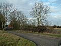
Approximate location of Durocornovium at Nythe Farm
