Dyer State Wayside facts for kids
Quick facts for kids Dyer State Wayside |
|
|---|---|

Dyer State Wayside
|
|
| Location | Gilliam, Oregon, United States |
| Area | 0.6 acres (0.24 ha) |
| Elevation | 2,431 ft (741 m) |
| Established | 1931; renovated 1997 |
| Named for | J.W. Dyer, land donor |
| Operator | Oregon Parks and Recreation Department; Dyer Partners (volunteers) |
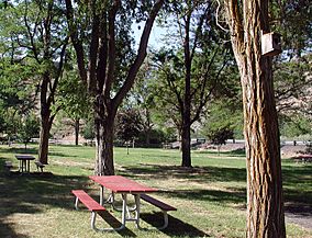
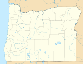
Dyer State Wayside is a small, peaceful rest stop in Oregon, United States. It's a great place to take a break, have a picnic, and use the public restrooms. This wayside covers about 0.6 acres and is located in a narrow canyon. You can find it along Oregon Route 19, about 10 miles (16 km) south of a town called Condon. It sits near a branch of Thirty Mile Creek.
The Story of Dyer State Wayside
The land for Dyer State Wayside was given to the state of Oregon in 1931 by a person named J.W. Dyer. That's why the park is named after him!
How Volunteers Helped
By 1997, the park had become overgrown with weeds and its picnic tables were rotting. A group of volunteers, who called themselves the Dyer Partners, decided to help. They worked hard to make the park beautiful again.
- They trimmed locust trees.
- They built new fences.
- They repaired the picnic tables.
- They even planted fruit trees!
Improving the Wayside
In 1999, the federal Bureau of Land Management donated two extra toilets for the park. The Oregon Parks and Recreation Department (OPRD) then built special underground vaults for these toilets. In 2000, OPRD installed a system to water the plants. Road crews from Gilliam County also helped by making pathways and improving the parking lot.
The volunteers continued to work on the park. In 2004, they tried to connect water pipes that had been put in a few years earlier. These efforts helped make Dyer State Wayside a nice place for travelers to stop and relax.


