Eagle Grove, Georgia facts for kids
Quick facts for kids
Eagle Grove, Georgia
|
|
|---|---|
| Country | United States |
| State | Georgia |
| County | Hart |
| Area | |
| • Total | 1.75 sq mi (4.54 km2) |
| • Land | 1.73 sq mi (4.48 km2) |
| • Water | 0.02 sq mi (0.05 km2) |
| Elevation | 823 ft (251 m) |
| Population
(2020)
|
|
| • Total | 139 |
| • Density | 80.30/sq mi (31.00/km2) |
| Time zone | UTC-5 (Eastern (EST)) |
| • Summer (DST) | UTC-4 (EDT) |
| Area code(s) | 706 & 762 |
| GNIS feature ID | 326255 |
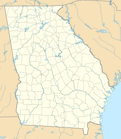
Eagle Grove is a small place in Hart County, Georgia, United States. It is called a census-designated place because the government counts its population separately. In 2020, 139 people lived there. A main road, U.S. Route 29, passes right through the community.
Contents
Understanding Eagle Grove's Population
What is a Census-Designated Place?
A census-designated place, or CDP, is an area that looks like a town but isn't officially governed as one. The United States Census Bureau defines these areas just for counting people. This helps them collect information about how many people live in different parts of the country.
How Many People Live Here?
Every ten years, the United States government counts everyone living in the country. This count is called a census. In 2010, 164 people lived in Eagle Grove. By the 2020 census, the population had changed to 139 people.
Who Lives in Eagle Grove?
The census also collects information about the different groups of people living in a community. This helps us understand the diversity of a place.
In Eagle Grove, most residents are White. In 2020, about 91% of the people were White. There are also smaller groups of people who are Black or African American, and Asian. A small number of people are also of Hispanic or Latino background.
See also

- You can also read about Eagle Grove, Georgia, in Spanish for kids: Eagle Grove (Georgia) para niños


