Eagle River (Michigan) facts for kids
Quick facts for kids Eagle River |
|
|---|---|

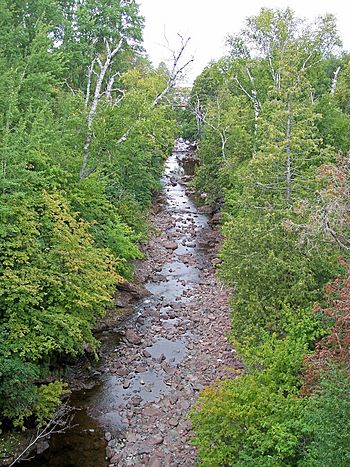
The Eagle River near its mouth in the community of Eagle River
|
|
| Country | United States |
| Physical characteristics | |
| Main source | at the confluence of its East and West Forks 47°23′21″N 88°16′42″W / 47.38917°N 88.27833°W |
| River mouth | in Eagle River, Michigan, at Lake Superior 47°24′54″N 88°17′57″W / 47.41500°N 88.29917°W |
The Eagle River is a small, short river in Michigan, USA. It flows for about 2.6 miles (4.2 kilometers) on the Keweenaw Peninsula. This river ends its journey by flowing into Lake Superior in a town also called Eagle River. Most of the river is located in Houghton Township.
Exploring the Eagle River
The Eagle River is an important natural feature of the Keweenaw Peninsula. It is known for its beautiful scenery and the way it flows into one of the largest freshwater lakes in the world, Lake Superior.
Where the River Begins
The main part of the Eagle River starts when two smaller streams, called the East Branch and the West Branch, join together. This meeting point is near the community of Phoenix. Phoenix is about two miles southeast of where the river flows into Lake Superior. From Phoenix, the river flows alongside M-26 all the way to the town of Eagle River.
The West Branch
The West Branch of the Eagle River begins about three miles southwest of Phoenix. It flows along the south side of a landform called the Cliff Range. A road named Cliff Drive runs next to this part of the river. Near Phoenix, U.S. Highway 41 and M-26 also join the area. The only important smaller stream that flows into the West Branch is Brodie Creek. Brodie Creek joins the West Branch just outside Phoenix.
The East Branch
The East Branch of the Eagle River starts from a place called Beaver Pond. This pond is about five miles east of Phoenix. Like the West Branch, the East Branch also flows west along the south side of the Cliff Range. U.S. Highway 41 runs parallel to this branch. Buffalo Creek is the only significant stream that flows into the East Branch. It enters the East Branch about three miles east of Phoenix.
 | Mary Eliza Mahoney |
 | Susie King Taylor |
 | Ida Gray |
 | Eliza Ann Grier |


