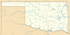
Earl, Oklahoma facts for kids
Quick facts for kids
Earl, Oklahoma
|
|
|---|---|
| Country | United States |
| State | Oklahoma |
| County | Johnston |
| Area | |
| • Total | 0.30 sq mi (0.78 km2) |
| • Land | 0.30 sq mi (0.78 km2) |
| • Water | 0.00 sq mi (0.00 km2) |
| Elevation | 728 ft (222 m) |
| Population
(2020)
|
|
| • Total | 44 |
| • Density | 146.18/sq mi (56.39/km2) |
| Time zone | UTC-6 (Central (CST)) |
| • Summer (DST) | UTC-5 (CDT) |
| FIPS code | 40-22450 |
| GNIS feature ID | 2812852 |
Earl is a small, unincorporated community located in Johnston County, Oklahoma, in the United States. It's also known as a census-designated place, which means the government counts the people living there for official records. In 2020, 44 people lived in Earl. For a short time, from 1893 to 1908, Earl even had its own post office!
What is an Unincorporated Community?
Imagine a place where people live, but it doesn't have its own city government, like a mayor or a city council. That's what an unincorporated community is! Instead, the area is usually managed by the larger county government, which in this case is Johnston County.
What is a Census-Designated Place?
A census-designated place (CDP) is an area that the U.S. Census Bureau defines just for counting people. It helps them gather information about how many people live in different areas, even if those areas aren't officially recognized cities or towns. This way, they can get a complete picture of the population across the country.
Population of Earl
The U.S. Census is like a big survey that counts everyone living in the United States every ten years. The latest count in 2020 showed that 44 people lived in Earl. This number helps us understand the size of different communities.
| Historical population | |||
|---|---|---|---|
| Census | Pop. | %± | |
| 2020 | 44 | — | |
| U.S. Decennial Census | |||
 | Delilah Pierce |
 | Gordon Parks |
 | Augusta Savage |
 | Charles Ethan Porter |


