East Honolulu, Hawaii facts for kids
Quick facts for kids
East Honolulu
|
|
|---|---|
 |
|
| Country | |
| State | |
| Counties | Honolulu |
| Area | |
| • Total | 34.45 sq mi (89.24 km2) |
| • Land | 23.01 sq mi (59.58 km2) |
| • Water | 11.45 sq mi (29.65 km2) |
| Population
(2020)
|
|
| • Total | 50,922 |
| • Density | 2,213.42/sq mi (854.61/km2) |
| Time zone | UTC-10 |
| Area code(s) | 808 |
| GNIS feature ID | 2583416 |
East Honolulu is a special area in Honolulu County, Hawaii, United States. It's called a census-designated place (CDP). This means it's a community that the government counts for population, but it's not a city or town with its own local government. In 2020, about 50,922 people lived here, making it the second largest CDP in Hawaii, right after Honolulu itself.
Contents
Exploring East Honolulu's Location
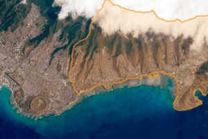
East Honolulu is located at about 21.2891 degrees North and 157.7173 degrees West. This area covers a total of about 34.45 square miles (89.24 square kilometers). Most of this area, about 23.01 square miles (59.58 square kilometers), is land. The rest, about 11.45 square miles (29.65 square kilometers), is water.
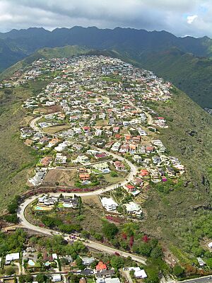
East Honolulu is found directly east of the main part of Honolulu. It starts near the Wai'alae Country Club. The area stretches all the way east to Makapu'u Point. This point is the easternmost spot on the island of Oahu. East Honolulu is known for its mostly upscale neighborhoods.
Communities in East Honolulu
East Honolulu includes several distinct communities. These areas are:
- ʻĀina Haina
- Hawaii Kai
- Niu Valley
Who Lives in East Honolulu?
| Historical population | |||
|---|---|---|---|
| Census | Pop. | %± | |
| 2010 | 49,914 | — | |
| 2020 | 50,922 | 2.0% | |
| U.S. Decennial Census | |||
Population Facts from 2020
In 2020, the population of East Honolulu was 50,992 people. There were 17,297 households in the area. The population density was about 2,213 people per square mile.
The community is very diverse. Here's a look at the different groups:
- About 25.3% of residents were White.
- About 0.6% were African American.
- About 0.1% were American Indian.
- About 47.6% were Asian.
- About 3.4% were Native Hawaiian and Pacific Islander.
- About 22.5% were from two or more races.
- People of Hispanic or Latino origin made up 5.8% of the population.
Many different age groups live in East Honolulu.
- About 19.5% of the population was under 18 years old.
- About 4.2% were under 5 years old.
- About 26% of the population was over 65 years old.
- The community has a balanced gender ratio, with 50.1% female and 49.9% male residents.
The average income for a household was $139,041. The average income per person was $61,753. About 3.3% of the population had incomes below the poverty line.
Learning and Schools in East Honolulu
The Hawaii Department of Education manages the public schools in the area.
Public Schools
Here are some of the public schools in East Honolulu:
Elementary Schools
- Ana Haina Elementary School
- Haha'ione Elementary School
- Kamilo'iki Elementary School
- Koko Head Elementary School
Middle Schools
- Niu Valley Middle School
High Schools
- Henry J. Kaiser High School
- Kalani High School
Private Schools
East Honolulu also has private school options:
- The Roman Catholic Diocese of Honolulu runs the Holy Nativity School.
- The Honolulu Waldorf School is another private school.
Public Library
The Hawaii State Public Library System operates the Aina Haina Public Library. It's a great place for students to find books and resources.
See also
 In Spanish: East Honolulu para niños
 | May Edward Chinn |
 | Rebecca Cole |
 | Alexa Canady |
 | Dorothy Lavinia Brown |


