East Shelburn, Indiana facts for kids
Quick facts for kids
East Shelburn, Indiana
|
|
|---|---|

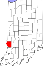
Sullivan County's location in Indiana
|
|
| Country | United States |
| State | Indiana |
| County | Sullivan |
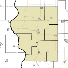
| Township | Curry |
| Elevation | 525 ft (160 m) |
| Time zone | UTC-5 (Eastern (EST)) |
| • Summer (DST) | UTC-4 (EDT) |
| ZIP code |
47879
|
| Area code(s) | 812, 930 |
| GNIS feature ID | 433928 |
East Shelburn is a small place in Sullivan County, Indiana. It is called an unincorporated community. This means it is a group of homes and businesses that are not officially a town or city. It does not have its own local government.
East Shelburn is located in southern Curry Township. It is also part of the larger Terre Haute area. This area is known as a Metropolitan Statistical Area. It means that Terre Haute and the nearby communities are connected. They share jobs, services, and transportation.
Where is East Shelburn Located?
East Shelburn is found in the state of Indiana. You can find it on a map using these coordinates: 39°10′28″N 87°22′47″W / 39.17444°N 87.37972°W. This location is about 525 feet (160 meters) above sea level. This means it is not very high up.
What is an Unincorporated Community?
An unincorporated community is a place where people live. It is not a city or a town. It does not have its own mayor or town council. Instead, it is usually governed by the county. For East Shelburn, this means Sullivan County helps manage things.
Understanding Metropolitan Areas
A Metropolitan Statistical Area (MSA) is a region. It includes a big city and its surrounding areas. These areas are closely linked. People might live in one part and work in another. The Terre Haute MSA includes East Shelburn. This shows how different communities are connected.
 | Jewel Prestage |
 | Ella Baker |
 | Fannie Lou Hamer |


