Ellenboro, Wisconsin facts for kids
Quick facts for kids
Town of Ellenboro
|
|
|---|---|

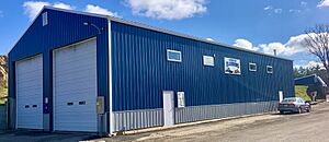
Town hall
|
|

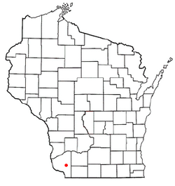
Location of the Town of Ellenboro
|
|
| Country | |
| State | |
| County | Grant |
| Area | |
| • Total | 36.2 sq mi (93.6 km2) |
| • Land | 36.2 sq mi (93.6 km2) |
| • Water | 0.0 sq mi (0.0 km2) |
| Elevation | 810 ft (247 m) |
| Population
(2000)
|
|
| • Total | 608 |
| • Density | 16.8/sq mi (6.5/km2) |
| Time zone | UTC-6 (Central (CST)) |
| • Summer (DST) | UTC-5 (CDT) |
| Area code(s) | 608 |
| FIPS code | 55-23400 |
| GNIS feature ID | 1583153 |
The Town of Ellenboro is a small community located in Grant County, Wisconsin, in the United States. It's not a city, but a type of local government area called a town. In the year 2000, about 608 people lived there.
Getting Around Ellenboro
The town is easy to reach! It's located just west of Wisconsin Highway 81. This highway connects Ellenboro to other nearby places. The town is about halfway between the cities of Platteville and Lancaster.
What Ellenboro Looks Like
Ellenboro covers an area of about 36.2 square miles (which is about 93.6 square kilometers). All of this area is land, meaning there are no large lakes or rivers within the town's borders.
Who Lives in Ellenboro?
In 2000, there were 608 people living in Ellenboro. Most of the people living there were White (about 99.34%). A small number (0.66%) were from two or more racial backgrounds. About 0.33% of the people were Hispanic or Latino.
There were 191 households in the town. A household is a group of people living together in one home. Many of these households (42.4%) had children under 18 living with them. Most households (70.2%) were married couples.
The average age of people in Ellenboro was 33 years old. About 33.9% of the population was under 18. This means Ellenboro is a community with many young people and families.
See also
- In Spanish: Ellenboro (Wisconsin) para niños
 | Calvin Brent |
 | Walter T. Bailey |
 | Martha Cassell Thompson |
 | Alberta Jeannette Cassell |

