Empire, Georgia facts for kids
Quick facts for kids
Empire, Georgia
|
|
|---|---|
| Country | United States |
| State | Georgia |
| Counties | Bleckley, Dodge |
| Area | |
| • Total | 2.32 sq mi (6.00 km2) |
| • Land | 2.30 sq mi (5.96 km2) |
| • Water | 0.02 sq mi (0.04 km2) |
| Elevation | 386 ft (118 m) |
| Population
(2020)
|
|
| • Total | 319 |
| • Density | 138.70/sq mi (53.54/km2) |
| Time zone | UTC-5 (Eastern (EST)) |
| • Summer (DST) | UTC-4 (EDT) |
| ZIP code |
31014
|
| Area code(s) | 478 |
| FIPS code | 13-27512 |
| GNIS feature ID | 0313945 |
Empire is a small place in the state of Georgia, in the United States. It's known as an unincorporated community, which means it doesn't have its own local government like a city or town. It's also a census-designated place, which is an area the government defines for counting people.
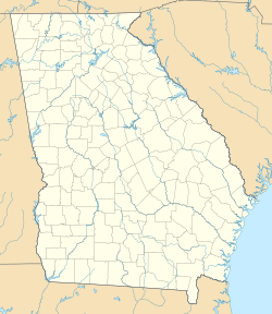
Empire is located across two different counties: Bleckley and Dodge. In 2020, about 319 people lived there.
History of Empire
Empire became an official "Town of Empire" in 1911. This happened when the Georgia General Assembly, which is like Georgia's state parliament, approved it. The people who started the community named it "Empire" to help promote a sawmill that was built there. A sawmill is a factory that cuts logs into lumber.
However, the town's official status was removed in 1995. This means it stopped being an official town with its own local government.
Where is Empire?
Empire is mostly in Dodge County, but a small part of it reaches into Bleckley County. Even though most of it is in Dodge County, it shares the same ZIP code as Bleckley County.
A main road, U.S. Route 23, goes right through Empire.
- If you go north on this road for about 4 miles (6.4 km), you'll reach Cochran. This is the main town, or "county seat," for Bleckley County.
- If you go south for about 12 miles (19 km), you'll find Eastman, which is the county seat for Dodge County.
- The larger city of Macon is about 42 miles (68 km) north of Empire on US-23.
The United States Census Bureau says that Empire covers a total area of about 2.32 square miles (6.0 square kilometers). A very small part of this area, about 0.02 square miles (0.04 square kilometers), is water.
Population Changes
| Historical population | |||
|---|---|---|---|
| Census | Pop. | %± | |
| 1920 | 970 | — | |
| 1930 | 158 | −83.7% | |
| 1940 | 162 | 2.5% | |
| 1950 | 157 | −3.1% | |
| 2010 | 393 | — | |
| 2020 | 319 | −18.8% | |
| U.S. Decennial Census 1850-1870 1870-1880 1890-1910 1920-1930 1940 1950 1960 1970 1980 1990 2000 2010 2020 |
|||
Empire was first counted as an official town in the 1920 U.S. Census. It continued to be listed in the census until 1950. After that, it wasn't listed in the census again until 2010. In 2010, it was listed as a census designated place, which is how it is known today.
See also
 In Spanish: Empire (Georgia) para niños
 | Charles R. Drew |
 | Benjamin Banneker |
 | Jane C. Wright |
 | Roger Arliner Young |


