Emporia, Florida facts for kids
Quick facts for kids
Emporia
|
|
|---|---|
| Country | |
| State | |
| County | Volusia |
| Elevation | 14 m (46 ft) |
| Time zone | UTC-5 (Eastern (EST)) |
| • Summer (DST) | UTC-4 (EDT) |
| enter ZIP code |
32180
|
| Area code(s) | 386 |
| GNIS feature ID | 282210 |
Emporia is a small place in Florida, United States. It's known as an unincorporated community. This means it's a group of homes and businesses that isn't officially a city or town with its own local government. Instead, it's managed by the larger Volusia County.
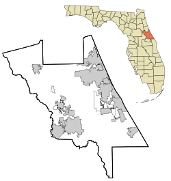
Emporia is found in the northwest part of Volusia County. You can find it along Emporia Road. It's located between two other communities: Pierson and Barberville.
What is Emporia Like?
Emporia is mostly a farming area. This means many people who live there work in agriculture. They might grow crops or raise animals. This kind of community is important for providing food and other products.
Location and Geography
Emporia is located in a specific spot in Florida. Its coordinates are 29 degrees, 12 minutes, 6 seconds North latitude and 81 degrees, 28 minutes, 5 seconds West longitude. This helps pinpoint its exact spot on a map.
The land in Emporia is about 14 meters (or 46 feet) above sea level. This elevation tells us how high the area is compared to the ocean.
How People Connect
If you need to send mail to Emporia, the postal code is 32180. This number helps the mail get to the right place. For phone calls, the area code for Emporia is 386.
The community uses the Eastern Time Zone. During standard time, it's 5 hours behind Coordinated Universal Time (UTC-5). In the summer, they switch to Daylight Saving Time (EDT), which is 4 hours behind UTC (UTC-4).


