Volusia County, Florida facts for kids
Quick facts for kids
Volusia County
|
||
|---|---|---|
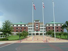
Volusia County courthouse in DeLand, built in 2001
|
||
|
||
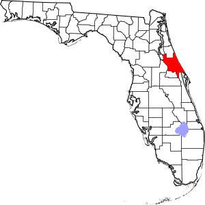
Location within the U.S. state of Florida
|
||
 Florida's location within the U.S. |
||
| Country | ||
| State | ||
| Founded | December 29, 1854 | |
| Named for | Community of Volusia | |
| Seat | DeLand | |
| Largest city | Deltona |
|
| Area | ||
| • Total | 1,432.44 sq mi (3,710.0 km2) | |
| • Land | 1,101.03 sq mi (2,851.7 km2) | |
| • Water | 331.40 sq mi (858.3 km2) 23.14% | |
| Population
(2020)
|
||
| • Total | 553,543 |
|
| • Density | 503/sq mi (194/km2) | |
| Time zone | UTC−5 (Eastern) | |
| • Summer (DST) | UTC−4 (EDT) | |
| Congressional districts | 6th, 7th | |
Volusia County is a county in the east-central part of Florida, a state in the United States. It's located between the St. Johns River and the Atlantic Ocean. In 2020, about 553,543 people lived here. This was a big increase from 2010!
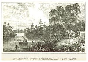
Volusia County was created on December 29, 1854. It was formed from a part of Orange County. The county was named after a community called Volusia. This community is in the northwestern part of the county. The first county seat (the main town for county government) was Enterprise. Since 1887, the county seat has been DeLand.
Volusia County is part of a larger area called the Deltona–Daytona Beach–Ormond Beach metropolitan area. This means it's connected to other nearby cities.
Contents
- What Does "Volusia" Mean?
- A Look Back: Volusia County's History
- Exploring Volusia County's Geography
- Who Lives in Volusia County?
- How Does Volusia County Make Money?
- Getting Around Volusia County
- Learning in Volusia County
- News and Entertainment
- Towns and Cities in Volusia County
- Images for kids
- See Also
What Does "Volusia" Mean?
The exact meaning of the name "Volusia" is a bit of a mystery. But there are a few interesting ideas about where it came from:
- Some people think it means "Land of the Euchee." The Euchee Indians moved into this area in the early 1700s. They lived about 10 miles south of the Volusia community.
- Another idea is that it was named after a British settler named Voluz. He owned a large farm (plantation) on the St. Johns River in the late 1700s.
- It might also come from the name Veluche. This was the last name of a French or Belgian person who ran a trading post in Volusia. Over time, Veluche might have changed to Volusia.
- Some believe the town was started and named by someone called Jere Volusia.
- A final theory suggests the Spanish named it after a famous Roman lawyer, Lucius Volusius Maecianus. He wrote many books and even taught the Roman emperor Marcus Aurelius.
A Look Back: Volusia County's History
Volusia County got its name from its biggest community, Volusia. The Florida government created the county by splitting Orange County on December 29, 1854. Back then, only about 600 people lived in Volusia County.
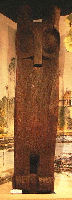
Long ago, the land that is now Volusia County was home to native groups like the Timucua and Mayaca peoples. Sadly, these groups no longer exist as separate tribes today. Many of them became sick or were affected by conflicts after European traders and settlers arrived. You can still see large shell mounds at Tomoka State Park and other places. These mounds show where these ancient people lived.
During the time when the British controlled Florida, a settlement called New Smyrna was started. It was in the southeast part of what is now Volusia County. This colony was connected to St. Augustine, the capital of East Florida, by a road called the Kings Road. When the colony didn't work out, many settlers, including people from Menorca and Greece, moved to St. Augustine.
The Seminole Indians, who are descendants of the Creek tribe, also lived in different parts of Volusia County. During a conflict called the Second Seminole War (1836–1842), the Seminole burned a large sugar farm in what is now Daytona Beach.
In 1836, a fort and supply base called Fort Florida was built. This was on the east side of the St. Johns River, in the area that is now DeBary.
Exploring Volusia County's Geography
Volusia County covers about 1,432 square miles. About 1,101 square miles are land, and 331 square miles (23.1%) are covered by water.
The county is bordered by the St. Johns River and Lake Monroe to the west. To the east, it has the Atlantic Ocean. Volusia County is about the same size as Rhode Island. It's located about 50 miles northeast of Orlando. It's also 60 miles north of the Kennedy Space Center and 89 miles south of Jacksonville.
What Are the Main Areas of Volusia County?
The government of Volusia County divides the area into three main regions:
- East Volusia: This area is also known as the greater Daytona Beach area. It includes cities like Daytona Beach, Ormond Beach, and Port Orange. It's named after the Halifax River that flows through it.
- Southeast Volusia: This region is often called the greater New Smyrna Beach area. It includes cities such as New Smyrna Beach, Edgewater, and Oak Hill.
- West Volusia: This part is known as St. Johns River country because the St. Johns River is nearby. It includes cities like DeLand, Deltona, and Orange City. Deltona is the largest city in all of Volusia County.
Which Counties Are Next to Volusia?
Volusia County shares borders with several other counties:
- Flagler County to the north
- Brevard County to the south
- Seminole and Orange Counties to the southwest
- Lake County to the west
- Marion and Putnam Counties to the northwest
Parks and Natural Areas to Explore
Volusia County has many beautiful parks and natural places:
- Addison Blockhouse Historic State Park
- Blue Spring State Park
- Bulow Creek State Park
- Canaveral National Seashore
- De Leon Springs State Park
- Dunlawton Plantation and Sugar Mill
- Gemini Springs Park
- Green Springs Park
- Hontoon Island State Park
- Lake Ashby Park
- Lake George State Forest
- Lake Woodruff National Wildlife Refuge
- North Peninsula State Park
- Ormond Beach Memorial Art Museum and Gardens
- Seminole Rest
- Smyrna Dunes Park
- Sugar Mill Ruins
- Tiger Bay State Forest
- Tomoka State Park
Rivers and Waterways
The county is home to many important rivers and waterways:
Fun Places to Visit
Volusia County has many attractions for visitors and residents:
- Athens Theater in DeLand
- Atlantic Center for the Arts in New Smyrna Beach
- Daytona International Speedway in Daytona Beach (famous for racing!)
- Jackie Robinson Ballpark in Daytona Beach
- Marine Science Center in Ponce Inlet
- Museum of Arts and Sciences (Daytona Beach)
- Ponce de Leon Inlet Lighthouse and Museum in Ponce Inlet
- Skydive DeLand at DeLand Airport
- Volusia County Fair and Expo Center in DeLand
Who Lives in Volusia County?
As of the 2020 census, there were 553,543 people living in Volusia County. There were 220,386 households and 136,510 families.
In 2020, the population was made up of different groups:
| Race | Pop 2010 | Pop 2020 | % 2010 | % 2020 |
|---|---|---|---|---|
| White (NH) | 372,982 | 379,527 | 75.41% | 68.56% |
| Black or African American (NH) | 49,548 | 55,338 | 10.02% | 10.0% |
| Native American or Alaska Native (NH) | 1,356 | 1,262 | 0.27% | 0.23% |
| Asian (NH) | 7,368 | 10,478 | 1.49% | 1.89% |
| Pacific Islander (NH) | 166 | 266 | 0.03% | 0.05% |
| Some Other Race (NH) | 778 | 2,692 | 0.16% | 0.49% |
| Mixed/Multi-Racial (NH) | 7,178 | 21,328 | 1.45% | 3.85% |
| Hispanic or Latino | 55,217 | 82,652 | 11.16% | 14.93% |
| Total | 494,593 | 553,543 | 100.00% | 100.00% |
In 2000, the average age in the county was 42 years old. About 20.3% of the population was under 18.
How Does Volusia County Make Money?
The economy of Volusia County is strong and growing. The total economic output of the county, called the gross metro product (GMP), increased from $12.98 billion in 2005 to $13.69 billion in 2006. This shows a lot of money moving around in the economy.
Many things help the economy grow. People feel good about spending money, and about 28,800 new residents moved to the county. Also, new buildings and projects added over $1.11 billion in investments. Health-care services and other professional services also grew steadily.
Manufacturing is a big part of Volusia County's economy. In 2006, there were over 430 manufacturing businesses. These jobs pay well, with an average annual wage of $37,632 in 2006. This was higher than the county's overall average wage of $32,200. Manufacturing helps the local economy more than many other types of businesses.
Getting Around Volusia County
Airports
Volusia County has several airports:
- Daytona Beach International
- DeLand Municipal Airport
- Massey Ranch Airpark
- New Smyrna Beach Municipal Airport
- Ormond Beach Municipal Airport
- Pierson Municipal Airport
- Spruce Creek Airport (Private)
Main Roads
Many important roads help people travel through Volusia County:
 I-95 is a major highway that runs north and south along the east coast.
 I-4 is a main highway that goes east and west through Central Florida.
 US 1 is a main local road that runs north and south through eastern Volusia County.
 US 17 is a main local road that runs north and south through western Volusia County.
 US 92 is an east-west route that connects to the International Speedway Boulevard.
 SR A1A is a beautiful road that runs along the coast.
Buses and Trains
The local bus service is called Volusia County Public Transit System (VOTRAN). Buses run throughout the county from Monday to Saturday. They are also accessible for people with disabilities. A ride costs $1.25, or you can get a one-day pass for $3.00.
You can also travel by train with Amtrak. The Silver Meteor and Silver Star routes serve Volusia County. For travel between Volusia County and Orlando, there's a commuter train called SunRail. This train line started in 2014 and reaches as far north as DeBary. It reached the DeLand Amtrak station in August 2024.
Learning in Volusia County
Public schools in Volusia County are managed by Volusia County Schools.
Public High Schools
- Atlantic High School
- DeLand High School
- Deltona High School
- Mainland High School
- New Smyrna Beach High School
- Pine Ridge High School
- Seabreeze High School
- Spruce Creek High School
- T. Dewitt Taylor Middle High School
- University High School
- Volusia High School
There are also private schools, like Father Lopez Catholic High School.
Colleges and Universities
Volusia County is home to several colleges and universities:
- Bethune-Cookman University
- Daytona State College
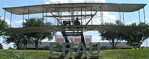
- Embry-Riddle Aeronautical University
- Keiser University
- Palmer College of Chiropractic
- Stetson University
- University of Central Florida
Vocational Schools
These schools teach specific job skills:
- Advanced Technology College
- Epic Flight Academy
- International Academy Beauty School
- Florida Technical College
- Palmer College of Chiropractic
- Phoenix East Aviation
- The Airline Academy
- WyoTech
News and Entertainment
Newspapers
- The West Volusia Beacon: An online newspaper covering DeLand and West Volusia.
- The Daytona Beach News-Journal: A daily newspaper covering all of Volusia County.
- Orlando Sentinel: A newspaper based in Orlando that also covers Volusia County.
- The Avion Newspaper: The student newspaper for Embry-Riddle Aeronautical University in Daytona Beach.
Television
WDSC-TV is a public TV station in Daytona Beach. It broadcasts to 10 counties in Central Florida. The TV station WESH is also located near Daytona Beach and Orlando. Other major TV stations from Orlando also serve Volusia County.
Radio
You can listen to many radio stations in Volusia County:
AM Radio Stations
- WELE, 1380 AM, Ormond Beach, News/Talk
- WMFJ, 1450 AM, Daytona Beach, Religious
- WNDB, 1150 AM, Daytona Beach, News/Talk/Sports
- WDJZ, 1590 AM, South Daytona, Talk
- WROD, 1340 AM, Daytona Beach, Classic Rock
- WSBB, 1230 AM, New Smyrna Beach, Standards
- WTJV, 1490 AM, DeLand, Spanish Language
- WYND, 1310 AM, DeLand, Religious
FM Radio Stations
- WAPN, 91.5 FM, Holly Hill, Contemporary Christian
- WAVX-LP, 107.1 FM, Ormond Beach, Contemporary Christian
- WCFB, 94.5 FM, Daytona Beach, Urban Adult Contemporary
- WHOG-FM, 95.7 FM, Ormond-by-the-Sea, Classic Rock
- WIKD-LP, 102.5 FM, Daytona Beach, Free-Format
- WJHM, 101.9 FM, Daytona Beach, Classic Hip Hop
- WJLU, 89.7 FM, New Smyrna Beach, Religious
- WJLU, 97.3 FM, DeLand, Religious
- WKRO-FM, 93.1 FM, Port Orange, Country
- WKTO, 88.9 FM, Edgewater, Religious
- WLGM-LP, 93.9 FM, Edgewater
- WNUE-FM, 98.1 FM, Deltona, Spanish Adult Hits
- WOCL, 105.9 FM, DeLand, Oldies
- WVYB, 103.3 FM, Holly Hill, Top 40
Towns and Cities in Volusia County
Cities
Towns
Census-Designated Places
These are areas that are like towns but don't have their own local government:
Other Communities
These are smaller communities that are not officially cities or towns:
- Alamana
- Allandale
- Ariel
- Bakerstown
- Barberville
- Beresford
- Bethune Beach
- Blake
- Blue Springs Landing
- Bluffton
- Boden
- Cassadaga
- Cabbage Bluff
- Connersville
- Conrad
- Cow Creek
- Creighton
- Cypress Lake Estates
- Daisy Lake
- Daytona Highridge Estates
- Daytona Park Estates
- Deadman Landing
- DeLand Highlands
- DeLeon Springs Heights
- Edgewater Junction
- Eldora
- Eldridge
- Ellinor Village
- Emporia
- Enterprise
- Farmton
- Fatio
- Fort Florida
- Glenwood
- Halifax Estates
- Harbor Oaks
- Hucomer
- Isleboro
- Kalamazoo
- Lake Ashby Shores
- Lemon Bluff
- Maytown
- Mission City
- Mound Grove
- National Gardens, Florida
- Orange City Hills
- Ortona
- Osteen
- Packwood Place
- Pennichaw
- Riverside
- Seabreeze
- Senyah
- Stone Island
- Sugar Mill Estates
- Tomoka Estates
- Valdez
- Volusia
- Wilbur By-The-Sea
Images for kids
See Also
 In Spanish: Condado de Volusia (Florida) para niños
 | William L. Dawson |
 | W. E. B. Du Bois |
 | Harry Belafonte |


