
Canaveral National Seashore facts for kids
Quick facts for kids Canaveral National Seashore |
|
|---|---|
|
IUCN Category V (Protected Landscape/Seascape)
|
|

An eastward view of the shoreline at sunrise.Photo by Steven H. Keys,Tripofalifestyle.com
|
|

Canaveral National Seashore
Location in Florida

Canaveral National Seashore
Location in the United States
|
|
| Location | Brevard County and Volusia County, Florida, United States |
| Nearest city | New Smyrna Beach, Florida and Titusville, Florida |
| Area | 57,662 acres (23,335 ha) |
| Established | January 3, 1975 |
| Visitors | 1,005,001 (in 2011) |
| Governing body | National Park Service |
| Website | Canaveral National Seashore |
The Canaveral National Seashore (CANA) is a special coastal park in Florida. It stretches between New Smyrna Beach and Titusville, Florida. This park is on a long, thin island called a barrier island. It was created on January 3, 1975, to protect its unique nature.
CANA covers 24 miles of beautiful beaches and sand dunes. It also has important mangrove wetlands and a big part of the Mosquito Lagoon. This seashore is the longest undeveloped stretch of land on Florida's East Coast. It's home to over 1,000 types of plants and 310 kinds of birds! The park is huge, covering about 57,662 acres. It has three main beach sections: Playalinda Beach, Klondike Beach, and Apollo Beach.
Contents
The National Park Service has found 120 old archaeological sites here. These sites show that early people, called Paleo-Indians, lived here as far back as 2000 B.C.E. They hunted, gathered food, and later started farming.
Ancient Mounds and Middens
You can still see mounds and middens (ancient trash piles) from these early times. Snyder’s Mound at Seminole Rest is from their earliest period. Castle Windy is a 17-foot-tall midden on the barrier island, used from 1200 CE for about 300 years.
Turtle Mound is the biggest midden, standing 35 feet tall. It was called Surruque by early Spanish explorers, named after the native people. Later, sailors called it Turtle Mound because it was an easy landmark.
Early Explorers and Naturalists
The names Canaveral and Los Moquitos (now Cape Canaveral and Mosquito Lagoon) are very old. Spanish explorers noted them in the 1500s. Famous naturalists like William Bartram in 1774 and Andre Michaux in 1788 wrote about Turtle Mound.
Protecting Our Coastlines
In 1934, the National Park Service started looking for "national beach parks." This led to the creation of Cape Hatteras National Seashore in 1937. In 1955, a report called Our Vanishing Shoreline said we needed to protect undeveloped coastal areas. Mosquito Lagoon and its barrier island were listed as top places to protect.
NASA and Wildlife Protection
In 1961, NASA chose Cape Canaveral for space launches. NASA bought over 100 square miles of land as a safety zone. In 1963, NASA and the Department of Interior agreed to make 25,000 acres into the Merritt Island National Wildlife Refuge. This refuge grew to 140,000 acres over the next ten years.
Creating the National Seashore
By 1968, many people wanted a national seashore here. An artist and environmentalist named Doris Leeper worked hard to stop building projects on the island. Local leaders also asked the government to create the seashore.
In 1974, government officials visited the area. Florida State Parks agreed to give about 4,000 acres of land to the new seashore. Some people worried about conflicts with rocket launches. But on January 3, 1975, President Gerald Ford signed the bill into law. Many people say Doris Leeper was the main reason Canaveral National Seashore was created.
Canaveral National Seashore is a great place for many outdoor activities. People love to go boating, kayaking, fishing, sunbathing, and hunting here. There are many boat ramps and places to launch kayaks. The beaches are very popular with both locals and visitors.
Viewing Space Launches
The John F. Kennedy Space Center is at the southern end of the barrier island. Because of this, sometimes parts of the seashore are closed during rocket launches. Playalinda Beach is a popular spot to watch launches from Kennedy Space Center and Cape Canaveral Space Force Station. You can often see NASA's Launch Complex 39B and SpaceX's Launch Complex 39A from the beach.
Fishing and Hunting
Fishing and hunting are very popular here. On the beaches, people catch fish like pompano, whiting, bluefish, and sharks. On the Mosquito Lagoon side, there are fishing piers. Anglers here catch speckled trout, redfish, sheepshead, black drum, and mangrove snapper.
More than two-thirds of the seashore is the Mosquito Lagoon. There are many places to launch kayaks and motorboats. During hunting season, hunters often go from the seashore into the nearby Merritt Island Wildlife Refuge. They can hunt waterfowl (like Canada goose, teal duck, and wood duck), deer, and wild pigs on certain days.
Gallery
-
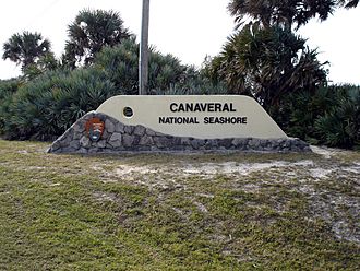
The New Smyrna Beach entrance to the park
-
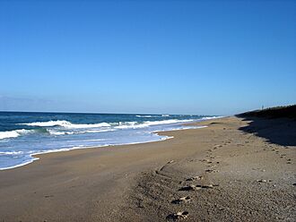
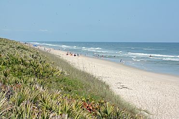
A SSE view down the shore
-
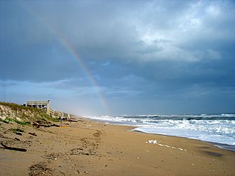
A NNW view up the shore
-
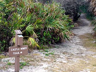
Castle Windy Trail in the park
-
Looking north on the southern part of the seashore


