
Florida State Road A1A facts for kids
Quick facts for kids
|
||||
|---|---|---|---|---|
| Lua error in Module:Infobox_road/map at line 15: attempt to index field 'wikibase' (a nil value). | ||||
| Route information | ||||
| Maintained by FDOT | ||||
| Length | 328.92 mi (529.35 km) | |||
| Existed | 1945 renumbering (definition)–present | |||
| Major junctions | ||||
| South end | Bertha Street in Key West | |||
|
||||
| North end | ||||
| Location | ||||
| Counties: | Monroe, Miami-Dade, Broward, Palm Beach, Martin, St. Lucie, Indian River, Brevard, Volusia, Flagler, St. Johns, Duval, Nassau | |||
| Highway system | ||||
| Florida State and County Roads Interstate • US • SR (Pre-1945) • Toll • County
|
||||


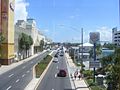
State Road A1A (often called SR A1A) is a famous road in Florida, a state in the United States. It runs along Florida's beautiful Atlantic Ocean coastline. This road is special because it connects many beach towns and cities.
SR A1A starts way down south in Key West. It then travels north, following the coast, until it reaches Callahan. This long journey makes it a key route for exploring Florida's eastern shores.
| Top - 0-9 A B C D E F G H I J K L M N O P Q R S T U V W X Y Z |
Exploring Florida's Coastal Highway
SR A1A is more than just a road; it's an adventure! It stretches for about 329 miles (530 kilometers). This makes it one of the longest state roads in Florida. It was officially named State Road A1A in 1945.
A Scenic Drive Along the Ocean
Imagine driving with the ocean on one side and palm trees on the other. That's what it's like on SR A1A! It passes through many popular places. These include Miami Beach, Fort Lauderdale, Palm Beach, Daytona Beach, and St. Augustine.
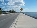
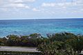
The road often runs right next to the beach. This gives drivers and passengers amazing views. You can see the sand, the waves, and sometimes even dolphins or manatees in the water.
Connecting Florida's Counties
SR A1A travels through many different counties in Florida. It starts in Monroe County (where Key West is). Then it goes through Miami-Dade, Broward, and Palm Beach.
As it heads north, it crosses Martin, St. Lucie, and Indian River counties. Further up, you'll find it in Brevard, Volusia, and Flagler counties. Finally, it passes through St. Johns, Duval, and ends in Nassau County.
Important Road Connections
Along its path, SR A1A connects with other major roads. These connections help people travel across Florida. For example, it meets I-595 in Dania Beach. It also crosses US 192 in Indialantic.
In Daytona Beach, it connects with US 92. Near Jacksonville Beach, it meets SR 202. In Yulee, it connects with US 17 and I-95. These connections make SR A1A a vital part of Florida's road network.
Images for kids
-
The beginning of SR A1A (mile marker 0) at Bertha Street in Key West
-
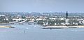
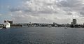
SR A1A crossing the Hillsboro Inlet between Pompano Beach and Hillsboro Beach
-
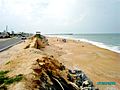
Scenic stretch of SR A1A in Flagler Beach
-
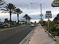
SR A1A northbound past the eastern terminus of US 92 in Daytona Beach
-
Northern terminus of SR A1A in Callahan
-
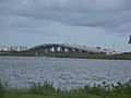
SR A1A as it runs over the 17th Street Causeway in Ft. Lauderdale.
-
SR A1A as it runs over the South Causeway in New Smyrna Beach.
-
SR A1A as it runs over the Halifax River in Port Orange.
-
SR A1A in Daytona Beach
-
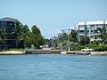
SR A1A in Key West
-
SR A1A in Boca Raton
-

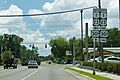
SR A1A sign in St. Augustine
-
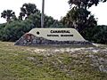
Entrance of Canaveral National Seashore from CR A1A.


.jpg)


See also
 In Spanish: Carretera Estatal de Florida A1A para niños
