Nassau County, Florida facts for kids
Quick facts for kids
Nassau County
|
||
|---|---|---|
|
County
|
||
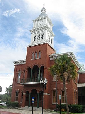
Nassau County Courthouse
|
||
|
||
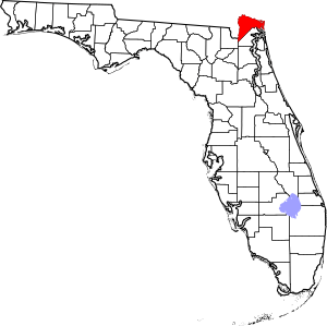
Location within the U.S. state of Florida
|
||
 Florida's location within the U.S. |
||
| Country | ||
| State | ||
| Founded | December 29, 1824 | |
| Named for | Duchy of Nassau | |
| Seat | Fernandina Beach | |
| Largest community | Yulee | |
| Area | ||
| • Total | 726 sq mi (1,880 km2) | |
| • Land | 649 sq mi (1,680 km2) | |
| • Water | 77 sq mi (200 km2) 10.6%% | |
| Population
(2020)
|
||
| • Total | 90,352 |
|
| • Estimate
(2023)
|
101,501 | |
| • Density | 127/sq mi (49/km2) | |
| Time zone | UTC−5 (Eastern) | |
| • Summer (DST) | UTC−4 (EDT) | |
| Congressional district | 4th | |
Nassau County is a county located in the northeastern part of Florida, a state in the United States. It's the county furthest to the northeast in Florida. In 2023, about 101,501 people lived here. This number has grown quite a bit from 90,352 people in 2020.
The main town, or county seat, where the county government is located, is Fernandina Beach. Nassau County is part of the larger Jacksonville, Florida Metropolitan Statistical Area, which has about 1.68 million people. The county is about 726 square miles (1,880 square kilometers) in size.
Nassau County has grown a lot since 2000, with over 40,000 new residents. This is because it's close to Jacksonville, has new homes, and offers many jobs in farming, tourism, and other businesses. It's also a popular place for military families who work at bases in nearby Duval County, Florida and Camden County, Georgia. In 2024, Nassau County will celebrate its 200th birthday!
Contents
- Discovering Nassau County's Past
- Nassau County's Climate
- Geography of Nassau County
- Getting Around Nassau County
- People of Nassau County
- Nassau County's Economy
- Education in Nassau County
- Libraries in Nassau County
- Media in Nassau County
- Towns and Communities
- Famous People from Nassau County
- Historic Places to Visit
- Images for kids
- See also
Discovering Nassau County's Past
Nassau County was created in 1824 from parts of Duval County. It was named after the Duchy of Nassau in Germany.
The Battle of Alligator Bridge happened in Nassau County near Callahan on June 30, 1778. This was a big fight during the American Revolutionary War. It was part of an effort to take over East Florida from the British, but it wasn't successful.
In 1817, a short-lived country called the Republic of the Floridas was set up on Amelia Island. This was one of many attempts to take Florida away from Spanish control and add it to the growing United States.
Before the American Civil War, some men from the county formed a group called the Davis Guards. This group later became Company K of the 2nd Florida Infantry Regiment in the Confederate army.
Nassau County's Climate
Nassau County has a humid subtropical climate. This means winters are mild, and summers are warm and humid. Most of the rain falls from May to September. The drier months are from November to April. Because Nassau County is near the coast and not too far north, it rarely gets very cold. Winters are usually mild and sunny.
| Climate data for Nassau County, Florida | |||||||||||||
|---|---|---|---|---|---|---|---|---|---|---|---|---|---|
| Month | Jan | Feb | Mar | Apr | May | Jun | Jul | Aug | Sep | Oct | Nov | Dec | Year |
| Mean daily maximum °F (°C) | 63.0 (17.2) |
65.8 (18.8) |
71.2 (21.8) |
76.8 (24.9) |
83.3 (28.5) |
88.0 (31.1) |
90.6 (32.6) |
89.3 (31.8) |
85.6 (29.8) |
79.2 (26.2) |
72.2 (22.3) |
64.9 (18.3) |
77.5 (25.3) |
| Daily mean °F (°C) | 53.8 (12.1) |
56.5 (13.6) |
61.9 (16.6) |
67.7 (19.8) |
75.0 (23.9) |
80.4 (26.9) |
82.6 (28.1) |
82.1 (27.8) |
79.2 (26.2) |
72.1 (22.3) |
63.9 (17.7) |
56.3 (13.5) |
69.3 (20.7) |
| Mean daily minimum °F (°C) | 44.5 (6.9) |
47.2 (8.4) |
52.6 (11.4) |
58.6 (14.8) |
66.7 (19.3) |
72.8 (22.7) |
74.6 (23.7) |
74.9 (23.8) |
72.8 (22.7) |
65.0 (18.3) |
55.6 (13.1) |
47.6 (8.7) |
61.1 (16.2) |
| Average precipitation inches (mm) | 3.42 (87) |
3.20 (81) |
3.92 (100) |
2.82 (72) |
2.31 (59) |
5.27 (134) |
5.52 (140) |
5.82 (148) |
6.91 (176) |
4.59 (117) |
2.08 (53) |
2.95 (75) |
48.81 (1,240) |
| Average precipitation days (≥ 0.01 in) | 9.1 | 8.4 | 8.4 | 5.9 | 6.0 | 11.5 | 11.9 | 12.5 | 11.8 | 8.1 | 7.3 | 8.2 | 109.1 |
| Source: NOAA (1981–2010 Normals) | |||||||||||||
Geography of Nassau County
Nassau County covers about 726 square miles (1,880 square kilometers). Most of this area, 649 square miles (1,681 square kilometers), is land. The rest, 77 square miles (199 square kilometers), is water. Amelia Island is the county's only island where people live. The city of Fernandina Beach is on Amelia Island.
Land Features and Zones
Nassau County has 12 different types of land areas, called topographical zones. Most of these zones stretch from north to south.
- The western part of the county, near Baker County, is mostly flat or slightly raised. The soil is sandy, and water doesn't drain well.
- Moving east, some areas have higher ground and better drainage.
- Further east, especially in the south, there are flat, low areas where water drains very poorly.
- East of these areas, there's a stretch of land that includes Hilliard. This area also has poor drainage, low land, and sandy soil.
- Then there are scattered areas of high, sandy land with mixed drainage.
- The area around Callahan has sandy soil on top with clay underneath. Many small creeks and rivers flow through this section, leading to low, poorly drained soils.
- East of Callahan, there's a large area of low, flat land with very poor drainage, filled with small creeks and rivers. In the north, these join the St. Marys River. In the south, they flow into the Nassau River and then the Atlantic Ocean.
- Further east, there's a section with very sandy soils and bad drainage.
- A large area, including Yulee, has poor drainage and sandy soil on higher ground. It also has large low areas with even worse drainage.
- To the south, along the Nassau River, there are low-lying areas with organic soils, which are mostly marshes and wetlands.
- Even further east and north, there's a large area of marshes and wetlands with many small islands. The Bells River and Jolly River flow through here, emptying into the Cumberland Sound.
- Amelia Island, the easternmost part of the county, has poor drainage in the west. As you go east towards the beach, the land becomes higher, sandier, and drains better. The northern part of the island has salty marshlands around Egan's Creek.
Neighboring Counties
Nassau County shares borders with:
- Camden County, Georgia – to the north
- Duval County – to the south and east
- Baker County – to the southwest
- Charlton County, Georgia – to the west
Getting Around Nassau County
Airports
- Fernandina Beach Municipal Airport
- Hilliard Airpark
Main Roads

 I-95 / SR 9 (Interstate 95)
 I-10 / SR 8 (Interstate 10)
 US 1 / SR 15
 US 17 / SR 5
 US 23
US 23
 US 90 / SR 10
 US 301
 SR A1A
 CR 2
CR 2 CR 15A
 CR 108
 SR 115 / CR 115
 CR 119
 SR 200
Railroads
Several important railroad lines run through Nassau County. The main one is the CSX Nahunta Subdivision. It runs alongside US 1 and 23 from Jacksonville. Another CSX line, the Callahan Subdivision, runs near US 301.
Closer to the east coast, the Kingsland Subdivision runs parallel to US 17. In Yulee, it connects with the First Coast Railroad.
The Norfolk Southern Railway also has a line, the Valdosta District, which crosses the county from northwest to southeast.
People of Nassau County
The population of Nassau County has grown steadily over the years. In 2020, there were 90,352 people living in the county.
| Race | Pop 2010 | Pop 2020 | % 2010 | % 2020 |
|---|---|---|---|---|
| White (NH) | 64,410 | 75,817 | 87.85% | 83.91% |
| Black or African American (NH) | 4,581 | 4,945 | 6.25% | 5.47% |
| Native American or Alaska Native (NH) | 248 | 222 | 0.34% | 0.25% |
| Asian (NH) | 619 | 863 | 0.84% | 0.96% |
| Pacific Islander (NH) | 46 | 52 | 0.06% | 0.06% |
| Some Other Race (NH) | 98 | 293 | 0.13% | 0.32% |
| Mixed/Multi-Racial (NH) | 932 | 3,711 | 1.27% | 4.11% |
| Hispanic or Latino | 2,380 | 4,449 | 3.25% | 4.92% |
| Total | 73,314 | 90,352 |
In 2020, there were 33,475 households and 24,357 families in the county. In 2000, about 32.8% of households had children under 18 living with them. The average household had 2.59 people.
In 2000, the largest groups of European ancestry in Nassau County were English (36.2%), Irish (13.6%), and German (11.7%).
The median age in the county was 38 years old in 2000. For every 100 females, there were 97.3 males. In 2021, the average household income was $64,943. About 8.1% of the population lived below the poverty line.
Nassau County's Economy
Nassau County has a varied economy. In the western and central parts, there are many tree farms. A big company called Rayonier owns a lot of this land and also runs a large pulp mill in Fernandina Beach. Tree farming, trucking, and pulp production have always been important here.
New homes are being built in the rural western areas. Fernandina Beach is a center for jobs like real estate, legal services, and healthcare. It's also close to two fancy resorts: the Ritz-Carlton Hotel and Amelia Island Plantation.
In the central county, there's a special place called White Oak Conservation. It used to be a private zoo with exotic animals like giraffes. Famous people, including former President Bill Clinton, have visited for relaxing trips.
Nassau County hosts many outdoor festivals and events. It has two world-class golf courses: The Golf Club at North Hampton, partly designed by Arnold Palmer, and the Amelia National Golf & Country Club, designed by Tom Fazio. Both have 18 holes and a par of 72.
The Nassau County Economic Development Board works to bring new businesses to the area. In 2017, the University of Florida announced plans for two health and fitness centers. In 2018, the energy company Florida Public Utilities moved its main office to Yulee.
Rayonier also built a new main office in Yulee in 2017. Rayonier plans to turn a large pine forest in Yulee into a community called Wildlight. This community will have homes, offices, medical centers, shops, and schools. Rayonier is working with Nassau County to build Wildlight Elementary School, which opened in 2017.
Fernandina Beach Municipal Airport is a general aviation airport. It's also used by the U.S. Navy, U.S. Coast Guard, and Florida Air National Guard. It helps reduce traffic at Jacksonville International Airport.
In Hilliard, the Federal Aviation Administration (FAA) has a big facility. This Air Traffic Control Center manages most of the commercial and civilian air traffic in the southeastern United States. Many people in Hilliard work for the FAA, including retired staff who live in Nassau County.
The Florida Welcome Center is located near the Florida/Georgia state line on I-95. It gives visitors information about travel, roads, sports, and attractions in Florida. As a nod to Florida's citrus history, visitors get a free cup of Florida orange or grapefruit juice.
Top Employers in Nassau County
As of June 2019, the biggest employers in Nassau County were:
| # | Employer | # of Employees in 2019 |
|---|---|---|
| 1 | Nassau County School District | 1,598 |
| 2 | The Omni Amelia Island Resort | 1,200 |
| 3 | Nassau County Government | 672 |
| 4 | The Ritz-Carlton, Amelia Island | 700 |
| 5 | Federal Aviation Administration | 550 |
| 6 | WestRock | 460 |
| 7 | Baptist Medical Center Nassau | 420 |
| 8 | Rayonier Advanced Materials | 300 |
| 9 | Care Centers of Nassau | 250 |
| 10 | Rayonier | 249 |
Education in Nassau County
Public Schools
The Nassau County Public School District runs the public schools.
- Elementary schools:
- Bryceville Elementary (Kindergarten-5th grade) – Bryceville
- Callahan Elementary (Pre-Kindergarten-2nd grade) – Callahan
- Callahan Intermediate (3rd-5th grade) – Callahan
- Emma Love Hardee Elementary (3rd-5th grade) – Fernandina Beach
- Hilliard Elementary (Pre-Kindergarten-5th grade) – Hilliard
- Southside Elementary (Pre-Kindergarten-2nd grade) – Fernandina Beach
- Wildlight Elementary (Kindergarten-5th grade) – Wildlight
- Yulee Elementary (3rd-5th grade) – Yulee
- Yulee Primary (Pre-Kindergarten-2nd grade) – Yulee
- Middle schools:
- Callahan Middle (6th-8th grade) (Mascot: Ramblers) – Callahan
- Fernandina Beach Middle (6th-8th grade) (Mascot: Pirates) – Fernandina Beach
- Yulee Middle (6th-8th grade) (Mascot: Hornets) – Yulee
- High schools:
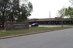
- Fernandina Beach High (9th-12th grade) (Mascot: Pirates) – Fernandina Beach
- West Nassau High (9th-12th grade) (Mascot: Warriors) – Callahan
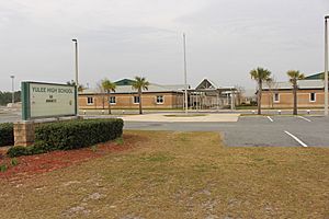
- Yulee High (9th-12th grade) (Mascot: Hornets) – Yulee
- Middle-senior high schools:
- Hilliard Middle-Senior High (6th-12th grade) (Mascot: Red Flashes) – Hilliard
Private Schools
- Amelia Island Montessori (Pre-Kindergarten-8th grade) – Fernandina Beach
- Faith Christian Academy (Pre-Kindergarten-12th grade) – Fernandina Beach
- Fernandina Beach Christian Academy (Kindergarten-5th grade) – Fernandina Beach
- Nassau Christian School (Pre-Kindergarten-12th grade) – Yulee
- St. Michaels Academy (Pre-Kindergarten-8th grade) – Fernandina Beach
- Sonshine Christian School (Pre-Kindergarten-12th grade) – Callahan
Higher Education
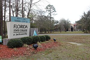
The Betty Cook Center in Nassau County, near Yulee, is a campus of Florida State College at Jacksonville. This college offers both associate's degrees (two-year degrees) and bachelor's degrees (four-year degrees).
Libraries in Nassau County
The Nassau County Public Library has 5 branches:
- Bryceville
- Callahan
- Fernandina Beach
- Hilliard
- Yulee
The Fernandina Beach branch was greatly improved in 2015 and reopened in 2016. Its size doubled to about 16,000 square feet (1,486 square meters). This update made the building, first opened in 1976, meet modern standards. The Fernandina Beach branch also holds over a thousand books and records from the Amelia Island Genealogical Society, which people can use inside the library.
Media in Nassau County
Nassau County has three newspapers. The largest is the Fernandina Beach News-Leader. Another paper, the Nassau County Record, is also owned by the same company. Both of these newspapers can be bought by subscription or at newsstands.
The Westside Journal is an independent newspaper. It is given out for free by mail and often features articles written by different people.
Towns and Communities
City
- Fernandina Beach (this is the county seat)
Towns
Census-Designated Places
These are areas identified by the U.S. Census Bureau for statistical purposes, but they are not officially incorporated cities or towns.
Other Communities
- Amelia City
- American Beach
- Andrews
- Becker
- Boulogne
- Bryceville
- Chester
- Crandall
- Crawford
- Dahoma
- Dyal
- Evergreen
- Franklintown
- Glenwood
- Gross
- Hedges
- Hero
- Ingle
- Italia
- Keene
- Kent
- Kings Ferry
- Lessie
- Mattox
- Nassauville
- O'Neil
- Verdie
- Yulee Heights
Gallery of Communities
Famous People from Nassau County
- William B. Allen (born 1944 in Fernandina Beach) – A political scientist who led the United States Commission on Civil Rights for a time.
- Kris Anderson – A basketball player for the Milwaukee Bucks.
- George Crady – A former member of the Florida House of Representatives.
- Kyle Denney – A baseball catcher in Major League Baseball.
- Ben "Bubba" Dickerson – A professional golfer.
- Derrick Henry – A football running back who won the Heisman Trophy in 2015 while playing for the Alabama and now plays for the Tennessee Titans.
- Howie Kendrick – A baseball player for the Anaheim Angels.
- Frank Murphy Jr – A former NFL football player for teams like the Chicago Bears and Miami Dolphins.
- Apple Pope – An American rugby league player for the United States national team.
- Tom Schwartz – An entrepreneur and TV star from the show 'Vanderpump Rules'.
- D. J. Stewart – A baseball left fielder who played for Florida State University.
- Rick Stockstill – A football head coach at Middle Tennessee, who grew up in Fernandina Beach.
- Zack Taylor – A baseball player and manager for the St. Louis Browns.
- Daniel Thomas – A football player for the Miami Dolphins.
- David Levy Yulee – Florida's first U.S. senator and a builder of Florida's first cross-state railroad. There is a statue of him in Fernandina Beach.
Historic Places to Visit
Nassau County has many places listed on the National Register of Historic Places. These include:
- Amelia Island Light – A historic lighthouse.
- Amelia Island Museum of History – A museum about the island's past.
- American Beach Historic District – An important historic area.
- Bailey House – A historic home.
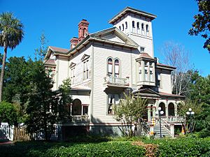
- Fairbanks House – Another historic home, now a bed and breakfast.
- Fernandina Beach Historic District – A whole area with many historic buildings.
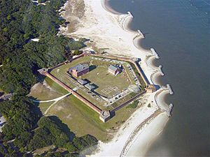
- Fort Clinch State Park – A large state park with a historic fort.
- Historic Nassau County Courthouse – The old courthouse building.
- Mount Olive Missionary Baptist Church – A historic church.
- Original Town of Fernandina Historic Site – The site of the original town.
- Tabby House – A unique historic house made of tabby (a type of concrete).
Images for kids
See also
 In Spanish: Condado de Nassau (Florida) para niños
 | Jessica Watkins |
 | Robert Henry Lawrence Jr. |
 | Mae Jemison |
 | Sian Proctor |
 | Guion Bluford |


