St. Lucie County, Florida facts for kids
Quick facts for kids
St. Lucie County
|
||
|---|---|---|

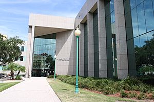
St. Lucie County Courthouse
|
||
|
||

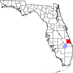
Location within the U.S. state of Florida
|
||
 Florida's location within the U.S. |
||
| Country | ||
| State | ||
| Founded | May 24, 1905 | |
| Named for | St. Lucie Inlet | |
| Seat | Fort Pierce | |
| Largest city | Port St. Lucie | |
| Area | ||
| • Total | 688 sq mi (1,780 km2) | |
| • Land | 572 sq mi (1,480 km2) | |
| • Water | 116 sq mi (300 km2) 16.9%% | |
| Population
(2020)
|
||
| • Total | 329,226 | |
| • Density | 576/sq mi (222/km2) | |
| Time zone | UTC−5 (Eastern) | |
| • Summer (DST) | UTC−4 (EDT) | |
| Congressional district | 21st | |
St. Lucie County is a county in southeastern Florida. In 2020, about 329,226 people lived there.
The county's main city, called the county seat, is Fort Pierce. The biggest city is Port St. Lucie, where 62% of the county's people live. St. Lucie County is the main part of the Port St. Lucie, FL Metropolitan Area.
Contents
History of St. Lucie County
The area was first home to the Ais tribe. They were hunter-gatherers. Their land stretched from the St. John's River to the St. Lucie Inlet. Spanish explorers often met this strong tribe. Spanish treasure ships sailed nearby to use the powerful Gulfstream current.
The Spanish gave the area names like Rio de Ays (now called Indian River) and Santa Lucia. This name came from a Spanish fort built in the late 1500s. In 1715, a famous Spanish treasure fleet sank off what is now St. Lucie County. This led to the area being called the Treasure Coast.
Early Settlements and Wars
In the early 1800s, the Spanish government gave land grants here. One grant went to James Hutchinson. It was about 2,000 acres (8.1 km2). Today, Hutchinson Island is named after him.
In the mid-1800s, Seminole people and runaway slaves found safety in this quiet area. By 1837, the Second Seminole War began in Florida. In December 1837, soldiers led by Lt. Colonel Benjamin K. Pierce sailed down the Indian River. They built a fort and named it after him. This fort is now the city of Fort Pierce.
In 1841, the U.S. government offered land to Americans who would settle here. Some of these lands were in today's St. Lucie County. The Third Seminole War in 1851 led to a second major fort. This was Fort Capron, built where St. Lucie Village is today.
After this, more people moved to the area. They came for health and work. The Flagler railroad reached the area in the 1890s. At the end of the 1800s, main jobs included growing pineapples, fishing, seafood canning, and raising cattle. Citrus fruits became a big crop in the early 1900s. The city of Fort Pierce officially started in 1901.
Forming St. Lucie County
Before 1905, this area was part of Brevard County. (Brevard County was actually called St. Lucie County from 1844 to 1855). In the summer of 1905, St. Lucie County was created. It was made from the southern part of Brevard County. Fort Pierce became its county seat.
Over time, parts of St. Lucie County were used to create other counties:
- In 1917, much of western St. Lucie County became Okeechobee County.
- In 1925, Indian River County was created from the northern part.
- Also in 1925, Martin County was formed from a small part of southeastern St. Lucie County and northern Palm Beach County.
Modern Growth and Development
The 1920s saw a lot of land buying and plans for new towns. But these plans failed when the economy crashed in 1929. During World War II, the U.S. Naval Amphibious Training Base was set up in Fort Pierce. Over 140,000 troops trained there. After the war, many people moved to the area. Some were sailors and their families who had trained at the Navy base.
In 1958, a company bought thousands of acres along the St. Lucie River. They wanted to build a new community. Smart advertising brought many retirees and families from the Northeast. This laid the groundwork for the city of Port St. Lucie. In the late 1900s, more people moved in, leading to new areas like St. Lucie West and Tradition.
The early 2000s brought challenges. Two major hurricanes hit in 2004. An economic slowdown began in 2008. In 2005, St. Lucie County celebrated its 100th birthday!
Geography
St. Lucie County covers about 688 square miles (1,780 km2). About 572 square miles (1,480 km2) is land, and 116 square miles (300 km2) is water. This means about 16.9% of the county is water.
Neighboring Counties
- Indian River County - to the north
- Martin County - to the south
- Okeechobee County - to the west
Transportation
Airports
- St. Lucie County International Airport is for general aviation (smaller planes). The closest airports for commercial flights are in Melbourne, Vero Beach, and West Palm Beach.
Major Roads
 Interstate 95
 Florida's Turnpike
 U.S. Route 1
 State Road A1A
 State Road 68
 State Road 70
 State Road 607
 State Road 608
 State Road 614
 State Road 615
 State Road 713
 State Road 716
Public Buses
St. Lucie County has a public bus system. It started in the 1990s as a service where you called for a ride. Later, it grew into a system with set routes. In 2002, the bus service expanded to Martin County. It is now called the Treasure Coast Connector.
Passenger Trains
Until 1968, the Florida East Coast Railway ran trains from Jacksonville to Miami. They stopped in Fort Pierce. Other long-distance trains also stopped in Fort Pierce until 1963.
In 2023, Brightline announced plans for a new train station on the Treasure Coast. Brightline is a fast train service between Miami and Orlando. As of 2024, there are no plans for a station in St. Lucie County. A station might be built in Stuart, Florida, just south of the county, by 2026.
People of St. Lucie County
| Historical population | |||
|---|---|---|---|
| Census | Pop. | %± | |
| 1910 | 4,075 | — | |
| 1920 | 7,886 | 93.5% | |
| 1930 | 7,057 | −10.5% | |
| 1940 | 11,871 | 68.2% | |
| 1950 | 20,180 | 70.0% | |
| 1960 | 39,294 | 94.7% | |
| 1970 | 50,836 | 29.4% | |
| 1980 | 87,182 | 71.5% | |
| 1990 | 150,171 | 72.3% | |
| 2000 | 192,695 | 28.3% | |
| 2010 | 277,789 | 44.2% | |
| 2020 | 329,226 | 18.5% | |
| 2023 (est.) | 373,586 | 34.5% | |
| U.S. Decennial Census 1790-1960 1900-1990 1990-2000 2010-2019 |
|||
In 2020, St. Lucie County had 329,226 people. There were 118,527 households and 81,648 families.
| Race | Pop 2010 | Pop 2020 | % 2010 | % 2020 |
|---|---|---|---|---|
| White (NH) | 170,032 | 176,533 | 61.21% | 53.62% |
| Black or African American (NH) | 51,373 | 64,597 | 18.49% | 19.62% |
| Native American or Alaska Native (NH) | 664 | 568 | 0.24% | 0.17% |
| Asian (NH) | 4,226 | 5,678 | 1.52% | 1.72% |
| Pacific Islander (NH) | 127 | 141 | 0.05% | 0.04% |
| Some Other Race (NH) | 845 | 2,470 | 0.3% | 0.75% |
| Mixed/Multi-Racial (NH) | 4,527 | 12,919 | 1.63% | 3.92% |
| Hispanic or Latino | 45,995 | 66,320 | 16.56% | 20.14% |
| Total | 277,789 | 329,226 | 100.00% | 100.00% |
In 2010, the population density was about 486 people per square mile. The county's population was 71.8% White, 19.1% African American, and 16.6% Hispanic or Latino.
Most people in St. Lucie County speak English (90.7%). About 14.6% speak Spanish.
In 2010, about 26.3% of households had children under 18. The average household had 2.53 people. The median age in the county was 42.4 years.
Animals of St. Lucie County
Some bird species in St. Lucie County are very sensitive to climate change. These include:
Education
Schools in St. Lucie County are run by St. Lucie County Public Schools. The county also has several colleges and universities:
- Florida Atlantic University Harbor Branch Oceanographic Institute
- Indian River State College Ft. Pierce and PSL Campus
- Keiser University PSL Campus
- University of Florida Institute of Food and Agricultural Sciences, Ft. Pierce
Libraries
The St. Lucie County Library System serves the county.
Places to Visit
- Experimental Oculina Research Reserve
- Heathcote Botanical Gardens
- Navy UDT-SEAL Museum (Fort Pierce was where the Navy SEALs first started)
- Old Fort Park
- St. Lucie County Aquarium
- St. Lucie County International Airport
- St. Lucie County Regional History Center
Communities
Cities
Towns
Census-Designated Places
These are areas that are like towns but are not officially incorporated cities.
- Fort Pierce North
- Fort Pierce South
- Hutchinson Island South
- Indian River Estates
- Lakewood Park
- River Park
- White City
Other Communities
See also
 In Spanish: Condado de Santa Lucía para niños
 | Toni Morrison |
 | Barack Obama |
 | Martin Luther King Jr. |
 | Ralph Bunche |


