Enemy Swim Lake facts for kids
Quick facts for kids Enemy Swim Lake |
|
|---|---|
| Location | Waubay Township, Day and Roberts counties, Lake Traverse Indian Reservation, South Dakota, United States |
| Coordinates | 45°26′22″N 97°15′58″W / 45.4394°N 97.2662°W |
| Basin countries | United States |
| Surface elevation | 1,854 ft (565 m) |
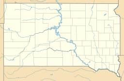
Enemy Swim Lake is a beautiful lake located in the northeastern part of South Dakota, a state in the United States. It's found in a special area known for many lakes, which were all formed by ancient glaciers. This lake is also part of the Lake Traverse Indian Reservation in Day County.
The lake sits at an elevation of about 1,854 feet (565 meters) above sea level. Its exact location can be found using coordinates: 45.4394 degrees North and 97.2662 degrees West.
The Story Behind the Name
Enemy Swim Lake has a very interesting name that tells a story from long ago. The name comes from the native Sioux people who lived in this area. It accurately keeps the original Sioux name for the lake.
The name remembers a time when Sioux people had to swim across the lake. They did this to escape from their enemies who were chasing them. So, the lake became known as the place where they had to "swim from the enemy." It's a reminder of an important historical event for the local Native American communities.
Glacial Lake Region
Enemy Swim Lake is part of a larger area known as the glacial lake region. This means the lake was created thousands of years ago by huge sheets of ice called glaciers. As these glaciers moved across the land, they carved out deep hollows and valleys.
When the climate warmed, the glaciers melted. The water filled these hollows, forming many lakes, including Enemy Swim Lake. This process shaped much of the landscape in northeastern South Dakota.
 | Emma Amos |
 | Edward Mitchell Bannister |
 | Larry D. Alexander |
 | Ernie Barnes |


