Day County, South Dakota facts for kids
Quick facts for kids
Day County
|
|
|---|---|

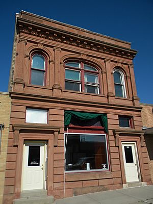
First National Bank (Webster, South Dakota)
|
|

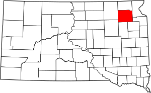
Location within the U.S. state of South Dakota
|
|
 South Dakota's location within the U.S. |
|
| Country | |
| State | |
| Founded | 1880 |
| Named for | Merritt H. Day |
| Seat | Webster |
| Largest city | Webster |
| Area | |
| • Total | 1,091 sq mi (2,830 km2) |
| • Land | 1,028 sq mi (2,660 km2) |
| • Water | 63 sq mi (160 km2) 5.8% |
| Population
(2020)
|
|
| • Total | 5,449 |
| • Estimate
(2023)
|
5,451 |
| • Density | 4.9945/sq mi (1.9284/km2) |
| Time zone | UTC−6 (Central) |
| • Summer (DST) | UTC−5 (CDT) |
| Congressional district | At-large |
Day County is a county located in the state of South Dakota in the United States. It's like a special area within the state. In 2020, about 5,449 people lived here. The main town, or county seat, is Webster. The county was named after Merritt H. Day, who was an important pioneer and a lawmaker in the Dakota Territory back in 1879.
Contents
What Day County Looks Like (Geography)
Day County has rolling hills, which means the land goes up and down gently. A lot of this land is used for farming. You'll also find many lakes and ponds, especially in the eastern part of the county. The land generally slopes downwards towards the west. The highest point in the county is in its northeast corner, which is about 2,014 feet (614 meters) above sea level.
The total area of Day County is about 1,091 square miles (2,826 square kilometers). Most of this is land (1,028 square miles or 2,662 square kilometers), and a smaller part is water (63 square miles or 163 square kilometers).
Lakes You Can Find Here
- Amsden
- Antelope
- Bitter
- Blue Dog
- Enemy Swim
- Horseshoe
- Lynn
- Minnewaste
- Pickerel Lake
- Reetz
- Rush
- Sweetwater
- Waubay
Main Roads (Major Highways)
Neighboring Counties
Day County shares its borders with these other counties:
- Marshall County to the north
- Roberts County to the east
- Grant County to the southeast
- Codington County to the southeast
- Clark County to the south
- Spink County to the southwest
- Brown County to the west
Special Natural Areas (Protected Areas)
These are places set aside to protect nature and wildlife:
- Buchner Slough State Public Shooting Area
- Holmquist Slough State Public Shooting Area
- Lily State Public Shooting Area
- Myland Pass State Public Shooting Area
- Nelson Slough State Public Shooting Area
- Pickerel Lake State Recreation Area
- Pierpont Lake Recreation Area
- Waubay National Wildlife Refuge
Who Lives Here (Demographics)
| Historical population | |||
|---|---|---|---|
| Census | Pop. | %± | |
| 1880 | 97 | — | |
| 1890 | 9,168 | 9,351.5% | |
| 1900 | 12,254 | 33.7% | |
| 1910 | 14,372 | 17.3% | |
| 1920 | 15,194 | 5.7% | |
| 1930 | 14,606 | −3.9% | |
| 1940 | 13,565 | −7.1% | |
| 1950 | 12,294 | −9.4% | |
| 1960 | 10,516 | −14.5% | |
| 1970 | 8,713 | −17.1% | |
| 1980 | 8,133 | −6.7% | |
| 1990 | 6,978 | −14.2% | |
| 2000 | 6,267 | −10.2% | |
| 2010 | 5,710 | −8.9% | |
| 2020 | 5,449 | −4.6% | |
| 2023 (est.) | 5,451 | −4.5% | |
| U.S. Decennial Census 1790-1960 1900-1990 1990-2000 2010-2020 |
|||
What the 2020 Census Showed
In 2020, the census counted 5,449 people living in Day County. There were 2,370 households (groups of people living together) and 1,451 families. On average, there were about 5.3 people per square mile. The average income for a household was $57,558 per year. For families, it was $76,583. About 14.7% of all people in the county lived below the poverty line. This included 21.5% of kids under 18 and 11.9% of people aged 65 or older.
What the 2010 Census Showed
In 2010, there were 5,710 people in Day County. Most people (88.1%) were white, and 9.5% were American Indian. A small number were from other backgrounds. About 1.1% of the population was of Hispanic or Latino origin.
Many people in Day County have ancestors from Germany (43.8%), Norway (25.1%), Poland (12.8%), and Ireland (8.8%). The average age of people in the county was 47.9 years old. The average income for a household was $36,818 per year. About 12.5% of the population lived below the poverty line.
Towns and Cities (Communities)
Day County has several towns and cities where people live:
Cities
Towns
Special Designated Area (Census-designated place)
- Enemy Swim
Small Villages (Unincorporated communities)
See also
 In Spanish: Condado de Day para niños
 | Bessie Coleman |
 | Spann Watson |
 | Jill E. Brown |
 | Sherman W. White |

