
Codington County, South Dakota facts for kids
Quick facts for kids
Codington County
|
|
|---|---|

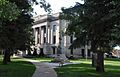
Codington County Courthouse in July 2013
|
|

Location within the U.S. state of South Dakota
|
|
 South Dakota's location within the U.S. |
|
| Country | |
| State | |
| Founded | 1877 (created) 1878 (organized) |
| Named for | Reverend George S. S. Codington |
| Seat | Watertown |
| Largest city | Watertown |
| Area | |
| • Total | 717 sq mi (1,860 km2) |
| • Land | 688 sq mi (1,780 km2) |
| • Water | 29 sq mi (80 km2) 4.0% |
| Population
(2020)
|
|
| • Total | 28,325 |
| • Estimate
(2023)
|
28,971 |
| • Density | 39.505/sq mi (15.253/km2) |
| Time zone | UTC−6 (Central) |
| • Summer (DST) | UTC−5 (CDT) |
| Congressional district | At-large |
Codington County is a county in the state of South Dakota. In 2020, about 28,325 people lived here. This makes it the 7th most populated county in South Dakota.
The main city and county seat is Watertown. The county was officially formed in 1877 and started working in 1878. It is named after Rev. George S. S. Codington, who was a lawmaker in the Dakota Territory.
Codington County is part of the Watertown, SD Micropolitan Statistical Area. This means Watertown is a central city for a smaller group of nearby communities.
Contents
Exploring Codington County's Land
Codington County has rolling hills and many lakes and ponds. You'll find lots of these, especially in the southwest part of the county. Most of the land is used for farming. The eastern and western sides of the county are higher up. The land generally slopes down towards the south.
The county covers a total area of about 717 square miles. Out of this, 688 square miles are land, and 29 square miles (about 4%) are water.
Main Roads and Travel
You can travel through Codington County using several important roads:
 Interstate 29
 U.S. Highway 81
 U.S. Highway 212
 South Dakota Highway 20
- South Dakota Highway 20P
For public transport, Jefferson Lines serves the area.
Neighboring Counties
Codington County shares borders with these other counties:
- Grant County - to the northeast
- Deuel County - to the southeast
- Hamlin County - to the south
- Clark County - to the west
- Day County - to the northwest
Protected Natural Areas
The county has several protected areas. These places help keep nature safe and offer spots for outdoor activities.
- American Game Association State Game Production Area
- Blythe State Game Production Area
- Christopherson Game Production Area
- Clarksean State Game Production Area
- Codington County State Game Production Area
- Curley State Game Production Area
- Elmore State Game Production Area
- Gilbert State Game Production Area
- Goose Lake State Game Production Area
- Hanson State Game Production Area
- Horseshoe Lake State Game Production Area
- Larson State Game Production Area
- McKillicans Lake State Game Production Area
- North Nichols State Game Production Area
- North Stink Lake State Game Production Area
- Pelican Lake State Recreation Area
- Punished Womans Lake State Game Production Area
- Sandy Shore State Recreation Area
- Spencer State Game Production Area
- Spoonbill Pass State Game Production Area
- Thompson's Point State Lakeside Use Area
- Warner Lake State Game Production Area
- Wolf State Game Production Area (partial)
Major Lakes in the County
Many lakes are found in Codington County, including:
- Cottonwood Lake
- Dry Lake
- Goose Lake
- Grass Lake
- Horseshoe Lake
- Kings Lake
- Lake Kampeska
- Lake Nicholson
- Long Lake
- McKillicans Lake
- Medicine Lake
- Pelican Lake
- Punished Womans Lake
- Round Lake
- Still Lake
- Warner Lake
People of Codington County
| Historical population | |||
|---|---|---|---|
| Census | Pop. | %± | |
| 1880 | 2,156 | — | |
| 1890 | 7,037 | 226.4% | |
| 1900 | 8,770 | 24.6% | |
| 1910 | 14,092 | 60.7% | |
| 1920 | 16,549 | 17.4% | |
| 1930 | 17,457 | 5.5% | |
| 1940 | 17,014 | −2.5% | |
| 1950 | 18,944 | 11.3% | |
| 1960 | 20,220 | 6.7% | |
| 1970 | 19,140 | −5.3% | |
| 1980 | 20,885 | 9.1% | |
| 1990 | 22,698 | 8.7% | |
| 2000 | 25,897 | 14.1% | |
| 2010 | 27,227 | 5.1% | |
| 2020 | 28,325 | 4.0% | |
| 2023 (est.) | 28,971 | 6.4% | |
| U.S. Decennial Census 1790-1960 1900-1990 1990-2000 2010-2020 |
|||
What the 2020 Census Showed
In 2020, there were 28,325 people living in Codington County. There were 12,026 households, which are groups of people living together. The population density was about 41 people per square mile.
What the 2010 Census Showed
In 2010, the county had 27,227 people. Most people (95.3%) were white. About 2.0% were American Indian. People of Hispanic or Latino origin made up 1.6% of the population.
The average age of people in the county was 37.7 years old. About 30.7% of households had children under 18 living with them.
Places to Live and Visit
City
- Watertown (This is the main city and where the county government is located.)
Towns
Census-Designated Place
- Waverly (This is a special area that the census bureau defines.)
Unincorporated Communities
These are smaller places that don't have their own local government:
Townships
Townships are smaller divisions of the county, often for local services:
- Dexter
- Eden
- Elmira
- Fuller
- Germantown
- Graceland
- Henry
- Kampeska
- Kranzburg
- Lake
- Leola
- Pelican
- Phipps
- Rauville
- Richland
- Sheridan
- Waverly
Images for kids
-
Codington County Courthouse in July 2013
See also
 In Spanish: Condado de Codington para niños
