Kranzburg, South Dakota facts for kids
Quick facts for kids
Kranzburg, South Dakota
|
|
|---|---|

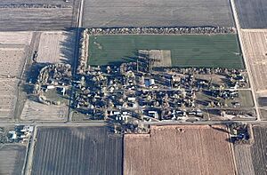
Kranzburg, SD from the air
|
|

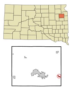
Location in Codington County and the state of South Dakota
|
|
| Country | United States |
| State | South Dakota |
| County | Codington |
| Founded | May 16, 1879 |
| Area | |
| • Total | 0.76 sq mi (1.98 km2) |
| • Land | 0.76 sq mi (1.98 km2) |
| • Water | 0.00 sq mi (0.00 km2) |
| Elevation | 1,975 ft (602 m) |
| Population
(2020)
|
|
| • Total | 163 |
| • Density | 213.35/sq mi (82.42/km2) |
| Time zone | UTC-6 (CST) |
| • Summer (DST) | UTC-5 (CDT) |
| ZIP code |
57245
|
| Area code(s) | 605 |
| FIPS code | 46-34340 |
| GNIS feature ID | 1267446 |
Kranzburg is a small town located in Codington County, South Dakota, in the United States. In 2020, about 163 people lived there. It is part of the larger Watertown area.
Contents
The Story of Kranzburg
Kranzburg was officially planned and settled in 1879. The town was named after four brothers from the Kranz family. These brothers were immigrants from a country called Luxembourg, specifically from a town called Vianden. They were among the first people to settle in this area. A post office has been open in Kranzburg since 1879, helping people send and receive mail for a very long time.
Where is Kranzburg?
Kranzburg is a small town that covers about 0.76 square miles (1.98 square kilometers) of land. There is no water within the town's official area.
Who Lives in Kranzburg?
| Historical population | |||
|---|---|---|---|
| Census | Pop. | %± | |
| 1960 | 156 | — | |
| 1970 | 143 | −8.3% | |
| 1980 | 136 | −4.9% | |
| 1990 | 132 | −2.9% | |
| 2000 | 185 | 40.2% | |
| 2010 | 172 | −7.0% | |
| 2020 | 163 | −5.2% | |
| 2021 (est.) | 168 | −2.3% | |
| U.S. Decennial Census 2020 Census |
|||
Population in 2010
In 2010, there were 172 people living in Kranzburg. These people lived in 64 different homes, and 49 of those were families. The town had about 226 people per square mile.
Most of the people in Kranzburg (99.4%) were White. About 0.6% were from other racial backgrounds. A small number (0.6%) were Hispanic or Latino.
About 31% of the homes had children under 18 living there. Most homes (70%) were married couples living together. The average home had about 2.69 people, and the average family had about 3.12 people.
The average age of people in Kranzburg was 39.5 years old. About 25% of the residents were under 18. About 15.7% were 65 years old or older. The town had slightly more males (51.2%) than females (48.8%).
Schools in Kranzburg
Holy Rosary Catholic School was the only school in Kranzburg for many years. It taught students from preschool up to sixth grade. The school closed in 2013 after serving the community for over 70 years.
Even though the school is closed, the building is still used. Religious education classes happen there every week during the school year. The attached hall is also used for different events, like dinners and an annual bazaar in September. A new playground was built on the school grounds in 2007.
Fun Events and Culture
Kranzburg is famous for its annual Fourth of July parade. People come from all over to celebrate Independence Day here. Even though Kranzburg is a small town with only about 172 residents, over 10,000 visitors come for the parade each year!
Important people, like U.S. Senator John Thune and Governor Kristi Noem, have even participated in the parade. It's a big event for such a small place.
Getting Around Kranzburg
U.S. Route 212 is a main road that runs along the south side of Kranzburg. If you drive east on this road, you can reach Minneapolis/St. Paul in about three and a half hours. Driving west for eight miles will take you to the city of Watertown.
You can also get to Interstate 29 by driving eight miles west and then 12 miles south. This interstate connects to many other places.
The Watertown Regional Airport is about 14 miles west of Kranzburg. From this airport, you can catch daily flights to big cities like Chicago and Denver.
See also
 In Spanish: Kranzburg para niños
 | Delilah Pierce |
 | Gordon Parks |
 | Augusta Savage |
 | Charles Ethan Porter |

