Luxembourg facts for kids
Quick facts for kids
Grand Duchy of Luxembourg
|
|
|---|---|
|
|
|
|
Motto: "Mir wëlle bleiwe wat mir sinn"
"We want to stay what we are" |
|
|
Anthem: "Ons Heemecht"
("Our Homeland") Royal anthem: "De Wilhelmus"a
|
|
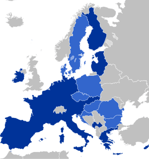
![Location of Luxembourg (green circle)– on the European continent (light green & dark grey)– in the European Union (light green) — [Legend]](/images/thumb/c/c3/EU-Luxembourg.svg/350px-EU-Luxembourg.svg.png)
Location of Luxembourg (green circle)
– on the European continent (light green & dark grey) |
|
| Capital and largest city
|
Luxembourg Lua error in Module:Coordinates at line 614: attempt to index field 'wikibase' (a nil value). |
| Official languages | National language: Luxembourgish Administrative languages: |
| Nationality (2025) |
|
| Religion
(2021)
|
|
| Demonym(s) |
|
| Government | Unitary parliamentary constitutional monarchy |
| Guillaume V | |
| Luc Frieden | |
| Legislature | Chamber of Deputies |
| Independence | |
|
• From the French Empire and elevation to Grand Duchy of Luxembourg
|
9 June 1815 |
|
• Independence in personal Union with the Netherlands (Treaty of London)
|
19 April 1839 |
|
• End of personal union with the Kingdom of the Netherlands
|
23 November 1890 |
|
• Occupation during World War I by the German Empire
|
1 August 1914 |
|
• Liberation from the Greater German Reich
|
1944/1945 |
| Area | |
|
• Total
|
2,586.4 km2 (998.6 sq mi) (168th) |
|
• Water (%)
|
0.23 (2015) |
| Population | |
|
• January 2025 estimate
|
|
|
• 2021 census
|
643,941 |
|
• Density
|
264/km2 (683.8/sq mi) (53rd) |
| GDP (PPP) | 2025 estimate |
|
• Total
|
|
|
• Per capita
|
|
| GDP (nominal) | 2025 estimate |
|
• Total
|
|
|
• Per capita
|
|
| Gini (2023) | ▲ 30.6 medium |
| HDI (2023) | very high · 25th |
| Currency | Euro (€) (EUR) |
| Time zone | UTC+1 (CET) |
|
• Summer (DST)
|
UTC+2 (CEST) |
| Note: Although Luxembourg is located in Western European Time/UTC (Z) zone, since 1 June 1904, LMT (UTC+0:24:36) was abandoned and Central European Time/UTC+1 was adopted as standard time,[1] with a +0:35:24 offset (+1:35:24 during DST) from Luxembourg City's LMT. | |
| Calling code | +352 |
| ISO 3166 code | LU |
| Internet TLD | .lub |
|
|
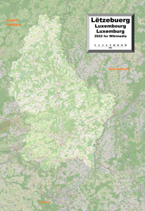
Luxembourg, officially known as the Grand Duchy of Luxembourg, is a small country in Western Europe. It's a landlocked nation, meaning it has no coastline. It shares borders with Belgium to the west and north, Germany to the east, and France to the south.
Its capital and largest city, Luxembourg City, is a very important place in Europe. It's one of the four main locations for the European Union (EU) institutions. For example, the highest court of the EU, the Court of Justice of the European Union, is located here. Luxembourg's culture, people, and languages are strongly influenced by France and Germany. Luxembourgish is the national language, while French is used for laws, and all three—Luxembourgish, German, and French—are used for government business.
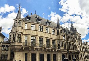
Luxembourg is Europe's seventh-smallest country, covering about 2,586 square kilometers (998 sq mi). In 2024, it had a population of 672,050, making it one of the least-populated countries in Europe. However, its population is growing quickly, with almost half of its residents being from other countries. Luxembourg is a representative democracy led by a constitutional monarch, Grand Duke Henri. It is the only country in the world that is still a sovereign grand duchy.
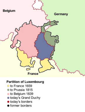
The County of Luxembourg started in the 11th century as part of the Holy Roman Empire. Its power grew, and in the 14th century, its ruler, Henry VII, became the Holy Roman Emperor. Luxembourg was later ruled by the Habsburgs in the 15th century and then by France in the 18th century. Over time, parts of Luxembourg were given away three times, making it smaller. After Napoleon's defeat, it was restored in 1815 and gained full independence in 1867 after a disagreement called the Luxembourg Crisis.
Luxembourg is a developed country with a strong economy. It has one of the world's highest GDP (PPP) per capita, making it one of the richest countries. It also ranks very high in terms of human development and equality for LGBT people. The historic city, with its impressive old forts, became a UNESCO World Heritage Site in 1994 because its defenses and old areas are so well preserved. Luxembourg is a founding member of important international groups like the European Union, OECD, the United Nations, NATO, and the Benelux. It was also a member of the United Nations Security Council in 2013 and 2014.
Contents
- Exploring Luxembourg's Past
- Early History: Before 963 AD
- How the County of Luxembourg Grew (963–1312)
- A Golden Age: The House of Luxembourg's Power (1312–1443)
- Foreign Rule and French Invasions (1444–1794)
- French Rule and National Awakening (1794–1890)
- World Wars and Modern Luxembourg (1890–Present)
- Joining NATO and the European Union (1945–Present)
- How Luxembourg is Governed
- Luxembourg's Geography and Environment
- Luxembourg's Economy
- People and Culture of Luxembourg
- Luxembourg's Culture and Arts
- See also
Exploring Luxembourg's Past
Early History: Before 963 AD
The first signs of people living in what is now Luxembourg go back about 35,000 years to the Paleolithic Age (Stone Age). Around 200 BC, Celtic tribes settled in this area, between the Rhine and Meuse rivers.
Centuries later, the Romans called these Celtic tribes the Treveri. Many ancient discoveries show they lived here, like the famous Oppidum of Titelberg. Around 58 to 51 BC, Julius Caesar conquered Gaul, and the area of Luxembourg became part of the Roman Empire for about 450 years. People lived in peace during this time, known as the Pax Romana.
Like other Celts in Gaul, the Celts in Luxembourg adopted Roman culture, language, and way of life. This mix is known as Gallo-Roman civilization. Evidence from this period includes the Dalheim Ricciacum and the Vichten mosaic, which you can see at the National Museum of History and Art in Luxembourg City.
From the 4th century, Germanic Franks moved into the area. Rome left in 406 AD, and Luxembourg became part of the Kingdom of the Franks. The Franks who settled here are thought to have brought the Germanic language that later became Luxembourgish.
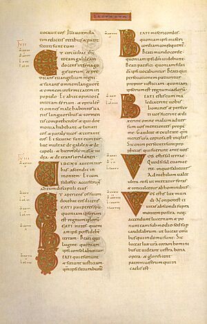
Christianity came to Luxembourg around the late 7th century. A famous missionary saint, Willibrord, and other monks founded the Abbey of Echternach in 698 AD. This abbey became very important in northern Europe for centuries. The Codex Aureus of Echternach, a book written entirely in gold ink, was made there in the 11th century.
How the County of Luxembourg Grew (963–1312)
After the Carolingian Empire was divided many times, the area of Luxembourg became part of different kingdoms. Finally, it was part of the Duchy of Lorraine, which was a state within the Holy Roman Empire.
Luxembourg's recorded history began in 963 AD. That's when Siegfried, Count of the Ardennes, acquired Lucilinburhuc (now Luxembourg Castle) on the Bock rock. A town slowly grew around this fort. This town became the center of a strategically important state. Siegfried's family expanded the fortress. By 1083, Conrad I was the first to call himself a "Count of Luxembourg", creating the independent County of Luxembourg (still part of the Holy Roman Empire).
By the mid-13th century, the Counts of Luxembourg had become very rich and powerful. They expanded their land from the Meuse to the Moselle rivers. By the time of Henry V the Blonde, many towns and areas like Bitburg, Arlon, and the County of Vianden were part of Luxembourg or its vassal states. The only major defeat was in 1288 at the Battle of Worringen, where Henry VI and his brothers died trying to add the Duchy of Limburg. But this battle still helped the Counts of Luxembourg gain military fame.
The Counts of Luxembourg reached their peak when Henry VII became King of the Romans, King of Italy, and finally, in 1312, Holy Roman Emperor.
A Golden Age: The House of Luxembourg's Power (1312–1443)
When Henry VII became Emperor, the House of Luxembourg family not only ruled the Holy Roman Empire but also gained influence across Central Europe.
Henry's son, John the Blind, became King of Bohemia in addition to being Count of Luxembourg. He is a major figure in Luxembourg's history and stories, seen as a brave knight. He also started the Schueberfouer fair in 1340 and died heroically at the Battle of Crécy in 1346. John the Blind is considered a national hero in Luxembourg.
In the 14th and early 15th centuries, three more members of the House of Luxembourg became Holy Roman Emperors and Bohemian Kings: Charles IV, Sigismund, and Wenceslaus IV. Charles IV created the Golden Bull of 1356, a law that shaped the Empire's government for a long time. Luxembourg remained an independent area (county) of the Holy Roman Empire. In 1354, Charles IV made it a duchy, and his half-brother Wenceslaus I became the first Duke of Luxembourg. Wenceslaus added the County of Chiny in 1364, and the new Duchy of Luxembourg reached its largest size.
During these 130 years, the House of Luxembourg competed with the House of Habsburg for power in Central Europe. This period ended in 1443 when the House of Luxembourg had no male heir to take the throne. All their lands were then given to other European noble families. The Duchy of Luxembourg became part of the Burgundian Netherlands, starting almost 400 years of foreign rule.
Foreign Rule and French Invasions (1444–1794)
In 1482, Philip the Handsome inherited the lands known as the Habsburg Netherlands, which included the Duchy of Luxembourg. For nearly 320 years, Luxembourg was owned by the powerful House of Habsburg, first under Austrian rule (1506–1556), then Spanish (1556–1714), and then Austrian again (1714–1794).
As a Habsburg possession, Luxembourg became involved in many wars between the Habsburg countries and the Kingdom of France for control of Europe. In 1542, the King of France, François I, invaded Luxembourg twice, but the Habsburgs under Charles V always took it back.
Luxembourg became part of the Spanish Netherlands in 1556. When France and Spain went to war in 1635, it led to the Treaty of the Pyrenees. This treaty caused the first partition of Luxembourg. Spain gave the Luxembourgish forts of Stenay, Thionville, and Montmédy, and the land around them, to France. This made Luxembourg smaller for the first time in centuries.
During the Nine Years' War in 1684, France invaded Luxembourg again and occupied it until 1697. It was then returned to the Spanish. When the War of the Spanish Succession started in 1701, Luxembourg sided with the French. However, it was later taken by pro-Austrian forces and given to Austria in 1714.
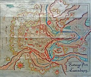
As the Duchy of Luxembourg kept changing hands between Spanish, Austrian, and French rule, each conquering nation helped make the Fortress even stronger. For example, the French military engineer Marquis de Vauban improved the defenses around the city, and these walls are still visible today.
French Rule and National Awakening (1794–1890)
During the War of the First Coalition, Revolutionary France invaded the Austrian Netherlands, including Luxembourg. In 1793 and 1794, most of the Duchy was quickly conquered. The French Revolutionary Army committed many terrible acts against the people and abbeys of Luxembourg. However, the Fortress of Luxembourg held out for almost 7 months before the Austrian forces surrendered. Luxembourg's long defense led Lazare Carnot to call it "the best fortress in the world, except Gibraltar," earning the city the nickname the Gibraltar of the North.
Luxembourg was then taken over by France and became the département des forêts (department of forests). This was made official in 1797. French officials in Luxembourg, who only spoke French, brought in many new rules, including the idea of laicism, which separated church and state. This caused a lot of anger in strongly Catholic Luxembourg. French was also made the only official language, and Luxembourgish people were not allowed to work in government jobs. When the French Army started forcing local people to join the military, riots broke out. This led to a rebellion in 1798 called Klëppelkrich. Even though the French quickly stopped this revolt, it had a big impact on the country's history and its people.
However, many ideas from this time, like the Napoleonic Civil Code introduced in 1804, are still important in Luxembourg today.
After Napoleon's defeat in 1815, the Duchy of Luxembourg was restored. But both the Kingdom of Prussia and the United Kingdom of the Netherlands wanted control of the land. At the Congress of Vienna, it was decided that Luxembourg would join the new German Confederation. At the same time, William I of the Netherlands, the King of the Netherlands, would also become the head of state of Luxembourg. To please Prussia, the Fortress of Luxembourg would be guarded by Prussian troops, and large parts of Luxembourg (around Bitburg and St. Vith) would become Prussian. This was the Second Partition of Luxembourg, making the Duchy smaller again. To make up for this, Luxembourg was made a Grand-Duchy, giving the Dutch kings the extra title of Grand-Duke of Luxembourg.
After Belgium became independent in 1830–1831, it claimed all of Luxembourg. But the Dutch King and Prussia didn't want to lose control of the important fortress. The problem was solved with the 1839 Treaty of London. This led to the Third Partition of Luxembourg. More than half of the land was given to Belgium, creating Luxembourg's modern-day borders. The 1839 treaty also made the remaining Grand-Duchy of Luxembourg fully independent.
In 1842, Luxembourg joined the German Customs Union (Zollverein). This opened up the German market, helped Luxembourg's steel industry grow, and led to the expansion of its railway network from 1855 to 1875.
In 1866, the Luxembourg Crisis almost caused a war between Prussia and France. Both countries wanted influence over Luxembourg and its strong fortress. To prevent war, the Second Treaty of London in 1867 confirmed Luxembourg's independence and neutrality. Prussia agreed to remove its troops from the Fortress of Luxembourg, but only if the fortifications were taken down, which happened that same year. During the Franco-Prussian war in 1870, Luxembourg's neutrality was respected, and neither France nor Germany invaded.
Because of these repeated arguments between big European powers, the people of Luxembourg slowly developed a strong sense of their own independence. This national awakening happened in the 19th century. Luxembourgers began to see themselves as Luxembourgers, not just part of bigger neighboring nations. This feeling of Mir wëlle bleiwe wat mir sinn ("We want to remain what we are") reached its peak in 1890. That's when the Dutch monarchy stopped holding the title of Grand-Duke of Luxembourg due to a family issue. From then on, Luxembourg would have its own monarchy, starting with Adolph of Nassau-Weilburg, which fully confirmed its independence.
World Wars and Modern Luxembourg (1890–Present)
In August 1914, during World War I, Imperial Germany broke Luxembourg's neutrality by invading it to attack France. Even with the German occupation, Luxembourg kept much of its independence and political system. The Luxembourgish government tried to stay strictly neutral. However, the people of Luxembourg worried that Germany would take over their country. About 1,000 Luxembourgers joined the French army. Their bravery is remembered at the Gëlle Fra monument.
After the war, many people, including the French and Belgian governments, felt that Grand-Duchess Marie-Adélaïde had cooperated with the Germans. There were calls for her to step down and for Luxembourg to become a Republic. After the German army left, some groups in Luxembourg City and Esch-sur-Alzette tried to create a worker's republic, but these attempts lasted only two days.
In November 1918, a vote in the Chamber of Deputies to end the monarchy was narrowly defeated. France questioned Luxembourg's neutrality during the war, and some in France and Belgium wanted to take over Luxembourg. In January 1919, a small part of the Luxembourgish Army rebelled, saying they were the army of a new republic. French troops stepped in and stopped the rebellion. Despite this, Marie-Adélaïde decided to step down in favor of her sister Charlotte five days later. In a public vote that same year, 77.8% of Luxembourgers voted to keep the monarchy and rejected a republic. Belgium continued to push for taking over Luxembourg, but these claims were rejected at the Paris Peace Conference, securing Luxembourg's independence.
In 1940, during World War II, Luxembourg's neutrality was again broken when Nazi Germany's Wehrmacht invaded the country. Unlike in World War I, under the German occupation of Luxembourg during World War II, Luxembourg was treated as German land and informally joined to the German province of Gau Moselland. This time, Luxembourg did not stay neutral. The Luxembourg government in exile in London supported the Allies, sending a small group of volunteers who fought in the Normandy invasion. Many resistance groups also formed inside the occupied country.
Luxembourg suffered greatly in the war. About 2.45% of its pre-war population was killed, and a third of all buildings were destroyed or badly damaged, mainly during the Battle of the Bulge. This was the highest loss in Western Europe. Around 1,000–2,500 of Luxembourg's Jewish people were killed in the Holocaust.
Joining NATO and the European Union (1945–Present)
After the war, the Grand Duchy became a founding member of the United Nations in 1945. Luxembourg's neutral status formally ended in 1948, and in April 1949, it also became a founding member of NATO. During the Cold War, Luxembourg continued to be involved with the Western Bloc. In the early 1950s, a small group of troops fought in the Korean War. Luxembourg troops have also been sent to Afghanistan to support ISAF.
In the 1950s, Luxembourg was one of the six countries that started the European Communities. This included the European Coal and Steel Community (1952), and later the European Economic Community and European Atomic Energy Community (1958). In 1993, these became part of the European Union. Luxembourgish politicians like Robert Schuman (one of the EU's founders), Pierre Werner (seen as the father of the Euro), Gaston Thorn, Jacques Santer, and Jean-Claude Juncker (all former Presidents of the European Commission) played a big role in creating the EU. In 1999, Luxembourg joined the eurozone, using the Euro currency. The country was also elected as a non-permanent member of the United Nations Security Council from 2013 to 2014.
The steel industry, using the rich iron-ore in the "Red Lands," drove Luxembourg's industrial growth in the early 20th century. After the steel industry declined in the 1970s, the country focused on becoming a global financial center and is now known as a banking hub. Since the early 21st century, its governments have worked to develop a knowledge economy, by founding the University of Luxembourg and starting a national space program.
How Luxembourg is Governed

Luxembourg is a "full democracy" with a parliamentary democracy led by a constitutional monarch. The Grand Duke and the cabinet (a group of ministers led by the Prime Minister) hold the executive power. Luxembourg's main law, the Constitution of Luxembourg, was first adopted on October 17, 1868, and was last updated on July 1, 2023.
The Grand Duke can dissolve the legislature, which means new elections must happen within three months. However, since 1919, the power belongs to the nation, and the Grand Duke exercises it according to the Constitution and laws.
The power to make laws belongs to the Chamber of Deputies. This is a single-chamber legislature with sixty members, who are directly elected for five-year terms from four different areas. Another group, the Council of State, made up of 21 citizens chosen by the Grand Duke, advises the Chamber of Deputies when they are writing new laws.
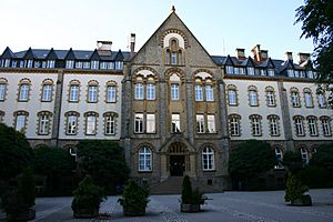
Luxembourg has three lower courts, two district courts, and a Superior Court of Justice (which includes the Court of Appeal and the Court of Cassation). There are also administrative courts and a Constitutional Court, all located in the capital.
How Luxembourg is Divided
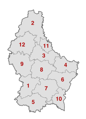
Luxembourg is divided into 12 cantons, which are then divided into 100 communes. Twelve of these communes have city status; Luxembourg is the largest.
Capellen (1) - Clervaux (2) - Diekirch (3) - Echternach(4) - Esch-sur-Alzette (5) - Grevenmacher (6) - Luxembourg (7) - Mersch (8) - Redange (9) - Remich (10) - Vianden (11) - Wiltz (12)
Luxembourg's Role in the World
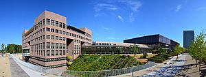
Luxembourg has always strongly supported European political and economic integration. In 1921, Luxembourg and Belgium formed the Belgium–Luxembourg Economic Union (BLEU) to share currency and customs. Luxembourg is a member of the Benelux Economic Union and was one of the founding members of the European Economic Community (now the European Union). It also participates in the Schengen Group, named after the Luxembourg village of Schengen where the agreements were signed. Most Luxembourgers believe that European unity works best with a strong relationship with the United States, so they have traditionally supported NATO and a pro-US foreign policy.
Luxembourg is considered a European capital because it hosts important EU institutions. These include the Court of Justice of the European Union, the European Court of Auditors, the European Investment Bank, and the Statistical Office of the European Union (Eurostat). The Secretariat of the European Parliament is in Luxembourg, but the Parliament usually meets in Brussels and sometimes in Strasbourg. Luxembourg also hosts the EFTA Court, which handles cases for countries in the European Single Market that are not part of the EU.
Luxembourg's Military
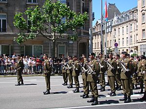
The Luxembourgish army is mainly based at the Centre militaire Caserne Grand-Duc Jean in Diekirch. The main staff is in the capital. The army is under civilian control, with the Grand Duke as the Commander-in-Chief. The Minister for Defense, Yuriko Backes, oversees army operations. The professional head of the army is the Chief of Defense, who is a general and reports to the minister.
Since Luxembourg is a landlocked country, it has no navy. Seventeen NATO AWACS airplanes are registered as Luxembourg's aircraft. Luxembourg and Belgium also share funding for one A400M military cargo plane.
Luxembourg has taken part in the Eurocorps and sent troops to UN missions in former Yugoslavia, like UNPROFOR and IFOR. It also contributed to the NATO SFOR mission in Bosnia and Herzegovina. Luxembourgish troops have also been deployed to Afghanistan to support ISAF. The army has also helped with humanitarian missions, such as setting up refugee camps for Kurds and providing aid to Albania.
Luxembourg's Geography and Environment
Luxembourg is one of Europe's smallest countries, ranking 168th out of 194 independent countries. It is about 2,586 square kilometers (998 sq mi) in size, measuring 82 kilometers (51 mi) long and 57 kilometers (35 mi) wide. It is located between 49° and 51° N latitude, and 5° and 7° E longitude.
To the east, Luxembourg borders the German states of Rhineland-Palatinate and Saarland. To the south, it borders the French region of Grand Est (Lorraine). To the west and north, it borders Belgium's Wallonia region, specifically the Belgian provinces of Luxembourg and Liège.
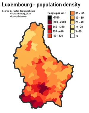
The northern third of the country is called the Éislek or Oesling, and it's part of the Ardennes mountains. This area has hills and low mountains, including the Kneiff near Wilwerdange, which is the highest point at 560 meters (1,837 ft). Other high points are the Buurgplaatz at 559 meters (1,834 ft) and the Napoléonsgaard at 554 meters (1,818 ft). This region is not very populated, with only one town (Wiltz) having more than five thousand people.
The southern two-thirds of the country is called the Guttland. It is more populated and diverse, divided into five geographic sub-regions. The Luxembourg plateau in south-central Luxembourg is a large, flat, sandstone area where Luxembourg City is located. Little Switzerland, in eastern Luxembourg, has rocky terrain and thick forests. The Moselle valley is the lowest area, running along the southeastern border. The Red Lands, in the far south and southwest, are Luxembourg's industrial heartland and home to many of its largest towns.
The border between Luxembourg and Germany is formed by three rivers: the Moselle, the Sauer, and the Our. Other important rivers are the Alzette, the Attert, the Clerve, and the Wiltz. The valleys of the mid-Sauer and Attert rivers mark the border between the Gutland and the Éislek regions.
Protecting the Environment
Luxembourg is known for its strong efforts in environmental protection. In 2020, it ranked second out of 180 countries in the Environmental Performance Index. It also ranks sixth among the top ten most livable cities in the world. The country aims to cut its GHG emissions (greenhouse gas emissions) by 55% in 10 years and reach zero emissions by 2050. Luxembourg also wants to increase its organic farming fivefold.
Climate of Luxembourg
Luxembourg has an oceanic climate, which means it has a lot of rain, especially in late summer. The summers are warm, and the winters are cool.
Luxembourg's Economy
Luxembourg has a stable and high-income market economy with steady growth, low inflation, and a lot of innovation. Unemployment is usually low. In 2011, Luxembourg was the world's second-richest country based on its GDP per person. In 2019, its GDP per person was 261% of the EU average. Luxembourg ranks high in economic freedom and quality of life. It was 20th in the Global Innovation Index in 2024.
The industrial sector, once dominated by steel until the 1960s, has now diversified to include chemicals, rubber, and other products. In recent decades, the growth of the financial sector has more than made up for the decline in steel production. Services, especially banking and finance, make up most of the country's economic output. Luxembourg is the world's second-largest center for investment funds (after the United States), the most important private banking center in the eurozone, and Europe's leading center for reinsurance companies. The government has also tried to attract Internet companies, with Skype and Amazon being some that moved their regional headquarters to Luxembourg. Other high-tech companies, like 3D scanner developer Artec 3D, have also set up here.
In 2009, there were concerns about Luxembourg's banking secrecy laws and its reputation as a tax haven. It was added to a "gray list" by the G20. In response, the country quickly adopted international standards for sharing tax information and was removed from the list. Luxembourg has close trade and financial ties with Belgium and the Netherlands (part of Benelux), and as an EU member, it benefits from the open European market.
Luxembourg's public debt in 2019 was $15.687 billion, or about $25,554 per person. The debt was 22.10% of its GDP.
The Luxembourg labor market has 445,000 jobs. About 120,000 are held by Luxembourgers, 120,000 by foreign residents, and 205,000 by people who live in neighboring countries and commute to work in Luxembourg. These commuters pay their taxes in Luxembourg, but their education is partly paid for by their home countries. This system is seen by some as a key to Luxembourg's economic growth, but it can be a challenge for the border countries.
How People Travel in Luxembourg
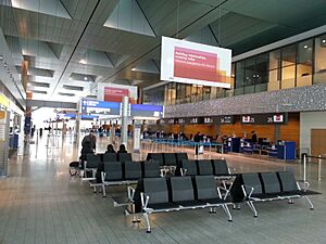
Luxembourg has good road, rail, and air transport. The road network has been greatly improved, with 165 kilometers (103 mi) of motorways connecting the capital to nearby countries. A high-speed TGV train link to Paris led to renovations at the city's railway station. A new passenger terminal at Luxembourg Airport opened in 2008. Luxembourg City brought back trams in December 2017, and there are plans for new light-rail lines in nearby areas.
Luxembourg has 681 cars per 1000 people, which is higher than most countries. On February 29, 2020, Luxembourg became the first country to offer free public transportation, which is almost entirely paid for by the government.
Communication and Technology
The telecommunications industry in Luxembourg is open to competition, and its electronic communication networks are very advanced. The government encourages investment in networks and services. Luxembourg has modern and widespread optical fiber and cable networks. In 2010, the government aimed to make the country a world leader in very high-speed broadband by having 1 Gbit/s coverage everywhere by 2020. In 2013, Luxembourg had the sixth highest internet download speed worldwide and the second highest in Europe. The country's location in Central Europe, stable economy, and low taxes help the telecommunication industry.
Luxembourg ranks second globally in the development of Information and Communication Technologies. It is connected to all major European Internet Exchanges and data centers. This allows Luxembourg to connect with major telecommunication operators worldwide. Luxembourg has also become a leading center for financial technology (FinTech) in Europe, with government support for initiatives like the Luxembourg House of Financial Technology.
About 20 data centers operate in Luxembourg. Six of these are certified as Tier IV Design, meaning they are very reliable. In a 2012-2013 survey of international data centers, Luxembourg's data centers held the top three spots for availability and performance.
People and Culture of Luxembourg
Major Towns in Luxembourg
|
Largest cities or towns in Luxembourg
2023 |
||
|---|---|---|
| Rank | Name | Pop. |
| 1 | Luxembourg | 132,780 |
| 2 | Esch-sur-Alzette | 36,625 |
| 3 | Differdange | 29,536 |
| 4 | Dudelange | 21,952 |
| 5 | Pétange | 20,563 |
| 6 | Sanem | 18,333 |
| 7 | Hesperange | 16,433 |
| 8 | Bettembourg | 11,422 |
| 9 | Schifflange | 11,363 |
| 10 | Käerjeng | 11,015 |
Who Lives in Luxembourg?
The people from Luxembourg are called Luxembourgers. The number of immigrants grew in the 20th century with people arriving from Belgium, France, Italy, Germany, and Portugal. Portuguese people make up the largest immigrant group. In 2013, about 88,000 Luxembourg residents had Portuguese nationality. In 2013, out of 537,039 permanent residents, 44.5% were from other countries or had foreign backgrounds. The largest foreign groups were Portuguese (16.4%), French (6.6%), Italians (3.4%), Belgians (3.3%), and Germans (2.3%).
Since the start of the Yugoslav wars, many immigrants have come to Luxembourg from Bosnia and Herzegovina, Montenegro, and Serbia. Each year, over 10,000 new immigrants arrive, mostly from EU countries and Eastern Europe.
Languages Spoken in Luxembourg
Luxembourg does not have any single "official" language. According to a 1984 law, Luxembourgish is the only national language of the Luxembourgish people. It is considered their mother tongue or "language of the heart" and is generally what they use to speak and write to each other. Luxembourgish is similar to dialects spoken in nearby Germany. It also has more than 5,000 words that come from French. Knowing Luxembourgish is a requirement for becoming a citizen.
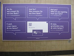
In addition to Luxembourgish, French and German are used for government and legal matters, making all three administrative languages. If a citizen asks a question in Luxembourgish, German, or French, the government should try to reply in that same language.
Luxembourg is a very multilingual country. In 2012, 52% of citizens said Luxembourgish was their native language, 16.4% said Portuguese, 16% French, 2% German, and 13.6% other languages (mostly English, Italian, or Spanish). Even though French is not the most common native language, it is the most widely known language in the country. In 2021, 98% of citizens could speak French well. Most people in Luxembourg can speak it as a second or third language. As of 2018, many people could speak multiple languages: 80% could speak English, 78% German, and 77% Luxembourgish.
Each of the three official languages is used in different parts of daily life. Luxembourgish is the language Luxembourgers generally use to talk and write to each other. There has been a recent increase in novels and movies made in Luxembourgish. However, the many foreign workers (about 44% of the population) usually don't use it to talk to each other.
Most official government and written communication is in French. French is also the main language for public information, like official statements, advertisements, and road signs. Because of the historical influence of the Napoleonic Code on Luxembourg's legal system, French is the only language for laws and is generally preferred by the government and courts. Discussions in parliament are mostly in Luxembourgish, but written government communications and official documents are usually in French, sometimes also in German.
While professional life is very multilingual, business leaders say French is the main working language in their companies (56%), followed by Luxembourgish (20%), English (18%), and German (6%).
German is often used in the media along with French and is considered a second language by most Luxembourgers. This is partly because German is similar to Luxembourgish and is the first language taught to children in primary school.
Because of the large Portuguese community, the Portuguese language is quite common in Luxembourg, though mostly within that community. Portuguese has no official status, but the government sometimes provides information in Portuguese.
Even though Luxembourg is very multilingual, some people worry that French is becoming too dominant and that Luxembourgish and German might disappear in the future.
Religion in Luxembourg
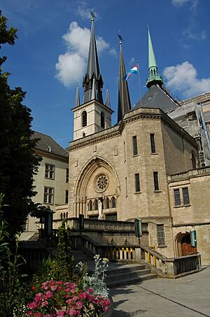
Luxembourg is a secular state, meaning the government is separate from religion. However, the state officially recognizes certain religions. This means the state helps with religious administration and pays some costs and salaries for clergy. The recognized religions include Catholicism, Judaism, Greek Orthodoxy, Anglicanism, Russian Orthodoxy, Lutheranism, Calvinism, Mennonitism, and Islam.
Since 1980, the government has not collected statistics on people's religious beliefs. A 2000 estimate suggested that 87% of Luxembourgers are Catholic, including the Grand Ducal family. The remaining 13% were Protestants, Orthodox Christians, Jews, Muslims, or people with other or no religion. A 2010 study found that 70.4% are Christian, 2.3% Muslim, 26.8% have no religion, and 0.5% follow other religions.
In a 2005 survey, 44% of Luxembourg citizens said they believe in God, 28% believe in some kind of spirit or life force, and 22% do not believe in any spirit, god, or life force.
Education in Luxembourg
Luxembourg's education system is trilingual. In the first years of primary school, teaching is in Luxembourgish, then it changes to German. In secondary school, the language of instruction changes to French. Students need to be good at all three languages to graduate from secondary school. Besides these three national languages, English is also taught, and many people in Luxembourg can speak English. In the last two decades, English has become more important in several areas, especially in finance. Portuguese, the language of the largest immigrant community, is also spoken by many people, but mostly within that community.
The University of Luxembourg is the only university located in Luxembourg. In 2014, the Luxembourg School of Business, a private business school, was created and received official approval in 2017. Two American universities also have smaller campuses in the country: Miami University (Dolibois European Center) and Sacred Heart University (Luxembourg Campus).
Health and Healthcare
According to the World Health Organization, Luxembourg's government spent over $4.1 billion on healthcare in 2010, which was about $8,182 for each citizen. The country spent almost 7% of its Gross Domestic Product on health, making it one of the highest-spending countries on health services in Europe.
Luxembourg's Culture and Arts
Luxembourg's culture has been greatly influenced by its neighbors. It still has many folk traditions, as it was a very rural country for much of its history. There are several notable museums, mostly in the capital. These include the National Museum of History and Art (NMHA), the Luxembourg City History Museum, and the new Grand Duke Jean Museum of Modern Art (Mudam). The National Museum of Military History (MNHM) in Diekirch is famous for its displays about the Battle of the Bulge. The Historic city of Luxembourg city including its fortification is a UNESCO World Heritage List site because of the historical importance of its fortifications.
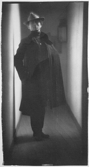
The country has produced some internationally known artists, including painters Théo Kerg, Joseph Kutter, and Michel Majerus. The photographer Edward Steichen is also famous; his The Family of Man exhibition is now permanently displayed in Clervaux and is on UNESCO's Memory of the World register. Editor and author Hugo Gernsback, who helped define science fiction, was born in Luxembourg City. Movie star Loretta Young also had Luxembourgish family roots.
Luxembourg was a founding participant of the Eurovision Song Contest and took part every year from 1956 until 1993. Although it could have returned in 1995, it chose not to until 2024. Luxembourg has won the competition five times: 1961, 1965, 1972, 1973, and 1983. It hosted the contest in 1962, 1966, 1973, and 1984. Before 2024, only nine of its 38 entries, and none of its five winning songs, were performed by Luxembourgish artists. However, for its 2024 return, there was a special focus on promoting music and artists from Luxembourg.
Luxembourg was the first city to be named European Capital of Culture twice. The first time was in 1995. In 2007, the European Capital of Culture included a cross-border area with Luxembourg, parts of Germany, Belgium, and France. This event aimed to encourage movement and the sharing of ideas across physical, psychological, artistic, and emotional borders.
Luxembourg was represented at the World Expo 2010 in Shanghai, China. Its pavilion, designed as a forest and fortress, was based on the Chinese name for Luxembourg, "Lúsēnbǎo," which means "forest and fortress." It showed Luxembourg as the "Green Heart in Europe."
Sports in Luxembourg
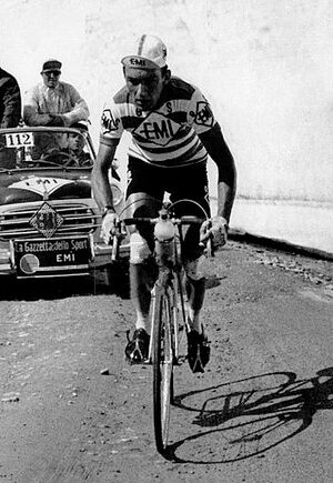
Unlike many European countries, sports in Luxembourg are not focused on just one national sport. Instead, people enjoy many different team and individual sports. Even without one main sport, over 100,000 people in Luxembourg (out of a total population of 660,000) are members of a sports federation. The Stade de Luxembourg, located in Gasperich, is the country's national stadium and largest sports venue. It can hold 9,386 people for sports events like football and rugby, and 15,000 for concerts. The largest indoor venue is d'Coque in Kirchberg, which can hold 8,300 people. This arena is used for basketball, handball, gymnastics, and volleyball, including the final of the 2007 Women's European Volleyball Championship. Hess Cycling Team is a women's road cycling team from Luxembourg.
What People Eat in Luxembourg
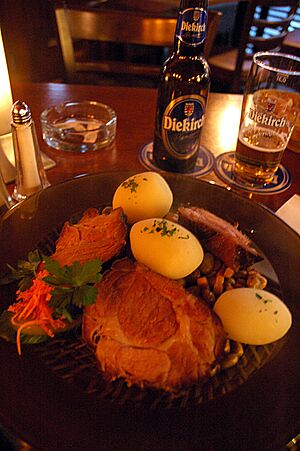
Luxembourg's food shows its location between Latin and Germanic cultures, with strong influences from French and German cooking. More recently, its cuisine has also been enriched by its many Italian and Portuguese immigrants.
Most traditional Luxembourgish dishes come from the country's folk recipes, similar to those in neighboring Germany. Luxembourg has the second highest number of Michelin-starred restaurants per person, after Japan and before Switzerland.
Media and Entertainment
The main languages used in Luxembourg's media are French and German. The newspaper with the largest circulation is the German-language daily Luxemburger Wort. Because many people in Luxembourg speak multiple languages, newspapers often have articles in both French and German without translation. There are also English and Portuguese radio stations and print publications.
Luxembourg is known in Europe for its radio and television stations (Radio Luxembourg and RTL Group). It is also the home of SES, a company that sends major European satellite services for Germany and Britain.
Thanks to a 1988 law that offered special tax benefits for audiovisual investments, film production and co-production in Luxembourg have grown steadily. There are about 30 registered production companies in Luxembourg.
Luxembourg won an Oscar in 2014 in the Animated Short Films category for Mr Hublot.
See also
 In Spanish: Luxemburgo para niños
 | Anna J. Cooper |
 | Mary McLeod Bethune |
 | Lillie Mae Bradford |


