
Diekirch (canton) facts for kids
Quick facts for kids Diekirch |
|
| Canton | |
| Country | |
|---|---|
| Capital | Diekirch |
| - coordinates | 49°52′N 6°10′E / 49.867°N 6.167°E |
| Highest point | |
| - elevation | 525 m (1,722 ft) |
| Lowest point | |
| - elevation | 175 m (574 ft) |
| Area | 204.5 km² (79 sq mi) |
| Population | 32,244 (2017) |
| Density | 158 /km² (409 /sq mi) |
| Canton | 24 February 1843 |
| Subdivisions | 10 communes |
| Timezone | CET (UTC+1) |
| - summer (DST) | CEST (UTC+2) |
| ISO 3166-2 | LU-DI |
| LAU 1 | LU00002 |
Diekirch (in Luxembourgish: Dikrech) is a canton in the country of Luxembourg. A canton is like a region or district. Its main town, or capital, is also called Diekirch.
Contents
History of Diekirch

The Diekirch canton has changed over time. On January 1, 2012, some big changes happened.
One part, called the commune of Hoscheid, moved. It became part of a new commune called Parc Hosingen. This new commune is in the Clervaux canton.
Also, two other communes, Ermsdorf and Medernach, joined together. They formed a brand new commune called Vallée de l'Ernz.
Geography of Diekirch
The Diekirch canton covers an area of about 204.5 square kilometers (about 79 square miles). In 2017, about 32,244 people lived there. This means there were about 157 people living in each square kilometer.
The canton is surrounded by other areas. To the north, it borders the cantons of Clervaux and Vianden. To the east, it touches the German district of Bitburg-Prüm. This German area is part of the state of Rhineland-Palatinate. It also borders the Echternach canton to the east.
To the south, you'll find the Mersch canton. To the west, it borders the cantons of Redange and Wiltz.
 |
Wiltz (canton) | Clervaux (canton) | Vianden (canton) | |
| Bitburg-Prüm (Germany) | ||||
| Redange (canton) | Mersch (canton) | Echternach (canton) |
Communes of Diekirch
A commune is like a local town or district. The Diekirch canton is made up of 10 different communes. Here are the communes and how many people lived in them in 2017:
- Bettendorf (2,753 people)
- Bourscheid (1,820 people)
- Diekirch (6,472 people)
- Erpeldange-sur-Sûre (2,392 people)
- Ettelbruck (8,833 people)
- Feulen (2,062 people)
- Mertzig (2,115 people)
- Reisdorf (1,202 people)
- Schieren (2,004 people)
- Vallée de l'Ernz (2,591 people) - This commune was created on January 1, 2012, by combining:
Related Pages
Gallery
-
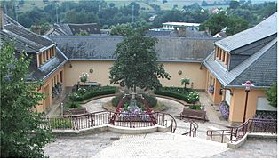
Community house in Miedernach
-
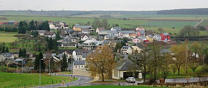
View of Ermsdorf
-
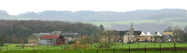
General view of Folkendange


See also
 In Spanish: Cantón de Diekirch para niños
