
Grevenmacher (canton) facts for kids
Quick facts for kids Grevenmacher |
|
| Canton | |
| Country | |
|---|---|
| Capital | Grevenmacher |
| - coordinates | 49°40′N 6°27′E / 49.667°N 6.450°E |
| Highest point | |
| - elevation | 411 m (1,348 ft) |
| Lowest point | |
| - elevation | 132 m (433 ft) |
| Area | 211.4 km² (82 sq mi) |
| Population | 29,525 (2017) |
| Density | 140 /km² (363 /sq mi) |
| Canton since | 24 February 1843 |
| Subdivisions | 8 communes |
| Timezone | CET (UTC+1) |
| - summer (DST) | CEST (UTC+2) |
| ISO 3166-2 | LU-GR |
| LAU 1 | LU00007 |
Grevenmacher (Luxembourgish: Gréiwemaacher) is a canton located in Luxembourg. A canton is like a region or a district within a country. The main town, or capital, of this canton is also called Grevenmacher. It's an important part of Luxembourg's geography and administration.
Contents
Exploring Grevenmacher's Geography
This section helps you understand where Grevenmacher is and what its landscape is like.
Size and Population of Grevenmacher
The Grevenmacher canton covers an area of about 211.4 square kilometers (which is about 81.6 square miles). In 2017, about 29,525 people lived here. This means there were about 140 people living in each square kilometer. This number is called the population density.
Grevenmacher's Neighbors
The Grevenmacher canton shares its borders with several other areas.
- To the north, it is next to the Echternach canton.
- To the east, it borders the German district of Trier-Saarburg. This district is part of the German state called Rhineland-Palatinate.
- To the south, you'll find the Remich canton.
- To the west, it is next to the Luxembourg district.
 |
Mersch (canton) | Echternach (canton) | |
|
| Trier-Saarburg (Germany) | ||||
| Luxembourg (canton) | Remich (canton) |
Communes of Grevenmacher
A commune is like a local town or village area that has its own local government. The Grevenmacher canton is made up of 8 different communes. Here are the communes and their populations from 2017:
- Betzdorf (3,810 people)
- Biwer (1,813 people)
- Flaxweiler (2,060 people)
- Grevenmacher (4,923 people)
- Junglinster (7,537 people)
- Manternach (2,068 people)
- Mertert (4,530 people)
- Wormeldange (2,784 people)
Related pages
Images for kids
-
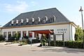
Town hall of Biwer
-
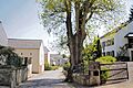
An old Oak tree in Godbrange, Junglinster
-
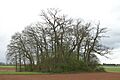
A Tumulus (ancient burial mound) in Flaxweiler


See also
 In Spanish: Cantón de Grevenmacher para niños
