Luxembourg (canton) facts for kids
Quick facts for kids Luxembourg |
|
| Canton | |
| Country | |
|---|---|
| Capital | Luxembourg |
| - coordinates | 49°36′N 6°08′E / 49.600°N 6.133°E |
| Highest point | |
| - elevation | 429 m (1,407 ft) |
| Lowest point | |
| - elevation | 228 m (748 ft) |
| Area | 238.5 km² (92 sq mi) |
| Population | 179,369 (2017) |
| Density | 752 /km² (1,948 /sq mi) |
| Canton since | 24 February 1843 |
| Subdivisions | 11 communes |
| Timezone | CET (UTC+1) |
| - summer (DST) | CEST (UTC+2) |
| ISO 3166-2 | LU-LU |
| LAU 1 | LU00011 |
Luxembourg (Luxembourgish: Lëtzebuerg) is a special area in the country of Luxembourg. It's called a canton. Think of it like a county or a region within a state.
The main city and capital of this canton is Luxembourg. This canton is unique because it's completely surrounded by other cantons. It doesn't share a border with any other country. Only the Mersch canton is like it.
Contents
Geography of Luxembourg Canton
The Luxembourg canton covers an area of about 238.5 square kilometers. That's about 92 square miles. In 2017, around 179,369 people lived there. This means it has a high population density. About 752 people live in each square kilometer.
The canton is surrounded by other cantons. To the north, you'll find the Mersch and Grevenmacher cantons. The Remich canton is to the southeast. To the southwest is the Esch-sur-Alzette canton. Finally, the Capellen canton is to the west.
 |
Mersch (canton) | Grevenmacher (canton) |  |
|
| Capellen (canton) | ||||
| Esch-sur-Alzette (canton) | Remich (canton) |
Towns and Villages (Communes)
The Luxembourg canton is made up of 11 smaller areas called communes. These are like towns or groups of villages. Here are the communes and their populations from 2017:
- Bertrange (7,999 people)
- Contern (3,736 people)
- Hesperange (15,049 people)
- Luxembourg (114,303 people)
- Niederanven (6,090 people)
- Sandweiler (3,592 people)
- Schuttrange (4,028 people)
- Steinsel (5,311 people)
- Strassen (8,828 people)
- Walferdange (8,046 people)
- Weiler-la-Tour (2,387 people)
More About Luxembourg
Images for kids
-
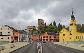
The center of Hesperange with the castle and the church
-
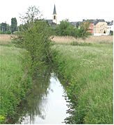
Syre river near Schuttrange, Luxembourg
-
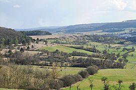
Niederanven, Luxembourg: Part of the nature reserve "Aarnescht"
-
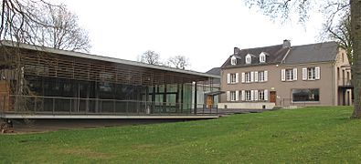
Culture house of Niederanven, Luxembourg
See also
 In Spanish: Cantón de Luxemburgo para niños
 | Delilah Pierce |
 | Gordon Parks |
 | Augusta Savage |
 | Charles Ethan Porter |


