Ennedi-Est (region) facts for kids
Quick facts for kids
Ennedi Est
إنيدي الشرقية
|
|
|---|---|

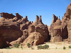
Hoodoos in the Ennedi Plateau
|
|

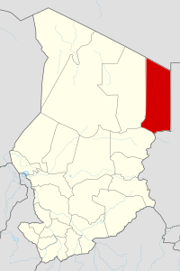
Map of Chad highlighting the Ennedi-Est region in red.
|
|
| Country | Chad |
| Departments | Am-Djarass, Wadi-Hawar |
| Communes | Am-Djarass, Bao, Djouna, Kaoura, Bahaï, Birdouani |
| Created | 2012 |
| Regional capital | Am-Djarass |
| Population
(2009)
|
|
| • Total | 113,862 |
| Time zone | UTC+01:00 (WAT) |
The Ennedi Est Region (which means Eastern Ennedi) is one of the 23 main areas, called regions, in the country of Chad. Its capital city is Am-Djarass. The region is currently led by Governor General Hassan Djorobo.
Contents
History of Ennedi Est
This region was created in 2012. It used to be part of a larger area called the Ennedi Region. The new Ennedi Est region covers the same land that was once known as the Ennedi Est Department.
Geography and Landscape
Ennedi Est is located in a very interesting part of Africa.
- To its north, it shares a border with Libya.
- To the east, it borders Sudan.
- To the south, it is next to the Wadi Fira Region.
- To the west, it borders the Ennedi-Ouest Region.
Most of this region is part of the huge Sahara Desert. This means it has a very dry climate with lots of sand and rocks. The northern border of Ennedi Est is within an area called the Aouzou Strip.
Main Towns and Villages
The biggest town and capital of the region is Am-Djarass. Other important places where people live include Bahaï, Bao Billiat, Kaoura, and Mourdi.
People of Ennedi Est
The main groups of people living in Ennedi Est are the Dazaga Toubou and the Zaghawa. These groups have their own unique cultures and languages.
How Ennedi Est is Organized
The Ennedi Est Region is divided into two smaller areas called departments. These departments are then split into even smaller areas called communes.
| Department | Capital City | Communes (Smaller Areas) |
|---|---|---|
| Am-Djarass | Am-Djarass | Am-Djarass, Bao, Djouna, Kaoura |
| Wadi-Hawar | Wadi-Hawar | Bahaï, Birdouani |
See also
 In Spanish: Región de Ennedi Este para niños

