
Entronque de Herradura facts for kids
Quick facts for kids
Entronque de Herradura
|
|
|---|---|
|
Village
|
|
 |
|
| Nickname(s):
Little Miami
|
|

Entronque de Herradura
Location in Cuba
|
|
| Country | |
| Province | Pinar del Río |
| Municipality | Consolación del Sur |
| Settled | 1907 |
| District | 1988 |
| Area | |
| • Total | 1.280 km2 (0.494 sq mi) |
| Elevation | 71 m (233 ft) |
| Population | |
| • Total | 6,086 |
| • Density | 4,755/km2 (12,320/sq mi) |
| • Demonym | Entronqueño |
| Time zone | UTC-5 (EST) |
| • Summer (DST) | UTC-4 (EDT) |
| Postal code |
24490
|
| Area code(s) | +53-48 |
Entronque de Herradura is a small village in Cuba. It is one of thirteen villages in the area. This village is part of the Consolación del Sur municipality. It is located in the Pinar del Río Province. The village covers about 1.28 square kilometers (0.49 square miles) of land.
Where is Entronque de Herradura?
This village is in the northeast part of Consolación del Sur. It shares borders with other places. To the north, you'll find the municipalities of La Palma and Los Palacios. To the east is Canal. The village of Herradura is to the south. To the west, it borders the Crucero de Echeverria district.
People Living Here
Entronque de Herradura has about 6,086 people living there. This means it's quite a busy place for its size. There are about 4,755 people per square kilometer. Because of its population, it is known as an "Urban Settlement." This means it's a place where many people live close together.
Images for kids
-
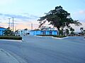
A view of Entronque de Herradura.
See also
 In Spanish: Entronque de Herradura para niños
