Ermine, Kentucky facts for kids
Quick facts for kids
Ermine, Kentucky
|
|
|---|---|

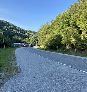
U.S. Route 119 in Ermine
|
|
| Country | United States |
| State | Kentucky |
| County | Letcher |
| Area | |
| • Total | 5.32242 sq mi (13.7850 km2) |
| • Land | 5.32242 sq mi (13.7850 km2) |
| • Water | 0 sq mi (0 km2) |
| Elevation | 1,240 ft (378 m) |
| Population
(2000)
|
|
| • Total | 662 |
| • Density | 14.4/sq mi (5.5/km2) |
| Time zone | UTC-5 (Eastern (EST)) |
| • Summer (DST) | UTC-4 (EDT) |
| ZIP code |
41815
|
| Area code(s) | 606 |
| GNIS feature ID | 491809 |
Ermine is a small place in Kentucky, United States. It is called an "unincorporated community". This means it's not officially a city or town with its own local government. It is part of Letcher County. Ermine has a special number for mail, called a ZIP Code, which is 41815.
About Ermine
Ermine is a quiet community located in the eastern part of Kentucky. It sits within Letcher County, which is known for its beautiful natural areas. The community is a place where people live and go to school.
What's in a Name?
A post office opened in Ermine in 1904. No one is completely sure how Ermine got its name. It might have been named after the first person who ran the post office, Ermine Webb. Or maybe it was named after someone else who lived there, like Ermine Hall or Ermine Craft.
School Life
Students in Ermine go to Letcher County Central High School. This school was built in the area in 2005. It serves as an important place for education and community events for young people.
 | Precious Adams |
 | Lauren Anderson |
 | Janet Collins |


