Etna, Indiana facts for kids
Quick facts for kids
Etna, Indiana
|
|
|---|---|

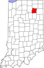
Whitley County's location in Indiana
|
|
| Country | United States |
| State | Indiana |
| County | Whitley |
| Township | Etna-Troy |
| Elevation | 932 ft (284 m) |
| Time zone | UTC-5 (Eastern (EST)) |
| • Summer (DST) | UTC-4 (EDT) |
| ZIP code |
46764
|
| Area code(s) | 260 |
| FIPS code | 18-21484 |
| GNIS feature ID | 434242 |
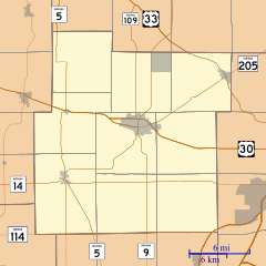
Etna is a small, unincorporated town in Whitley County, Indiana. Being "unincorporated" means it doesn't have its own local government like a city or a regular town. Instead, it's governed by the county and the specific area it's in, called a township. Etna is located within Etna-Troy Township.
A Look Back: Etna's History
Etna was officially planned and laid out in 1849. This process is called "platting." It's like drawing a map for a new community, showing where streets and lots will be. The town was named after Etna, Ohio. This was the hometown of one of the first people to settle here.
A post office opened in Etna in 1851. This was an important place for sending and receiving mail. In 1861, the post office name changed to Hecla. It stayed Hecla until 1904, when it finally closed.
Where is Etna?
Etna is located in the state of Indiana. Its exact spot on a map is 41 degrees, 16 minutes, 25 seconds North latitude. It is also 85 degrees, 34 minutes, 25 seconds West longitude. This location is in Whitley County. The elevation of Etna is about 284 meters (932 feet) above sea level.
 | Janet Taylor Pickett |
 | Synthia Saint James |
 | Howardena Pindell |
 | Faith Ringgold |


