Fairport, Iowa facts for kids
Quick facts for kids
Fairport, Iowa
|
|
|---|---|

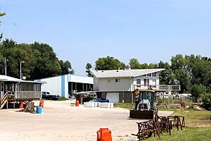
Fairport Marina in 2023
|
|
| Country | United States |
| State | Iowa |
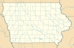
| County | Muscatine |
| Area | |
| • Total | 1.89 sq mi (4.89 km2) |
| • Land | 1.86 sq mi (4.82 km2) |
| • Water | 0.03 sq mi (0.07 km2) |
| Elevation | 568 ft (173 m) |
| Population
(2020)
|
|
| • Total | 204 |
| • Density | 109.68/sq mi (42.34/km2) |
| Time zone | UTC-6 (Central (CST)) |
| • Summer (DST) | UTC-5 (CDT) |
| ZIP code |
52761 (Muscatine)
|
| Area code(s) | 563 |
| FIPS code | 19-26580 |
Fairport is a small community in Muscatine County, Iowa, United States. It's known as an "unincorporated community" and a "census-designated place" (CDP). This means it's not an official city, but the government counts its population for statistics. Fairport is located right along the famous Mississippi River and Iowa Highway 22. In 2020, 204 people lived there.
Fairport's Past
Fairport was first planned out in 1839. When it was first created, it had a different name: "Salem."
Long ago, Fairport was an important stop for trains. Two big railroad companies, the Chicago, Rock Island and Pacific Railroad and the Milwaukee Road, had stops here.
In 1940, the community had about 150 people living in it.
Where is Fairport?
Fairport is found in the eastern part of Muscatine County. It sits on the north bank of the mighty Mississippi River. The community also stretches north to include the high bluffs that look over the river.
Iowa Highway 22 goes right through Fairport. If you travel west on this highway, you'll reach Muscatine, which is about 8 miles (13 km) away. Muscatine is the main town, or "county seat," for Muscatine County. If you head east on the highway for about 20 miles (32 km), you'll arrive in Davenport.
Who Lives in Fairport?
The word "demographics" helps us understand who lives in a place. It's about the population and other facts about the people there.
According to the 2020 census, Fairport had a population of 204 people.
| Historical population | |||
|---|---|---|---|
| Census | Pop. | %± | |
| 2020 | 204 | — | |
| U.S. Decennial Census | |||
Learning in Fairport
Students in Fairport attend public schools that are part of the Muscatine Community School District. The high school for students in this area is Muscatine High School.
 | Kyle Baker |
 | Joseph Yoakum |
 | Laura Wheeler Waring |
 | Henry Ossawa Tanner |


