Fakaofo facts for kids

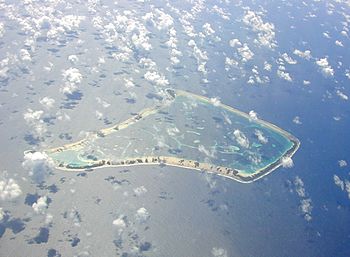
Aerial view of Fakaofo
|
|

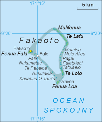
A map of Fakaofo Atoll and all its islands (map in Polish)
|
|
| Lua error in Module:Location_map at line 420: attempt to index field 'wikibase' (a nil value). | |
| Geography | |
|---|---|
| Archipelago | Tokelau |
| Total islands | 43 |
| Major islands | Fale on Pacific Ocean |
| Area | 3 km2 (1.2 sq mi) |
| Largest settlement | Fale |
| Demographics | |
| Population | 483 |
Fakaofo, once called Bowditch Island, is a small group of islands in the Pacific Ocean. It's part of the Tokelau islands. Fakaofo is an atoll, which means it's a ring-shaped coral reef. This reef surrounds a central lagoon. The land area is tiny, only about 3 square kilometers (1.1 square miles). The lagoon inside is much bigger, about 45 square kilometers.
In 2006, about 483 people officially lived on Fakaofo. Most people on the island belong to a Christian church.
Contents
Exploring Fakaofo's Geography and Government
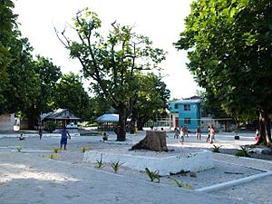
The main village on Fakaofo is called Fale. It's located on Fale Islet, on the western side of the atoll. Just two kilometers west of Fale is a larger islet called Fenua Fala. A second village was built there in 1960.
Fakaofo is made up of many small islets. Some of these include Teafua, Nukumatau, Nukulakia, Fenua Loa, Saumatafanga, Motu Akea, Matangi, Lalo, and Mulifenua.
The island is governed by a group called the Council of Elders. This council is made up of citizens who are over 60 years old. They help make important decisions for the community.
A Look Back at Fakaofo's History
The first time outsiders saw Fakaofo was in 1835. A whale ship named General Jackson sighted the island. It came back again in 1839.
The island was later named Bowditch. This name honored Nathaniel Bowditch, a famous American navigator. In 1838, the American ship USS Peacock (1813) visited the island. This ship was part of a big American journey of discovery. It was called the United States Exploring Expedition. Nathaniel Bowditch wrote a very important book about navigation. It's still used by sailors today.
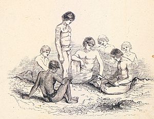
One explorer, Charles Erskine, wrote about the people he met on Fakaofo. He said they didn't know how to make fire. This was very unusual for the time.
In one of the villages, there is a special monument made of coral. It represents Tui Tokelau, a god that people on the islands used to worship.
For many years, from 1856 to 1979, the United States claimed Fakaofo. They also claimed other Tokelau islands. But in 1979, the U.S. agreed that Tokelau belonged to New Zealand. They also set up a maritime boundary between Tokelau and American Samoa. This agreement was called the Treaty of Tokehega.
Islands of Fakaofo Atoll
- Mulifenua
- Vini
- Motu Pelu
- Avaono
- Talapeka
- Te Lafu
- Olokalaga
- Palea
- Manumea
- Ofuna
- Kavivave
- Heketai
- Motuloa
- Motu Akea
- Motu Iti
- Niue
- Fugalei
- Manuafe
- Otafi Loto
- Otafi Loa
- Kaivai
- Nukuheheke
- Nukamahaga Lahi
- Nukamahaga Iti
- Tenki
- Pagai
- Matakitoga
- Vaiaha
- Falatutahi
- Lapa
- Hugalu
- Logotaua
- Tafolaelo
- Otano
- Akegamutu
- Te Loto
- Kapiomotu
- Metu
- Hakea Mahaga
- Pukava
- Hakea
- Te Kau Afua o Humu
- Nukulakia
- Te Papaloa
- Pataliga
- Nukumatau
- Fale
- Te Afua tau Lua
- Fenua Fala
See also
 In Spanish: Fakaofo para niños
 | James B. Knighten |
 | Azellia White |
 | Willa Brown |


