Fanning, Kansas facts for kids
Quick facts for kids
Fanning, Kansas
|
|
|---|---|

|
|
| Country | United States |
| State | Kansas |
| County | Doniphan |
| Founded | 1870 |
| Elevation | 883 ft (269 m) |
| Time zone | UTC-6 (CST) |
| • Summer (DST) | UTC-5 (CDT) |
| Area code | 785 |
| FIPS code | 20-22975 |
| GNIS ID | 473026 |
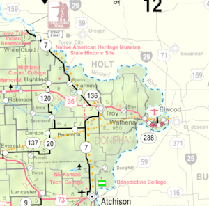
Fanning is a small, unincorporated community in Doniphan County, Kansas, United States. This means it's a group of homes and businesses, but it doesn't have its own local government like a city or town. Fanning is located along K-7 highway. It is about 5 miles (8 km) northwest of Troy.
Fanning's History
Fanning began in the year 1870. The community started when the Burlington and Missouri River Railroad built its tracks through this area. The new railroad helped the community grow.
A post office opened in Fanning in December 1870. It helped people send and receive mail. The post office served the community for many years. It stayed open until July 1933, when it was closed.
Black History Month on Kiddle
African-American Ballerinas:
 | Precious Adams |
 | Lauren Anderson |
 | Janet Collins |

All content from Kiddle encyclopedia articles (including the article images and facts) can be freely used under Attribution-ShareAlike license, unless stated otherwise. Cite this article:
Fanning, Kansas Facts for Kids. Kiddle Encyclopedia.


