Ferndale, Indiana facts for kids
Quick facts for kids
Ferndale
|
|
|---|---|

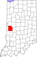
Parke County's location in Indiana
|
|
| Country | United States |
| State | Indiana |
| County | Parke |
| Township | Union |
| Elevation | 617 ft (188 m) |
| Time zone | UTC-5 (Eastern (EST)) |
| • Summer (DST) | UTC-4 (EDT) |
| ZIP code |
47872
|
| Area code(s) | 765 |
| GNIS feature ID | 434459 |
Ferndale is a small, unincorporated community located in Union Township, within Parke County, in the U.S. state of Indiana. An unincorporated community is a group of homes and businesses that does not have its own local government. Instead, it is managed by the larger county or township it is part of.
Contents
History of Ferndale
Ferndale has a short but interesting history. A post office was first opened in Ferndale in the year 1884. This means that people living there could send and receive mail right in their own community. The post office served the area for about 20 years. However, it eventually closed down in 1904.
How Ferndale Got Its Name
The name "Ferndale" was chosen for a very simple and natural reason. The community was named because of the many ferns that grew near where the original settlement was located. It's a name that connects the place directly to its natural surroundings.
Geography of Ferndale
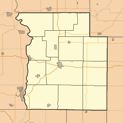
Ferndale is situated in a specific spot in Indiana. It is located at coordinates 39°42′26″N 87°04′01″W / 39.70722°N 87.06694°W. These numbers help pinpoint its exact location on a map.
Elevation and Surroundings
The community sits at an elevation of 617 feet (about 188 meters) above sea level. This means it is 617 feet higher than the ocean. Understanding its elevation helps us know more about the local landscape and how it fits into the wider geography of Parke County.
 | Roy Wilkins |
 | John Lewis |
 | Linda Carol Brown |


