Fier District facts for kids
Quick facts for kids
Fier District
Rrethi i Fierit
|
|
|---|---|

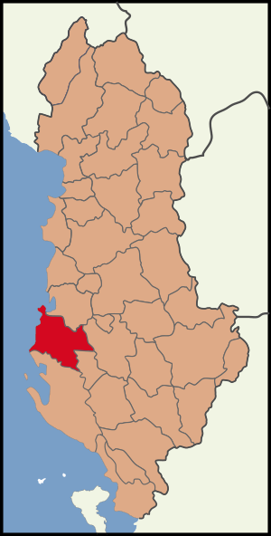
Map showing the district within Albania
|
|
| Country | |
| County | Fier County |
| Capital | Fier |
| Area | |
| • Total | 785 km2 (303 sq mi) |
| Population
(2010)
|
|
| • Total | 199,442 |
| • Density | 254.07/km2 (658.0/sq mi) |
The District of Fier is a region in Albania. It is one of the many districts that make up the country. This area is part of Fier County. About 199,442 people lived here in 2010. The main city and capital of the district is Fier.
What is a District?
A district is like a smaller part of a larger area. Think of it as a neighborhood within a city, but for a whole country. Districts help organize how a country is run. They make it easier to manage local services and people.
In Albania, districts used to be very important for local government. They helped manage things like schools, roads, and public safety. Even though the way Albania is organized has changed, the Fier District is still a well-known area.
Where is Fier District?
The Fier District is located in the western part of Albania. It is close to the Adriatic Sea. This area is known for its flat lands and fertile soil. The district covers about 785 square kilometers. That's roughly the size of a medium-sized city.
The capital city, Fier, is a central point for the district. It is a place where many people live and work. Being near the sea means the district has a mild climate. This is good for farming and other activities.
Life in Fier District
Many people in Fier District work in farming. The land is good for growing crops. You might see fields of wheat or corn. Some people also work in industries related to oil and gas. There are also jobs in services, like shops and restaurants.
The district has a mix of old and new. You can find ancient ruins and modern buildings. People here enjoy their local traditions and culture. It's a place where history meets everyday life.
See also
 In Spanish: Distrito de Fier para niños
 | Chris Smalls |
 | Fred Hampton |
 | Ralph Abernathy |

