Fier facts for kids
Quick facts for kids
Fier
|
|||
|---|---|---|---|
|
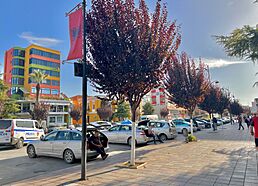
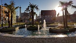
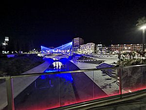
Top to bottom, left to right: Centre of Fier, Gold Market Shopping centre, Archaeological Museum of Apolonia, Shën Gjergj Cathedral and Mosque of Fier, University of Fier, Apartment buildings in Fier, Fountain in Fier
|
|||
|
|||
| Country | |||
| County | Fier | ||
| Incorporated | 1869 | ||
| Area | |||
| • Municipality | 619.9 km2 (239.3 sq mi) | ||
| Elevation | 44 m (144 ft) | ||
| Population
(2011)
|
|||
| • Municipality | 120,655 | ||
| • Municipality density | 194.636/km2 (504.11/sq mi) | ||
| • Municipal unit | 55,845 | ||
| Demonym(s) | Albanian: Fierak (m), Fierake (f) | ||
| Time zone | UTC+1 (CET) | ||
| • Summer (DST) | UTC+2 (CEST) | ||
| Postal Code |
9301-9305
|
||
| Area Code | 034 | ||
Fier (pronounced fi-ER) is a city in Albania. It is the seventh largest city in the country. Fier is the main city of Fier County and Fier Municipality. It sits on the Gjanica River, in a flat area called the Myzeqe Plain.
The city is located between the Seman River to the north and the Vjosë River to the south. It is also near the Mallakastra Mountains. Fier has a Mediterranean climate, which means it has mild winters and hot, dry summers. This climate is affected by how close the city is to the Adriatic Sea.
Fier was founded in the 1800s. It was officially started in 1864 by Omer Pasha Vrioni II. The city is only about 11 kilometers (7 miles) from the ancient ruins of Apollonia. Apollonia was an old settlement built around 588 BCE by Ancient Greek settlers.
Today, Fier is an important center for transportation in southwestern Albania. Major roads like the A2 motorway and SH 4 highway pass through it. These roads help connect different parts of Albania.
Contents
What's in a Name?
The name "Fier" might come from the Albanian word fier, which means "fern". It was common for people in the Myzeqe area to name places after local plants.
Another idea is that the name comes from the Italian word fiera. This word means "trade fair". This makes sense because Fier was once a busy marketplace.
A Look Back in Time
The history of Fier is connected to the oil, gas, and bitumen found nearby. Bitumen is a sticky, black substance like asphalt. People knew about these natural resources as early as the 1st century AD.
An ancient writer named Strabo wrote about the area around AD 17. He described a place near Apollonia where fire came out of a rock. He also mentioned hot water springs and asphalt. He said that asphalt was dug from a nearby hill.
In the 1300s and 1400s, traders from Venice used this area. They bought farm products from the Myzeqe lowlands here.
Fier officially became a city in 1864. Kahreman Pasha Vrioni, a local leader, asked French architects to design a new city. He wanted it to be a center for crafts and trade. A market for 122 merchants was built along the Gjanica River between 1864 and 1865. The first people to live in the city were workers for Kahreman Pasha Vrioni. Also, some Aromanian families who had lived in the area since the early 1800s moved there.
About 12 kilometers (7.5 miles) from Fier are the ruins of Apollonia. This was one of the most important ancient Greek settlements in Albania. It was founded around 600 BC on a hill near the sea. Greek settlers from Corfu and Corinth built it. Back then, the Vjosë River flowed closer to Apollonia. Before an earthquake in the 3rd century AD changed the land, Apollonia's harbor could hold many ships.
Apollonia grew rich from trading slaves and farming. Around the 400s BC, a workshop was set up to make coins. These coins were used for trade throughout the region. Later, Apollonia became involved in wars and came under Roman control in 229 BC. It was a very important city for the Romans.
In 45 and 44 BC, Octavian, who later became Emperor Augustus, studied in Apollonia for six months. The city was famous for its learning, especially for teaching public speaking. A famous Roman speaker, Cicero, called it a "great and important city."
Over time, Apollonia began to decline. The Vjosë River filled with mud, and the coastline changed after an earthquake.
After communism ended in Albania, new buildings were constructed in Fier. An Orthodox church was rebuilt in 1999, allowing people to practice their religion freely.
Where Fier Is Located
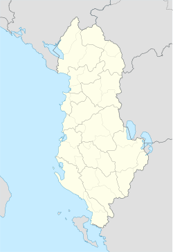
Fier is located on the Gjanica River in southwestern Albania. It is in the southeast part of the Myzeqe Plain. The city is between the Seman River to the north and the Vjosë River to the south. It is also close to the Adriatic Sea.
The municipality of Fier is part of the County of Fier. It includes Fier and several nearby areas. The municipality stretches from the mouth of the Seman River in the northwest to the mouth of the Vjosë River in the southwest. The total area of Fier municipality is about 619.9 square kilometers (239.3 square miles).
Fier's Climate
Fier has a Mediterranean climate. This means it has mild winters and hot, dry summers.
| Climate data for Climate data for Fier | |||||||||||||
|---|---|---|---|---|---|---|---|---|---|---|---|---|---|
| Month | Jan | Feb | Mar | Apr | May | Jun | Jul | Aug | Sep | Oct | Nov | Dec | Year |
| Mean daily maximum °C (°F) | 10.8 (51.4) |
12 (54) |
15.2 (59.4) |
18.8 (65.8) |
23.1 (73.6) |
27.7 (81.9) |
30.6 (87.1) |
31.2 (88.2) |
25.8 (78.4) |
21.4 (70.5) |
16.7 (62.1) |
12 (54) |
20.4 (68.9) |
| Mean daily minimum °C (°F) | 3.1 (37.6) |
3.7 (38.7) |
5.9 (42.6) |
9.1 (48.4) |
13.3 (55.9) |
17.6 (63.7) |
20 (68) |
20.4 (68.7) |
16.8 (62.2) |
12.9 (55.2) |
9 (48) |
4.8 (40.6) |
11.4 (52.5) |
| Average precipitation mm (inches) | 77 (3.0) |
83 (3.3) |
87 (3.4) |
80 (3.1) |
58 (2.3) |
36 (1.4) |
27 (1.1) |
27 (1.1) |
91 (3.6) |
100 (3.9) |
123 (4.8) |
112 (4.4) |
901 (35.4) |
| Average precipitation days | 7 | 7 | 7 | 8 | 6 | 4 | 3 | 3 | 7 | 7 | 8 | 9 | 76 |
| Average relative humidity (%) | 76 | 73 | 71 | 70 | 69 | 64 | 60 | 60 | 69 | 74 | 75 | 77 | 70 |
| Mean daily sunshine hours | 6.8 | 7.6 | 8.9 | 10.2 | 11.5 | 12.4 | 12.6 | 11.8 | 10.1 | 8.5 | 7.4 | 6.7 | 9.5 |
| Source: Climate-Data | |||||||||||||
Fier's Economy
Fier is an important city for industry. It is built near the Gjanica River and is surrounded by marshland. Fier and the nearby town of Patos are centers for oil, bitumen, and chemical industries in Albania.
Fier also used to have a power plant. Although it was shut down in 2007, there are plans to restart it. This would help Albania get electricity from different sources.
The city is a good base for visiting important ancient sites. These include Byllis and Apollonia. Main roads from Fier lead to Vlora (about 35 km or 22 miles away) and Patos (about 8 km or 5 miles away). If you travel about 19 km (12 miles) west of the city, you can find the beautiful Seman Beach.
Fier is also known for growing olive trees, especially a type called Kalinjioti. This helps Albania's olive oil industry. Fier, along with Vlora, Berat, and Elbasan, produces almost 90% of Albania's olive oil.
The city also makes many other products, like sugar, bread, and animal products. This helps the economy of the whole county.
The Trans Adriatic Pipeline (TAP) is a big project that crosses Fier. A pumping station for the pipeline is being built in Fier. This project helps the city and country by bringing in investments and creating jobs. The pipeline started in 2015 and was expected to be finished in 2020. It will supply natural gas to Albania.
Getting Around Fier
You can find urban buses that travel throughout Fier. There are also buses at the main bus terminal that can take you to other places in Albania and the Balkan region.
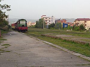
Fier has a railway station, Fier railway station. Trains used to run during the communist era, but they are not currently in use. The SH4 is a state road that connects Fier to Durres. The SH8 is another state road that goes from Fier to Vlore. There are plans to build a highway between Fier and Vlore.
People of Fier
| Historical population | ||
|---|---|---|
| Year | Pop. | ±% |
| 1950 | 7,040 | — |
| 1955 | 9,647 | +37.0% |
| 1960 | 14,391 | +49.2% |
| 1969 | 22,000 | +52.9% |
| 1979 | 33,100 | +50.5% |
| 1989 | 43,086 | +30.2% |
| 2001 | 56,164 | +30.4% |
| 2011 | 55,845 | −0.6% |
| Source: pop-stat.mashke.org | ||
Fier is the seventh most populated city and the sixth most populated municipality in Albania. In 2011, the city part of Fier had about 55,845 people. The whole municipality of Fier, including nearby areas, had a total population of 120,655 in 2011.
Like other cities in southern Albania, Fier has a mix of different religions. There are both Muslims and Orthodox Christians living there.
Culture and Sports
The main sports in Fier are football (soccer) and basketball. The city's main football team is KF Apolonia. They play in the Albanian First Division. There is another team called KF Çlirimi that plays in the Albanian Second Division. KF Apolonia plays its home games at Loni Papuçiu Stadium. KF Çlirimi plays at Stadiumi Fusha Sportive e Shkolles Bujqesore.
The basketball team in Fier is BC Apolonia. They play in the Albanian Basketball League. Their home games are played at the Fier Sports Palace.
Famous People from Fier
Many notable people were born in Fier, including:
- Besa Kokëdhima
- Luftar Paja
- Kujtim Majaci
- Eleni Foureira
- Ermal Meta
- Hasna Xhukiçi
- Helena Kadare
- Jani Minga
- Jakov Xoxa
- Mario Gjata
- Keidi Bare
- Liri Gero
- Odise Roshi
- Qemal Bey Vrioni
- Rovena Stefa
- Gledi Mici
Fier Around the World
Fier is connected with other cities around the world. It is a twin city with:
Fier also works together with:
See also
 In Spanish: Fier (Albania) para niños
 | Selma Burke |
 | Pauline Powell Burns |
 | Frederick J. Brown |
 | Robert Blackburn |


