Flush, Kansas facts for kids
Quick facts for kids
Flush, Kansas
|
|
|---|---|

|
|
| Country | United States |
| State | Kansas |
| County | Pottawatomie |
| Elevation | 1,093 ft (333 m) |
| Time zone | UTC-6 (CST) |
| • Summer (DST) | UTC-5 (CDT) |
| Area code | 785 |
| FIPS code | 20-23625 |
| GNIS ID | 484769 |
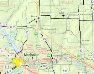
Flush is a small, unincorporated community in Pottawatomie County, Kansas, United States. It is located between the towns of St. George and Westmoreland. An 'unincorporated community' means it is a group of homes and buildings that is not officially a town or city with its own local government.
Contents
The Story of Flush
How Flush Got Its Name
The community of Flush was named after an early settler, Michael Floersch. When a post office opened in Flush in June 1899, the postmaster-general had trouble saying "Floersch." So, the name was changed to Flush. The postal service in Flush stopped in November 1927.
Early Settlers and the Church
Many of the first people to settle in Flush were German-speaking immigrants. The local church had priests who spoke German until 1927. The church also started a school in the 1890s. This school helped educate the children of the community until it closed in 1976.
A Town's Hopes for Growth
In 1908, Flush seemed ready for a big change. There were plans to build a railroad right through the community. The Floersch family even built a large grain mill to serve the expected railroad. However, the railroad was never built. Because of this, Flush did not grow as much as the immigrants had hoped. By 1914, most people living in the original town area had moved to other communities.
Flush Today
Today, the main part of Flush is the St. Joseph's Catholic Church campus. This campus includes the church building, a rectory (where the priest lives), a parish hall, and a cemetery. The church building itself was built in 1901 and was last updated in 2001.
Flush and the St. Joseph Church community are well-known for their annual event called the Flush Picnic. This picnic is a fundraiser for the church. It features a delicious fried chicken dinner and a fun fair. The picnic attracts more than 2,000 people to Flush. It is usually held on the last Wednesday in July each year.
Education in Flush
The public schools for the Flush community are part of the Rock Creek USD 323 school district. Rock Creek High School is located about one mile north of Flush. It was built in 1991.
The Catholic parochial school in Flush, which was run by the church, closed in 1976. The high school mascot for Flush was the Flush Rockets.
 | DeHart Hubbard |
 | Wilma Rudolph |
 | Jesse Owens |
 | Jackie Joyner-Kersee |
 | Major Taylor |


