St. George, Kansas facts for kids
Quick facts for kids
St. George, Kansas
|
|
|---|---|

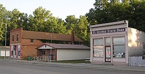
First Street in St. George (2012)
|
|

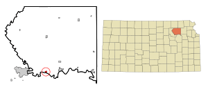
Location within Pottawatomie County and Kansas
|
|

|
|
| Country | United States |
| State | Kansas |
| County | Pottawatomie |
| Founded | 1857 |
| Incorporated | 1919 |
| Government | |
| • Type | Mayor–Council |
| Area | |
| • Total | 0.65 sq mi (1.67 km2) |
| • Land | 0.65 sq mi (1.67 km2) |
| • Water | 0.00 sq mi (0.00 km2) |
| Elevation | 1,099 ft (335 m) |
| Population
(2020)
|
|
| • Total | 1,054 |
| • Density | 1,622/sq mi (631.1/km2) |
| Time zone | UTC-6 (CST) |
| • Summer (DST) | UTC-5 (CDT) |
| ZIP code |
66535
|
| Area code | 785 |
| FIPS code | 20-62200 |
| GNIS ID | 2396491 |
St. George or Saint George is a small city in Pottawatomie County, Kansas, United States. In 2020, about 1,054 people lived there. The city might be named after some of the first settlers who had the name George.
Contents
History of St. George
The city of St. George was first planned in 1857. Later, in 1879, the entire town moved about a mile. This move happened so the town could be closer to the new railroad tracks. Being near the railroad was important for trade and travel.
Geography of St. George
St. George is a small city in terms of size. According to the United States Census Bureau, the city covers a total area of about 0.69 square miles (1.67 square kilometers). Almost all of this area, about 0.68 square miles, is land. A very tiny part, about 0.01 square miles, is water.
People and Population
| Historical population | |||
|---|---|---|---|
| Census | Pop. | %± | |
| 1860 | 78 | — | |
| 1870 | 118 | 51.3% | |
| 1880 | 206 | 74.6% | |
| 1920 | 211 | — | |
| 1930 | 216 | 2.4% | |
| 1940 | 203 | −6.0% | |
| 1950 | 251 | 23.6% | |
| 1960 | 259 | 3.2% | |
| 1970 | 241 | −6.9% | |
| 1980 | 309 | 28.2% | |
| 1990 | 397 | 28.5% | |
| 2000 | 434 | 9.3% | |
| 2010 | 639 | 47.2% | |
| 2020 | 1,054 | 64.9% | |
| U.S. Decennial Census | |||
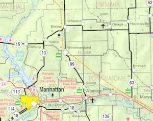
St. George is part of the larger Manhattan, Kansas area. This means it's connected to the economic and social life of the nearby city of Manhattan.
How Many People Live Here? (2010 Census)
In 2010, a count of the population showed that 639 people lived in St. George. These people lived in 228 different homes. Most of these homes, 161 of them, were families.
The city had about 939 people per square mile. There were 255 housing units, which are places where people can live.
Most of the people in St. George were White (90.9%). A small number were African American (0.3%), Native American (1.4%), or Asian (0.9%). About 1.4% were from other backgrounds, and 5.0% were from two or more backgrounds. People of Hispanic or Latino heritage made up 5.8% of the population.
Many homes (46.5%) had children under 18 living there. Most homes (55.3%) were married couples living together. About 10.5% of homes were led by a woman without a husband. About 4.8% were led by a man without a wife. The average home had 2.80 people, and the average family had 3.39 people.
The average age of people in the city was 30.2 years old. About 33.2% of residents were under 18. About 7.7% were 65 years old or older. The population was almost evenly split between males (49.0%) and females (51.0%).
Education in St. George
Students in St. George attend schools in the Rock Creek USD 323 public school district. This district was created by combining schools from St. George and Westmoreland.
Rock Creek High School is located between the two communities. Its sports teams are called the Rock Creek Mustangs. Younger students attend St. George Elementary, which is located right in St. George.
The original St. George High School closed in 1991 when the school districts joined together. The mascot for the old St. George High School was the St. George Trojans.
Famous People from St. George
- Wendell Hall was a singer and songwriter. He was known for his popular songs.
See also
 In Spanish: St. George (Kansas) para niños
 | Shirley Ann Jackson |
 | Garett Morgan |
 | J. Ernest Wilkins Jr. |
 | Elijah McCoy |

