Foel Chwern facts for kids
| Alternative name | Y Foel Cherwn |
|---|---|
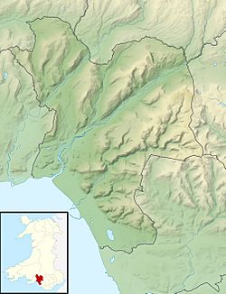
| Location | High ridge east of Cwmgwrach, Neath Port Talbot, Wales (OS Grid ref SN898038) |
| Region | South Wales |
| Coordinates | 51°43′22″N 3°35′46″W / 51.7228°N 3.5962°W |
| Type | Round cairn |
| Area | 50 m2 (540 sq ft) |
| History | |
| Periods | Bronze Age |
| Cultures | Celtic Brittonic |
| Site notes | |
| Condition | Grass-covered mound of slabby stones, poorly defined edges. |
| Public access | Yes |
| Reference no. | GM235 |
Foel Chwern is an ancient burial mound located in Wales. It's a special type of monument called a round cairn. This means it's a large pile of stones, often covered with grass, that was built a very long time ago.
This cairn dates back to the Bronze Age. This was a period in history when people used bronze to make tools and weapons. The Bronze Age in Britain lasted from about 2500 BC to 800 BC. Foel Chwern is found high up on a plateau, or flat area, east of the Neath valley. It's also quite close to the top of Craig y Llyn, which is a tall hill. From this spot, you can see far across the land to the north. A long walking path called the Coed Morgannwg Way goes right past the cairn. The area around it is now part of the Rheola Forest, filled with conifer trees.
What is the Foel Chwern Cairn like?
The Foel Chwern cairn is a mound of small stones. It measures about 8 metres (26 ft) across and is about 0.4 metres (1.3 ft) high. Many of the stones you can see are flat pieces of sandstone, which is a common rock in that area.
Most of the mound is covered in grass, so it's hard to see all the stones. The edges of the cairn are also not very clear. In the past, around the 1970s, the cairn was slightly damaged during tree planting work. At that time, archaeologists did a small dig, or "partial excavation," to check its size. However, they didn't find any burials or other ancient objects inside the mound.
Even though no finds were made, Foel Chwern is still very important. It is protected as a Scheduled Monument. This means it's a nationally important archaeological site that is legally protected from damage.
Where is Foel Chwern located?
The Foel Chwern cairn sits on a high ridge, about 568 metres (1,864 ft) above sea level. This ridge is part of a larger area that reaches its highest point at Craig y Llyn. Craig y Llyn is about 1 kilometer (half a mile) south of the cairn and is the highest point in Glamorgan.
This area is mostly empty land, with no roads nearby. It is now covered with many conifer trees, forming part of the Rheola Forest. The Forestry Commission planted these spruce and larch trees in the mid-1900s. Before the trees, this plateau was a busy coal mining area. There were more than 150 coal mines and 15 tramways used to move coal. Today, a large open-cast coal mine still operates about a kilometer north of the cairn.
The ridge where Foel Chwern is located stretches between Rhigos and Mynydd Resolven. Many other Bronze Age cairns are found along this same ridge. For example, to the west, you can find Craig-y-Pant and Garn Fach. To the east, there are Twyn Canwyllyr, Craig-y-Bwlch, and Rhondda Fach Cairns. All these ancient monuments are in similar high places along the ridge.
How to visit Foel Chwern
It's a bit of a walk to get to Foel Chwern, as there are no roads within 3 kilometers (2 miles) of the cairn. The closest main road is the A4061, which crosses Hirwaun Common.
However, it's easy to access the monument once you're in the area. The long-distance walking path called the Coed Morgannwg Way runs right past the cairn. This path goes east to west along the ridge. There are also other tracks, paths, and cycle paths within the Rheola Forest that lead to the cairn. National Route 47 of the National Cycle Network also passes through the woodland south of Foel Chwern.
 | Aaron Henry |
 | T. R. M. Howard |
 | Jesse Jackson |


