Fort Wayne Rivergreenway facts for kids

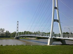
The Rivergreenway is a super cool network of trails in Fort Wayne, Indiana. It's like the main path for the growing Fort Wayne Trails system! This amazing trail system has almost 25 miles of connected paths. They follow along or near Fort Wayne's three rivers: the St. Joseph River, the St. Marys River, and the Maumee River.
In 2009, the Rivergreenway was even named a National Recreation Trail. This means it's recognized as a special trail for fun and exercise! The Rivergreenway also connects to another trail called the Wabash & Erie Canal Towpath Trail. By 2011, with the Wabash & Erie Canal Towpath Trail finished, Fort Wayne had a huge 50 miles of connected trails!
Contents
Where the Trails Begin
The Rivergreenway starts right in downtown Fort Wayne. This is where the three rivers meet! It's like the "zero-mile marker" for the St. Joseph, St. Marys, and Maumee Pathways.
Exploring the Rivergreenway Trails
The Rivergreenway is made up of several different pathways, each with its own unique journey.
St. Joseph Pathway
- This pathway is about 3.4 miles long.
- It follows the west side of the St. Joseph River.
- You can follow it from where the rivers meet all the way to Indiana University – Purdue University Fort Wayne (IPFW).
- A part of this trail was finished in 2010. It includes a new path across the Coliseum Blvd Bridge and even goes under the bridge to connect with IPFW.
St. Joe Blvd Pathway
- This trail is about 1.14 miles long.
- It runs along the east side of the St. Joseph River.
- This section was built as part of a project to help control floods.
St. Marys Pathway
- The St. Marys Pathway is about 8.75 miles long.
- It goes south from the downtown river meeting point to Tillman Park.
- Along the way, this pathway connects to many city parks! These include the Historic Old Fort, Lawton, Headwaters, Bloomingdale, Swinney, Foster, and Tillman parks.
- This is also the main trail that connects you to downtown Fort Wayne.
Maumee Pathway
- This pathway is also about 8.75 miles long.
- It heads east on the north side of the Maumee River.
- It winds its way to Moser Park in the City of New Haven.
- In 2009, a small path was added to Coliseum Blvd. This gives trail users another way to get onto the trail.
Yarnell Trail
- The Yarnell Trail is about 1.11 miles long.
- It starts in West Swinney Park, near where the St. Marys Pathway is.
- It goes west through West Swinney Park and along West Jefferson Boulevard to Rockhill Park.
Southtown Centre Trail
- This trail is about 0.60 miles long.
- It begins at Tillman Park, where the St. Marys Pathway ends.
- It runs south along Hanna Street and then crosses a field to the back of Southtown Centre.
- By 2017, this trail had connected to Anthony Boulevard.
 | Isaac Myers |
 | D. Hamilton Jackson |
 | A. Philip Randolph |

