
St. Joseph River (Maumee River tributary) facts for kids
Quick facts for kids St. Joseph River |
|
|---|---|

Map of the Maumee River watershed showing the St. Joseph River.
|
|
| Other name(s) | Little St. Joseph River, Bean Creek, Kochisahsepe |
| Country | United States |
| Physical characteristics | |
| Main source | Hillsdale County, Michigan 856 ft (261 m) 41°38′53″N 84°33′56″W / 41.6480556°N 84.5655556°W |
| River mouth | Maumee River, Ft. Wayne, Indiana 751 ft (229 m) 41°05′00″N 85°07′56″W / 41.0833333°N 85.1322222°W |
| Length | 100 mi (160 km) |
| Basin features | |
| Tributaries |
|
| GNIS ID | 2678706 |


The St. Joseph River (also called Kociihsasiipi in the Miami-Illinois language) is a river in the United States. It flows for about 86.1-mile-long (138.6 km). This river is a branch of the Maumee River. It flows through parts of northwestern Ohio and northeastern Indiana. Some of its smaller streams, called headwaters, start in southern Michigan.
The St. Joseph River helps drain a lot of farmland. All the water from this area eventually flows into Lake Erie. It's important to know that there's another river called the St. Joseph River of Lake Michigan. That river is completely separate. It starts in western Michigan and flows into Lake Michigan.
Contents
How the St. Joseph River Was Formed
Long, long ago, when the last big ice age was ending, a huge sheet of ice called the Erie Lobe glacier started to melt and move away. As it melted, it left behind large piles of dirt and rocks called moraines. The St. Joseph River began as a channel for meltwater between two of these moraines.
At first, the St. Joseph River joined the St. Marys River. Together, they flowed into the Wabash River. But later, a huge ancient lake called Glacial Lake Maumee (which was the ancestor of today's Lake Erie) started to shrink. This change opened up the modern Maumee River. The Maumee River then "captured" the water from the St. Joseph and St. Marys rivers. This even made the St. Marys River change its direction to flow into the St. Joseph River!
The St. Joseph River Today
The St. Joseph River officially begins in northern Williams County, Ohio. This is where its two main parts, the East Branch and the West Branch, meet. Both of these branches actually start in southern Hillsdale County, Michigan. The very beginning of the East Branch is only about 3 miles (4.8 km) away from where the St. Joseph River of Lake Michigan starts.
Both the East and West branches first flow southeast. Then, they turn southwest and go through the northwestern part of Ohio, passing by Montpelier. The St. Joseph River then enters De Kalb County in northeastern Indiana. It continues flowing southwest past Saint Joe. Finally, it reaches the city of Fort Wayne. In Fort Wayne, the St. Joseph River meets the St. Marys River. When these two rivers join, they form the Maumee River.
To help protect Fort Wayne from floods, the US Army Corps of Engineers built a special flood control system. This includes a floodwall and a road along the St. Joseph River.
Rivers and Creeks that Join the St. Joseph
Many smaller rivers and creeks flow into the St. Joseph River. These are called tributaries. Here are some of the main ones:
- Cedar Creek
- Bear Creek
- Buck Creek
- Fish Creek
- Eagle Creek
- Nettle Creek (which flows from Nettle Lake)
- The East Branch St. Joseph River (starts in Michigan)
- The West Branch St. Joseph River (starts in Michigan)
Where the River Drains
The St. Joseph River and all the smaller streams that flow into it drain water from many different areas. This area is called its drainage basin. The St. Joseph River basin includes parts of several counties in three different states:
- In Indiana, it drains parts of Allen, DeKalb, Noble, and Steuben counties.
- In Ohio, it drains parts of Defiance and Williams counties.
- In Michigan, it drains parts of Hillsdale County.
Images for kids
-
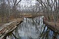
The St. Joseph River near the Ohio Turnpike in Bridgewater Township.

