Frankland River (Western Australia) facts for kids
Quick facts for kids Frankland |
|
|---|---|

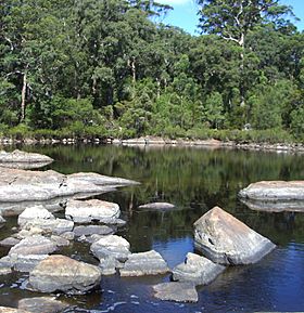
Circular pool in the Frankland River
|
|
|
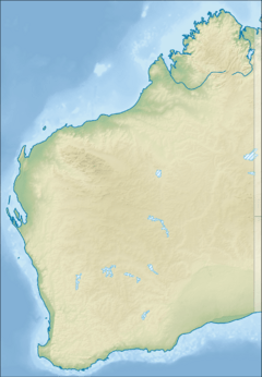
Location of the river mouth in Western Australia
|
|
| Other name(s) | Nyungar: Kwakoorillup |
| Country | Australia |
| State | Western Australia |
| Region | Great Southern |
| Physical characteristics | |
| River mouth | Nornalup Inlet west of Walpole 34°59′53″S 116°45′00″E / 34.99806°S 116.75000°E |
| Length | 162 km (101 mi) |
| Basin features | |
| Basin size | 5,722 km2 (2,209 sq mi) |
| Tributaries |
|
| National park | Walpole-Nornalup |
The Frankland River is a long and important river in the Great Southern part of Western Australia. It carries the most water of any river in this region. It is also the eighth largest river in the entire state. The Noongar people are the original inhabitants of this land. They have lived here for thousands of years. They call the river Kwakoorillup.
Contents
Exploring the Frankland River
The Frankland River is a big part of the landscape in Western Australia. It flows through a beautiful area. Let's learn more about where it is and how it got its name.
Where is the Frankland River Located?
The Frankland River starts when two smaller streams, Towerlup Brook and Ornabullup Creek, join together. This happens near a place called Trollup Hill. From there, the river flows for about 162 kilometers (101 miles).
One of its main branches is the Gordon River. This river begins southwest of the town of Broomehill. Eventually, the Frankland River joins two other rivers, the Walpole and the Deep. All three rivers flow into the Nornalup Inlet. This inlet is a large body of water west of the town of Walpole.
How the Frankland River Got Its Name
The area around the Frankland River was explored a long time ago. In December 1829, a naval surgeon named Thomas Braidwood Wilson explored the region. He named a nearby mountain, Mount Frankland, after George Frankland. George Frankland was a surveyor in another part of Australia called Van Diemen's Land (now Tasmania).
Wilson explored with a Noongar man named Mokare. Mokare was from King George Sound. They also had other companions with them. Later, in January 1831, Captain Thomas Bannister saw the river. He told Governor James Stirling about it. Governor Stirling decided to name the river Frankland, influenced by Wilson's earlier naming of the mountain. Before this, some seal hunters knew the river as the "Deep River."
The Land Around the River
Most of the land around the Frankland River is used for farming. About 85% of the river's catchment area has been cleared for agriculture. A catchment area is all the land where water drains into a river. Farmers mainly grow cereals like wheat and raise sheep here. There is also some dairy farming, tree farming, grape growing, and olive farming.
Over time, the water in the river has become saltier. In the 1970s and 1980s, the water had a small amount of salt. But since the year 2000, the salt levels have increased quite a lot.
The Traditional Owners of the River
The traditional owners of the land around the Frankland River are the Noongar people. They have lived in this area for many thousands of years. They have a deep connection to the land and its waterways. The Noongar people have their own name for the Frankland River, which is Kwakoorillup. This name reflects their long history and knowledge of the river.
See also
 | Janet Taylor Pickett |
 | Synthia Saint James |
 | Howardena Pindell |
 | Faith Ringgold |


