Gévora (river) facts for kids
Quick facts for kids Gévora |
|
|---|---|

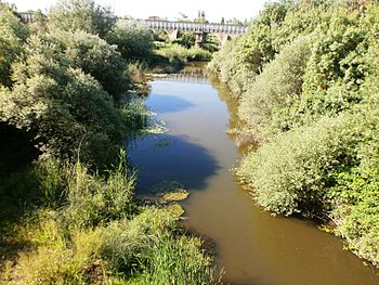
The Gévora close to its mouth
|
|
| Native name |
|
| Country | Portugal, Spain |
| Physical characteristics | |
| Main source | Serra de São Mamede 1,027 m (3,369 ft) 39°18′47″N 7°21′38″W / 39.31306°N 7.36056°W |
| River mouth | Guadiana 38°53′31″N 6°57′53″W / 38.89194°N 6.96472°W |
| Length | 73.81 km (45.86 mi) |
| Basin features | |
| Progression | Guadiana→ Gulf of Cádiz |
The Gévora river, also known as Xévora, is a cool waterway in the southwest of Europe. It flows through two countries: Portugal and Spain. The Gévora is like a smaller friend to a bigger river called the Guadiana, which it eventually joins.
This river starts high up in the Serra de São Mamede mountains in Portugal. It begins at an elevation of 1,027 meters (about 3,369 feet) above sea level. The Gévora travels for about 73.81 kilometers (around 45.86 miles).
The Gévora River's Journey
The Gévora river begins its journey in the Serra de São Mamede mountain range in Portugal. It starts at a high point, about 1,027 meters (3,369 feet) above the sea. From there, it flows for about 73.81 kilometers (45.86 miles).
Where Does It Flow?
At first, the river flows generally from west to east. But when it reaches Spain, it makes a turn and starts flowing south. Finally, the Gévora river empties into the Guadiana river. This happens near the city of Badajoz in Spain.
River Friends: Tributaries
Like many rivers, the Gévora has smaller streams and rivers that join it. These are called tributaries. They add more water to the main river.
- Some of the main tributaries that join the Gévora from its left side are the Jola, Guarranque, and Zapatón.
- On its right side, you'll find tributaries like the Gevorete, Codosero, and Abrilongo.
These smaller rivers help make the Gévora the important waterway it is!
See also
 In Spanish: Río Gévora para niños
 | Isaac Myers |
 | D. Hamilton Jackson |
 | A. Philip Randolph |

