Serra de São Mamede facts for kids
Quick facts for kids Serra de São Mamede |
|
|---|---|
| Saint Mammes Range | |

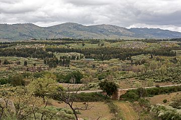
The Serra de São Mamede near Castelo de Vide
|
|
| Highest point | |
| Peak | Pico de São Mamede |
| Elevation | 1,025 m (3,363 ft) |
| Isolation | 75.65 km |
| Dimensions | |
| Length | 25 km (16 mi) NW/SE |
| Width | 9 km (5.6 mi) NE/SW |
| Geography | |
| Country | |
| State/Province | Portalegre District |
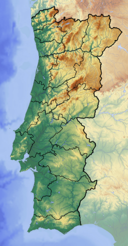
| Range coordinates | 39°17′N 7°21′W / 39.283°N 7.350°W |
| Parent range | Montes de Toledo |
| Geology | |
| Orogeny | Alpine |
| Age of rock | Ordovician, Silurian and Devonian |
| Type of rock | Quartzite, Dolomite |
The Serra de São Mamede is a beautiful mountain range located in the Portalegre District of Portugal. It's also known as the Saint Mammes Range. This area is special because it's one of the few places in the Alentejo region that sometimes gets snow in winter!
This mountain range acts like a natural divider. To the north, its rivers flow into the Tagus River. To the south, other rivers from the range flow into the Guadiana River. Some of the main rivers starting here are the Sever and Nisa, which go towards the Tagus. The Caia River and its branch, the Arronches, flow towards the Guadiana.
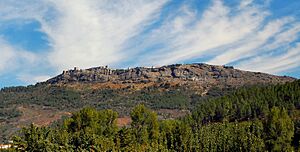
Several important towns are found in this area. Marvão is an old, fortified town built high up on a ridge of the range. Its amazing castle is a great example of a medieval fortress. It dates back to the time of the Reconquista, when Christians took back the Iberian Peninsula from the Moors. Other towns nearby include Portalegre, Castelo de Vide, Arronches, and Alegrete.
Contents
About the Serra de São Mamede
The Serra de São Mamede stretches for about 25 kilometers (about 15.5 miles). It runs from Castelo de Vide in Portugal to La Rabaza in Spain, right near the border. This range is part of the Alto Alentejo area in Portugal. It's a bit lower than the nearby Sierra de San Pedro range in Spain.
The highest point in the range is Pico de São Mamede, which is 1,025 meters (about 3,363 feet) tall. This makes it the tallest peak in mainland Portugal south of the Tagus River. Other important peaks include Fria, Pico de Marvão, and Penha da Castelo de Vide. Geographically, this range is part of a larger mountain system called the Montes de Toledo, which covers a big part of the Iberian Peninsula.
Climate and Nature
The weather in the Serra de São Mamede is a mix of Atlantic and Mediterranean climate. This means it gets some rain from the ocean and also has warm, dry summers.
Plants of the Range
The natural areas of the range are covered with Shrubland and different types of trees. You'll find cork oak trees, which are famous for their bark used to make corks. There are also Pyrenean oak trees. In the higher, rocky areas, shrubs grow between the rocks. Holm oak trees grow in drier spots, and Sweet chestnut trees are found at higher elevations.
On the lower parts of the mountains, there are large areas of olive trees and maritime pine trees. You might also see some areas planted with trees that are not native to Portugal, like eucalyptus.
Animals of the Range
The Serra de Sao Mamede Natural Park is a special protected area within the mountain range. This park is home to one of the largest bat colonies in Europe! It's a very important place for these flying mammals. You can also spot large birds of prey here, like the griffon vulture and the powerful Bonelli's eagle.
How the Mountains Were Formed
Geology of the Serra de São Mamede
The rocks that make up the Serra de São Mamede are mostly Quartzite and Dolomite, especially in the higher parts of the range. These are very strong and resistant rocks. In the southwestern part of the mountains, between Portalegre and Fortios, you can also find Granite rock.
See also
 In Spanish: Sierra de San Mamés (Portugal) para niños
- Geography of Portugal
- Geology of the Iberian Peninsula
 | Selma Burke |
 | Pauline Powell Burns |
 | Frederick J. Brown |
 | Robert Blackburn |


