Garcihernández facts for kids
Quick facts for kids
Garcihernández
|
|
|---|---|

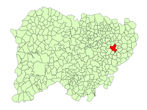
Location in Salamanca
|
|
| Country | Spain |
| Autonomous community | Castile and León |
| Province | Salamanca |
| Comarca | Tierra de Alba |
| Area | |
| • Total | 48 km2 (19 sq mi) |
| Elevation | 814 m (2,671 ft) |
| Population
(2018)
|
|
| • Total | 464 |
| • Density | 9.67/km2 (25.04/sq mi) |
| Time zone | UTC+1 (CET) |
| • Summer (DST) | UTC+2 (CEST) |
| Postal code |
37810
|
Garcihernández is a small village and a municipality in western Spain. It is located in the province of Salamanca, which is part of the Castile and León region.
This village is about 30 kilometers (19 miles) away from Salamanca, the capital city of the province. In 2018, about 464 people lived in Garcihernández.
Garcihernández was also the site of an important historical event. In 1812, a battle called the Battle of García Hernández took place here during the Peninsular War.
Exploring Garcihernández: Geography and Location
Garcihernández is a small area covering about 48 square kilometers (18.5 square miles). It sits quite high up, about 814 meters (2,671 feet) above sea level. The postal code for the village is 37810.
Life and Work: The Economy of Garcihernández
The main way people in Garcihernández make a living is through agriculture. This means farming is very important here.
Unlike many other villages in the Alba de Tormes area, Garcihernández has managed to keep its population. In the 1990s, many people left small villages in Spain to move to bigger cities. However, many people from Garcihernández found work in construction, often as masons, in the capital city or other places. They chose to keep living in their home village. This helped stop people from moving away from Garcihernández.
See also
 In Spanish: Garcihernández para niños
 | DeHart Hubbard |
 | Wilma Rudolph |
 | Jesse Owens |
 | Jackie Joyner-Kersee |
 | Major Taylor |

