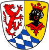
Garmisch-Partenkirchen (district) facts for kids
Quick facts for kids
Garmisch-Partenkirchen
|
||
|---|---|---|
|
||
| Country | ||
| State | Bavaria | |
| Adm. region | Upper Bavaria | |
| Region | Oberland | |
| Capital | Garmisch-Partenkirchen | |
| Area | ||
| • Total | 1,012 km2 (391 sq mi) | |
| Population
(2000)
|
||
| • Total | 86,600 | |
| • Density | 85.57/km2 (221.63/sq mi) | |
| Time zone | UTC+1 (CET) | |
| • Summer (DST) | UTC+2 (CEST) | |
| Vehicle registration | GAP | |
| Website | landratsamt-gap.de | |
Garmisch-Partenkirchen is a special area in Bavaria, Germany. It's called a Landkreis, which is like a county or district. This area is famous for its amazing natural beauty and tall mountains.
It's located in the Alps, which are big mountains in Europe. The highest mountain in Germany, the Zugspitze, is found right here! It stands at 2,962 meters (about 9,718 feet) tall. Imagine climbing to the top and seeing all of Germany below!
Towns and Villages in Garmisch-Partenkirchen
The Garmisch-Partenkirchen district doesn't have any big cities. Instead, it's made up of many smaller towns and villages, which are called municipalities. Each one has its own unique charm and history. These places are where people live, work, and go to school.
Here are some of the municipalities you can find in this district:
- Bad Bayersoien
- Bad Kohlgrub
- Eschenlohe
- Ettal
- Farchant
- Garmisch-Partenkirchen (This is also the main town of the district!)
- Grainau
- Großweil
- Krün
- Mittenwald
- Murnau am Staffelsee
- Oberammergau
- Oberau
- Ohlstadt
- Riegsee
- Saulgrub
- Schwaigen
- Seehausen am Staffelsee
- Spatzenhausen
- Uffing
- Unterammergau
- Wallgau
See also
- In Spanish: Distrito de Garmisch-Partenkirchen para niños
 | William Lucy |
 | Charles Hayes |
 | Cleveland Robinson |


