George L. Smith State Park facts for kids
Quick facts for kids George L. Smith State Park |
|
|---|---|

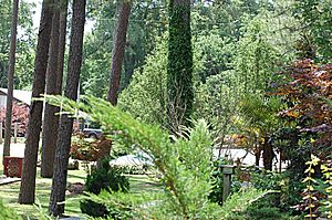
Entrance to the George L. Smith state park
|
|
| Lua error in Module:Location_map at line 420: attempt to index field 'wikibase' (a nil value). | |
| Location | Emanuel County, Georgia |
| Nearest city | Twin City, Georgia |
| Area | 412-acre (1.67 km2) |
George L. Smith State Park is a beautiful park in Emanuel County, Georgia. It covers about 1,634 acres (6.6 square kilometers). The park is named after George L. Smith, who was an important politician from Georgia. He used to be the speaker of the Georgia House of Representatives.
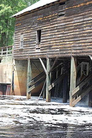
This park is a great place to visit. You can see an old grist mill, a charming covered bridge, and a historic dam. The park also has a large 412-acre (1.7 square kilometer) mill pond. This pond is full of tall cypress trees. It's a perfect spot for fishing and canoeing. Because the park is in a quiet, remote area, it's also wonderful for watching birds and exploring nature. You might even spot rare birds like the great blue heron or the white ibis!
The park also has a museum near the lake and mill. This museum shares the history of the area. It shows old tools from the grist mill. You can also learn about the 15 Mile Creek watershed and its estuary.
Contents
Park Fun: Things to Do and See
George L. Smith State Park offers many fun activities for visitors. Whether you like camping or exploring trails, there's something for everyone.
Camping and Staying Over
If you want to stay overnight, the park has several options:
- 18 campsites for tents, trailers, or RVs.
- 8 cozy cottages for rent.
- 1 large group shelter, great for gatherings.
- 1 special pioneer campground for a more rustic experience.
Exploring the Trails
The park has many ways to explore its natural beauty:
- You can walk on 7.0 miles (11.3 kilometers) of walking trails.
- There are 10 miles (16 kilometers) of canoe trails on the pond.
- You can rent canoes to paddle around the pond.
Nature's Home: Plants and Animals
The park is a special place for many different plants and animals. It has unique habitats that you can explore.
Walking Through Nature Trails
The park's nature trails are about seven miles long. They wind through sandy soil. As you walk, you'll pass through a bird sanctuary. You'll also see areas where gopher tortoises live. These tortoises dig burrows in the loose soil.
Forests and Wildlife
The park has many hardwood trees. These trees attract different types of birds. You might see woodpeckers and sap suckers. These birds are not often seen in the pine forests of southern Georgia. The park also has old sand dunes. Here, you'll find longleaf pines and wiregrass. There are also turkey oaks and a forest of small dwarf oaks. The thick wiregrass provides great cover for many different animals.
The Mill Pond: A Watery Wonderland
The park's main feature is its large "pond." It's more than a mile long and offers great water activities.
Pond Depth and Paddling
The pond's depth changes depending on the area:
- Near the edges, it's about 2 to 3 feet (0.6 to 0.9 meters) deep.
- Further out, it's about 5 to 7 feet (1.5 to 2.1 meters) deep.
- In the middle, along the "red trail," it can be 8 to 10 feet (2.4 to 3.0 meters) deep.
- Right in front of the mill house, it's the deepest, at 12 to 14 feet (3.7 to 4.3 meters).
During very dry times, the water level can drop a lot. Some of the paddling trails might even dry up.
Paddling Trails and Rentals
There are three paddling trails on the pond:
- One trail goes up the center of the pond.
- Two other trails run closer to the outside edges.
You can rent kayaks and canoes at the park. However, it's not a good idea to use inflatable boats. There are sometimes submerged tree stumps that could damage them.
 | Victor J. Glover |
 | Yvonne Cagle |
 | Jeanette Epps |
 | Bernard A. Harris Jr. |


