Geospatial Information Authority of Japan facts for kids
| 国土地理院 Kokudo Chiri-in |
|

Geospatial Information Authority of Japan logo
|
|
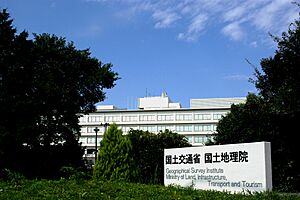
 Geospatial Information Authority of Japan headquarters |
|
| Agency overview | |
|---|---|
| Formed | June 2, 1869 |
| Preceding agency |
|
| Jurisdiction | |
| Headquarters | Yubinbango 305-0811, Ibaraki Prefecture, Tsukuba City, Kitago No. 1, Japan |
| Employees | 671 civilian staff (2018) |
| Annual budget | 9,640,335 thousand yen |
| Agency executive |
|
| Parent agency | Ministry of Land, Infrastructure and Transport |
The Geospatial Information Authority of Japan (国土地理院, Kokudo Chiri-in), often called GSI, is a special government group in Japan. Its main job is to survey the land and create maps for the whole country.
From 1949 until March 2010, it was known as the Geographical Survey Institute. Even though the name changed, it kept the same initials, GSI. It is part of the Ministry of Land, Infrastructure, Transport and Tourism. The main offices of the GSI are in Tsukuba City, in Ibaraki Prefecture.
The GSI also runs a fun place called the Science Museum of Map and Survey. It is located in Tsukuba and teaches visitors all about maps and surveying.
How GSI Helps with Earthquakes
The GSI uses special equipment to help understand earthquakes. Since April 1996, they have had "MT monitoring systems" set up in Japan. These systems continuously record signals from the Earth's electromagnetic field.
These stations are at places like the Mizusawa Geodetic Observatory. They measure tiny changes in the Earth's field. Scientists believe these changes might be linked to earthquake activity.
The information collected by the GSI is available to other scientists. This helps them study how electromagnetic events and earthquakes are connected. You can find this data online if you are a scientist.
The GSI is also part of a group called the Coordinating Committee for Earthquake Prediction. This committee works together to help predict earthquakes in Japan.
GSI in Books and Stories
The GSI has even appeared in a famous book! It was featured in the novel Norwegian Wood. This book was written by the well-known author Haruki Murakami.
In the story, one of the characters, nicknamed "stormtrooper," planned to work at the GSI. When the novel was set, back in the late 1960s, the GSI was located in Tokyo.
See also
- Japanese maps, learning about the history of mapping in Japan.
- Japanese map symbols, the official symbols used by the GSI on their maps.
- Global Map
 | William L. Dawson |
 | W. E. B. Du Bois |
 | Harry Belafonte |

