Gerlane, Kansas facts for kids
Quick facts for kids
Gerlane, Kansas
|
|
|---|---|

|
|
| Country | United States |
| State | Kansas |
| County | Barber |
| Elevation | 1,398 ft (426 m) |
| Time zone | UTC-6 (CST) |
| • Summer (DST) | UTC-5 (CDT) |
| Area code | 620 |
| FIPS code | 20-26140 |
| GNIS ID | 484521 |
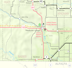
Gerlane is a small, quiet place in Kansas, United States. It's what we call an unincorporated community. This means it's not officially a city or town with its own local government. Instead, it's part of a larger area called Barber County, Kansas. You can find Gerlane about 9 miles (14.5 km) south of a bigger town called Medicine Lodge, Kansas.
Contents
A Look Back: Gerlane's History
Early Days and the Bank
Gerlane used to be a busier place. In 1917, it even had its own bank! It was called the Gerlane State Bank. A bank being "chartered" means it was officially allowed to open and do business.
The Railroad Connection
For a while, Gerlane was located right along the Atchison, Topeka and Santa Fe Railway tracks. Trains were a very important way to travel and move goods back then. Being on a railway line helped the community grow.
Changes Over Time
However, things changed for Gerlane. In 1942, the train tracks were removed. After the tracks were gone, Gerlane became less important as a community.
The Post Office
Gerlane also had its own post office. It opened in 1909, helping people send and receive mail. But like the bank, the post office eventually closed. It stopped operating in 1943.
 | Anna J. Cooper |
 | Mary McLeod Bethune |
 | Lillie Mae Bradford |


