Gießen Rural District facts for kids
Quick facts for kids
Gießen
|
|
|---|---|
 |
|
| Country | |
| State | Hesse |
| Adm. region | Gießen |
| Capital | Gießen |
| Area | |
| • Total | 854.66 km2 (329.99 sq mi) |
| Population
(2002)
|
|
| • Total | 254,731 |
| • Density | 298.0495/km2 (771.945/sq mi) |
| Time zone | UTC+1 (CET) |
| • Summer (DST) | UTC+2 (CEST) |
| Vehicle registration | GI |
| Website | http://www.lkgi.de |
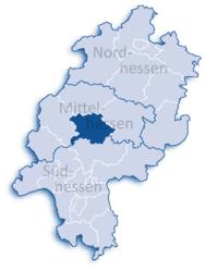
Gießen is a Kreis, which means a district or county, located in the middle of Hesse, Germany. It's a region where many towns and villages come together. The district is named after its biggest city, Gießen.
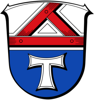
What the Gießen Coat of Arms Means
The coat of arms for the Gießen district tells a story about its history.
- Top Part: You'll see a wooden triangle at the top. This shape represents the traditional style of houses found in the area. It shows the local architecture and heritage.
- Bottom Part: The symbol at the bottom belongs to the Saint Antonius order. This was a religious group that started a monastery in a town called Grünberg in 1242. They also helped to start the university in Gießen in 1607. This part of the coat of arms shows the district's long history and its connection to education.
Towns and Villages in Gießen
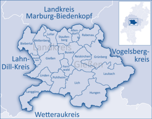
The Gießen district is made up of several towns and smaller communities called municipalities. Each one has its own unique character and history.
Here are the main towns in the district:
And these are the municipalities (villages and smaller communities):
- Biebertal
- Buseck
- Fernwald
- Heuchelheim
- Langgöns
- Rabenau
- Reiskirchen
- Wettenberg
Black History Month on Kiddle
Influential African-American Artists:
 | James Van Der Zee |
 | Alma Thomas |
 | Ellis Wilson |
 | Margaret Taylor-Burroughs |

All content from Kiddle encyclopedia articles (including the article images and facts) can be freely used under Attribution-ShareAlike license, unless stated otherwise. Cite this article:
Gießen Rural District Facts for Kids. Kiddle Encyclopedia.


