
Glen Aubrey, New York facts for kids
Quick facts for kids
Glen Aubrey, New York
|
|
|---|---|

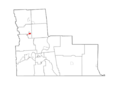
Map highlighting Glen Aubrey's location within Broome County.
|
|

Glen Aubrey, New York
Location in New York
|
|
| Country | United States |
| State | New York |
| County | Broome |
| Town | Nanticoke |
| Area | |
| • Total | 0.99 sq mi (2.56 km2) |
| • Land | 0.99 sq mi (2.56 km2) |
| • Water | 0.00 sq mi (0.00 km2) |
| Elevation | 990 ft (300 m) |
| Population
(2020)
|
|
| • Total | 446 |
| • Density | 451.87/sq mi (174.55/km2) |
| Time zone | UTC-5 (Eastern (EST)) |
| • Summer (DST) | UTC-4 (EDT) |
| ZIP codes |
13777
|
| Area code(s) | 607 |
| FIPS code | 36-29058 |
| GNIS feature ID | 0951166 |
Glen Aubrey is a small community in New York, United States. It is known as a hamlet, which is a small settlement, often smaller than a village. Glen Aubrey is located in Broome County, within the town of Nanticoke. In 2020, about 446 people lived there.
Where is Glen Aubrey Located?
Glen Aubrey is found in the southeastern part of the town of Nanticoke. A main road, New York State Route 26, goes right through the community. This road can take you south about 12 miles (19 km) to Endicott. Endicott is a town west of Binghamton. If you travel north on Route 26 for about 6 miles (10 km), you will reach Interstate 81 near Whitney Point.
The community covers a total area of about 1 square mile (2.6 square kilometers). All of this area is land. Glen Aubrey is situated in a valley. This valley is formed by the East Branch of Nanticoke Creek. This creek flows south and eventually joins the Susquehanna River.
How Many People Live Here?
The number of people living in Glen Aubrey changes over time. Here's a look at the population from recent counts:
- In 2010, the population was 485 people.
- In 2020, the population was 446 people.
This information comes from the official U.S. Decennial Census.
Images for kids
-
Map highlighting Glen Aubrey's location within Broome County.
-

A robot for kids.

See also
 In Spanish: Glen Aubrey para niños
